Sunny spells for many over the coming days but west will be best as cloud and murk drift in off of the North Sea.
For the Western Isles of Scotland, the Lake District and the Republic of Ireland in particular, the period from mid-April to mid-May is often one of the sunniest of the year. This is because of the persistence of winds between North and East that have duly arrived on time this spring. Great for more western areas, but not if you live in the East, where especially towards the coast, it can often be grey, misty at times and quite cold.
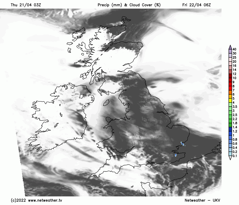
This morning has dawned fine and sunny in most parts, but it's been a cold start with a touch of frost across parts of Scotland and the North of England. Any remaining mist or fog patches inland will quickly clear, but towards the coasts of North East England and East Scotland, sea fret will be more stubborn, keeping it much cooler here. So it's a fine, dry day again for most with lots of sunshine, but some cloud will develop mainly in central and southern areas, perhaps leading to a few showers later, mainly over Wales and towards the South West.
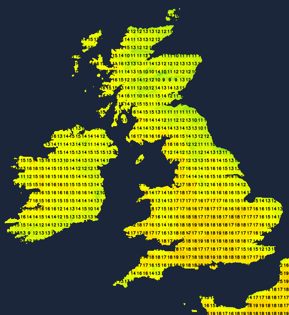
It'll become quite warm over sheltered parts of the West, and South Wales, where temperatures may reach 18C or locally 19C, but 14 to 16C will be a more general maximum. In eastern areas, a North East wind will be quite brisk, and where sea mist continues the hug some shorelines, temperatures will struggle to reach a decidedly chilly 8 or 9C.
Any showers in the West into the evening soon melt away, leaving a mostly dry night. There'll be clear spells, with sheltered parts of Cumbria, Northern Ireland and West Scotland seeing a touch of frost and maybe a few short-lived mist or fog patches again towards dawn. North Sea coasts see mist and very low cloud becoming more extensive that'll drift inland to many central and eastern parts of both Scotland and England, perhaps as far West as the Welsh marshes making these parts grey by daybreak. This'll prevent temperatures here from falling below 5 or 6C despite a cold and brisk North East wind. Elsewhere 2 to 4C is more likely, with temperatures perhaps falling as low as -2C in a few sheltered Highland glens.
West is best on Friday, where you'll see the bulk of the sunshine and the highest temperatures again. But in the East, mist and low cloud, giving a little drizzle in places at first, could take a while to lift and clear before probably 'burning' back to the coast.
Most parts stay dry, although the odd shower could develop again, most likely in the South and South West Top temperatures a cooler 12 to 15C, generally maybe 16 or 17C in some sheltered western areas. But only 8 or 9C is likely again along North Sea coasts in a brisk and cold North Easterly wind.
It remains much the same into the evening and night, with clear spells in the North and West giving a slight frost again where you have shelter from the North Easterly wind. Low cloud and mist return to many central and eastern parts, giving a little drizzle here and there, with perhaps a few showers in the South. Lowest temperatures -2 to +2C in the North and West and 3 to 6C in the East and South.
With winds from a North Easterly quarter well established over the weekend and well into next week, there'll be much of the same. The North and West continue to see the driest, warmest weather, while the East and South will often be cooler and more cloudy. But the risk of catching a shower will become more acute, especially in central and southern areas, where some could become heavy with the chance of thunder.
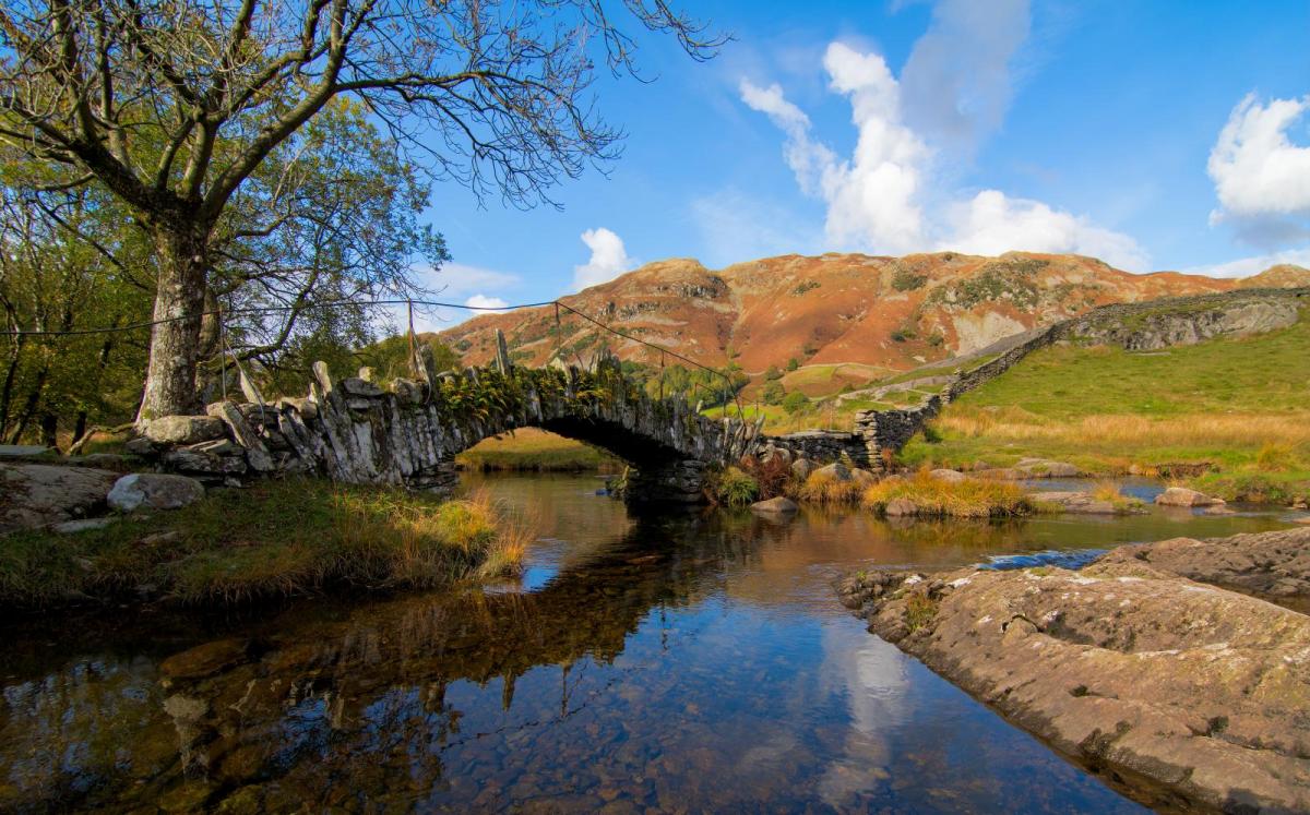
Photo today of Slaters Bridge in the Lake District