


Easter is leaving us on a cooler, somewhat more unsettled note but still with a fair amount of dry, bright weather today for us to enjoy.
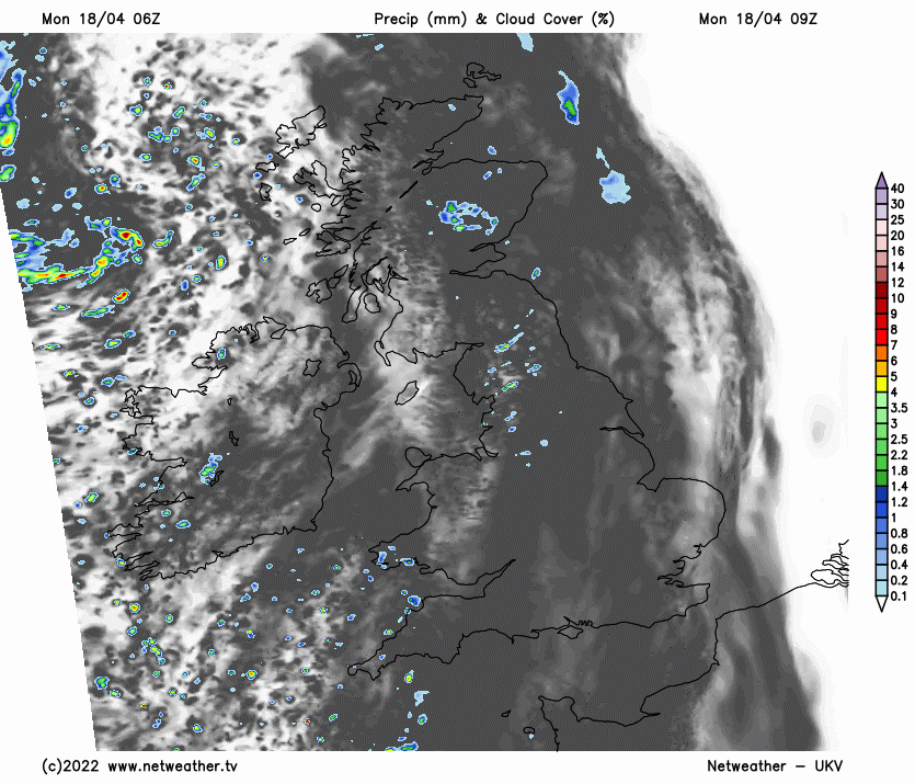
Easter is leaving us on a cooler, somewhat more unsettled note but still with a fair amount of dry, bright weather today for us to enjoy. A couple of weak fronts that moved in off the Atlantic overnight are responsible for the subtle change but will be the last that make progress across the country for a while, as winds through the week turn into an easterly quarter.
The first front is clearing into the North Sea, with the other giving a line of showers currently crossing the North of England and Scotland. As the front weakens through the morning, we'll be left with just a few showers over England, Wales and East Scotland. Cloud amounts will vary, but there'll be some sunshine, with many places missing the showers and staying dry. However, across the North and West of Scotland and parts of Northern Ireland, you won't be quite so lucky, with showers more likely here, some heavy.
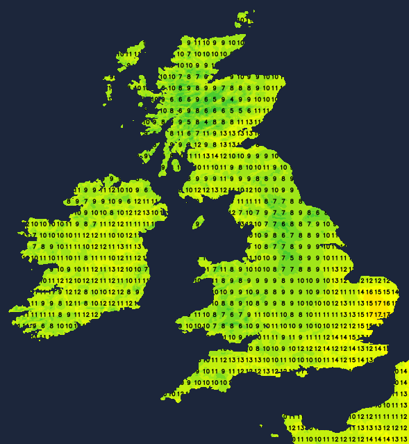
A Westerly breeze will mostly be light, but with a more noticeable South Westerly across Scotland and Northern Ireland, that'll be somewhat blustery in the North and West. It'll also be noticeably cooler, especially over England and Wales, with top temperatures 10 to 12C in the North and West and 14 to 16 locally 17C in the East and South, down on yesterday's figures but still close to normal for mid-April.
Showers will keep going across the North and West of both Scotland and Northern Ireland, where some will be heavy in a gusty South-West wind. Elsewhere many of the showers fade after dark to leave a mainly dry night with clear spells. Light winds may allow some short-lived mist or fog patches and a touch of frost, this mostly over Scotland, to the South of Belfast and across parts of northern England. Here temperatures could fall close to freezing, but 2 to 6C will be a more general minimum.
Tuesday sees the showers continuing across the North and West of Scotland, with coastal parts of East Anglia and the South East probably turning more cloudy, maybe with a few showers in a North to North Easterly breeze. But much of the country will be under a slack pressure regime giving light winds, just a few showers and some sunshine. After a cold start across parts of the North, temperatures will reach 11 to 15C, but it may feel somewhat chilly towards some exposed coasts of Kent and East Anglia.
The showers fade into the evening across the bulk of the country, leaving most parts with a dry night. There'll be clear spells, and with light winds, mist, patchy fog and pockets of frost will form again towards morning. The showers in the North and West should also begin to fade, but across East Anglia and the South East, a North Easterly breeze may bring more in the way of cloud and a few primarily light showers. The lowest temperatures will be close to freezing again, but more generally 2 to 5C.
The remainder of the week sees winds eventually turning into the East This will make it quite cool and cloudy at times along North Sea coasts, with the East and South seeing a scattering of showers. The driest, brightest weather will be reserved for the North and West, but here, there'll be a greater risk of overnight frost with clearer skies.


