Changeable conditions spill over into next week, with showers or rain in places, though becoming less windy. Turning drier and more settled from Thursday, as high pressure takes control.
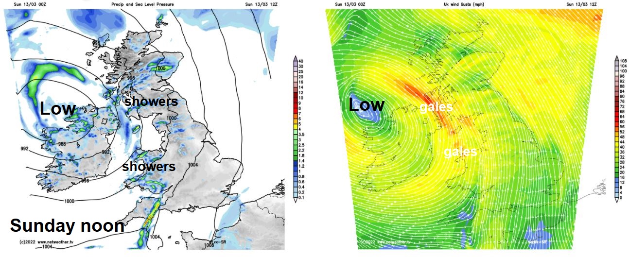
Sunday will be blustery and showery across much of Britain, thanks to an area of low pressure close the west over Ireland, which will bring gales across western areas. Monday will see further showers across the northwest and far south, but generally an improvement on Monday - with winds not as strong. Tuesday’s looking largely dry and settled away from the far northwest, but Wednesday looks to see rain developing from the south merging with a band of rain pushing in from the west to affect many areas. A ridge of pressure extends from the southwest over the UK on Thursday, before merging with a larger high pressure system extending west from Russia. This will bring a drier and more settled end to the week.
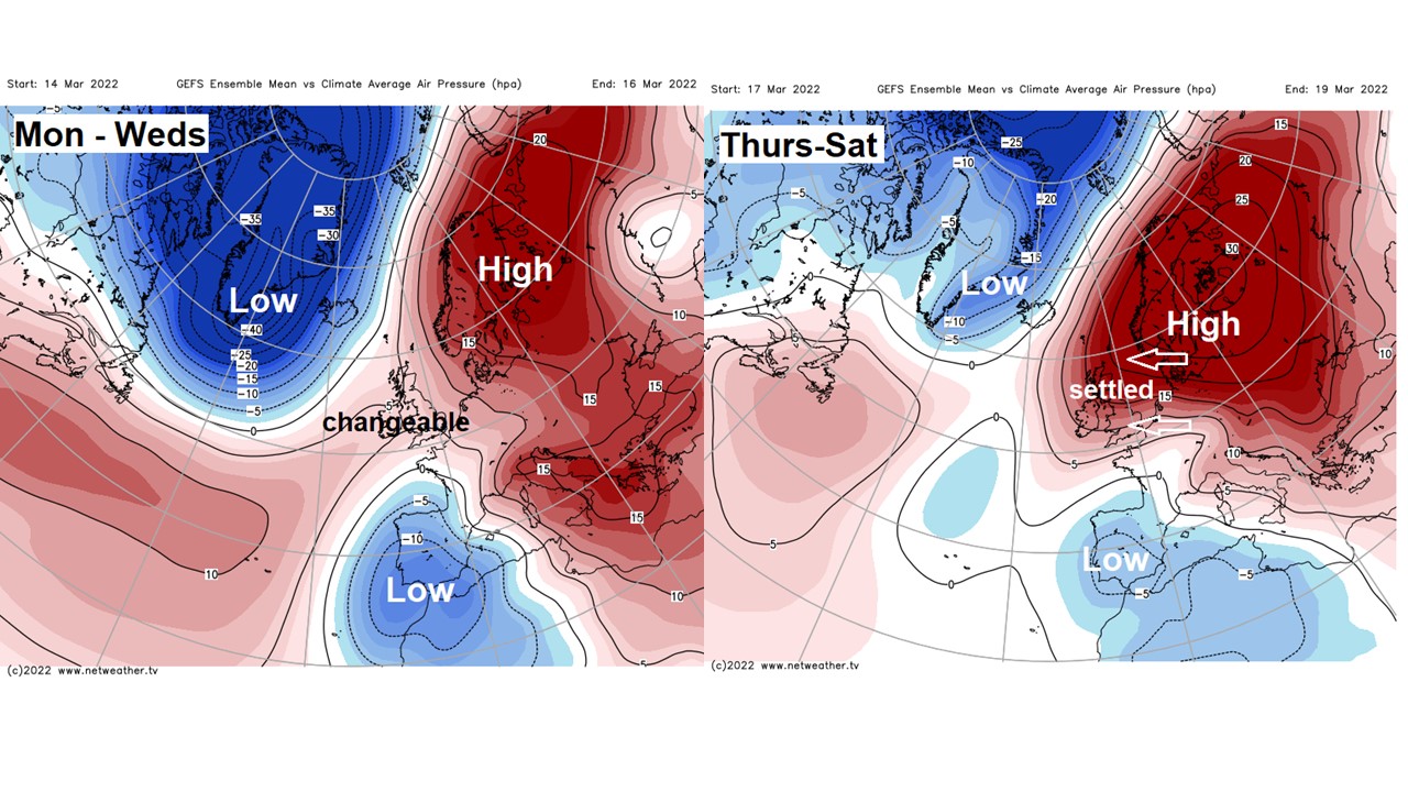
Despite the changeable theme up until Thursday, with a threat of showers for some Monday and rain on Wednesday, much of next week will be mild with the winds from the south or southwest, Temperatures in the south could reach the mid-teens on Tuesday and Wednesday. However, although it looks like it will continue mostly dry and settled next weekend, with high pressure centred to the northeast, easterly winds may well develop, bringing in colder air from eastern Europe by Sunday.
For now, wind with sunshine and scattered showers the theme for many on Sunday. An area of low pressure, still quite deep but filling, will drift north across western Ireland today. On the low’s eastern flank will be fairly tight isobars towards the west and here will be gales for a time, particularly around Irish Sea coastal areas, northern Ireland and southwestern Scotland, with gusts of 40-50mph likely, locally up to 60mph – with some rough seas.
A windy day generally, but with the southerly direction of the wind, it will be mild – temperatures reaching 10-13C. Showers will be most frequent and heaviest towards the west – where they will be accompanied by hail and thunder locally. Sunny spells between the showers, a few showers towards the east too, while a trailing front will bring thicker cloud with some rain moving north for a time across SE England and East Anglia.
With clearing skies and winds easing tonight across Wales, central and southern areas of England – it will turn chilly, with a ground frost forming in places. Cloudier and windier further north, with some showery rain in the northwest.
After a bright but chilly start, cloud will increase across south Wales, southern England and East Anglia – with showers breaking out, some heavy locally. Mostly dry and bright for north Wales, Midlands, cloudier and windier for northern England, N. Ireland and Scotland, with showery rain spreading east. Temperatures reaching 9-11C across Scotland and N. Ireland, 10-14C across England and Wales.
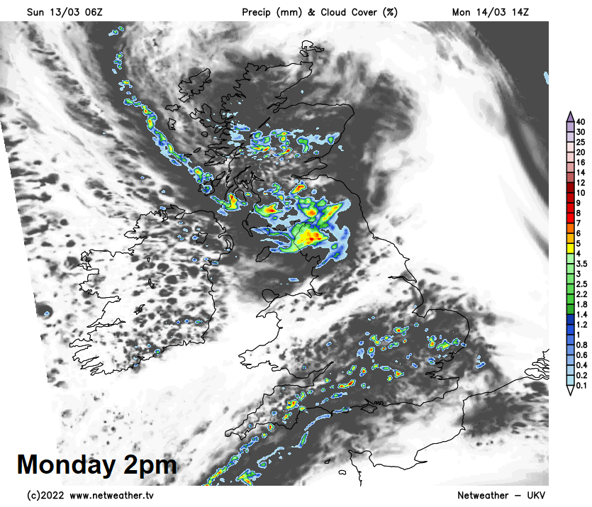
After a chilly start, with a touch of frost locally and a few fog patches in the south to clear, a drier picture more widely on Tuesday, as a ridge of high pressure builds in. A bright morning for most, but clouding over from the west across northern and western parts through the day, with rain moving in across the far northwest. Southern central and eastern England perhaps staying bright or sunny for much of the day. Mild again, temperatures reaching the mid-teens in the south and east, 9-13C elsewhere.
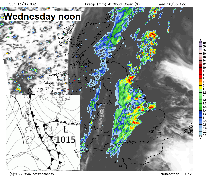
All change on Wednesday, as we see quite a complex interaction between two weather systems, one moving up from the south and the other approaching from the west culminating in rain breaking out in places. A warm front looks to push of from the south, bringing in some warm air from France, while a frontal system also approaches from the west. Some uncertainty where the rain will develop, but likely cloudy across England and Wales, with outbreaks of rain developing, locally heavy. Also, a band of rain spreading east from western Scotland and N. Ireland across northern areas. Turning cooler for Scotland and N. Ireland as the rain clears east, with temperatures reaching 8-9C in the afternoon. Mild across the south, if the sun comes out long enough across SE England and East Anglia, temperatures may reach 16-17C, otherwise 10-13C across England and Wales.
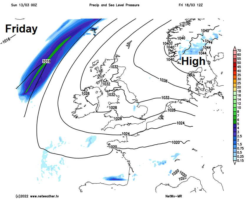
Turning drier and more settled on Thursday, as high pressure builds in across the UK from the southwest, sunny and light winds for most, but cloud and a little rain possible for the far northwest. Cooler in the south, temperatures reaching 9-13C. Friday sees a large high pressure system centred to the northeast, this feeding in a southeasterly flow but generally dry and bright or sunny conditions.
Dry and settled conditions look to continue through next weekend, with high pressure centred over the Baltic and southern Scandinavia in control feeding in southeasterly or easterly winds, which could bring increasingly colder air from eastern Europe by the end of the weekend and into early next week – so an increasing risk of widespread overnight frosts.