Friday's cold air will be moved on by a warm sector for Saturday. It will be windy throughout the UK, with gales in the north where snow showers continue and the chilly conditions return.
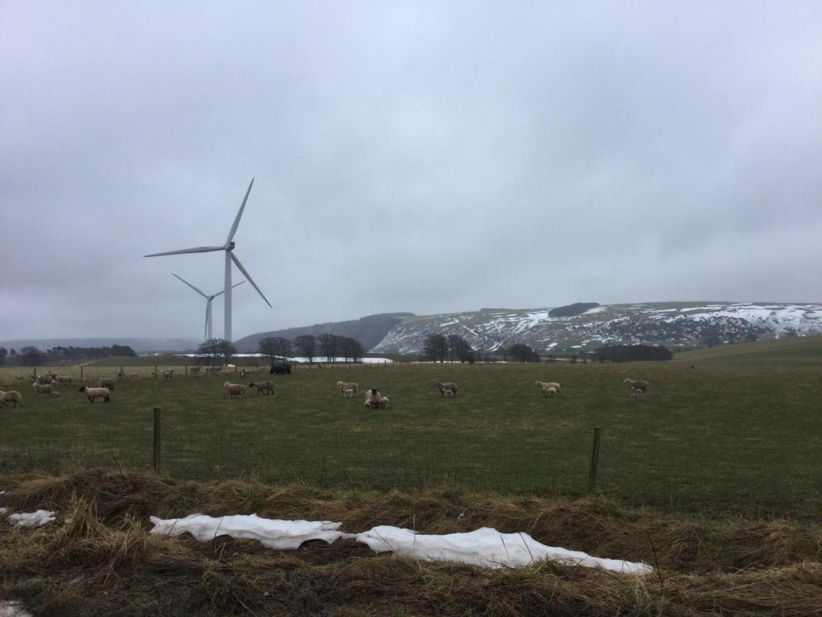
London started the day at 10C and Edinburgh at 2C. Belfast was also at 2C with a warning for ice this morning and Cardiff saw frontal rain as temperatures began to fall. Cold air will reach right down through the UK today with a northwest wind making it feel even colder. It stays windy through the weekend so do take note of that when looking at forecast higher air temperatures. For a weekend walk, run or ride one way is going to be much easier than the other.
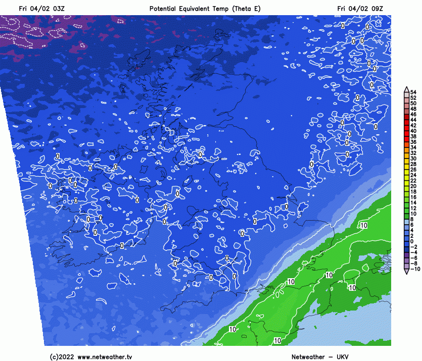
The plunge of cold polar air for Friday shifting the early mildness from SE England, then milder 'Warm Sector' for Saturday but a cold front soon appears from the northwest, lowering the temperatures once more in the north.
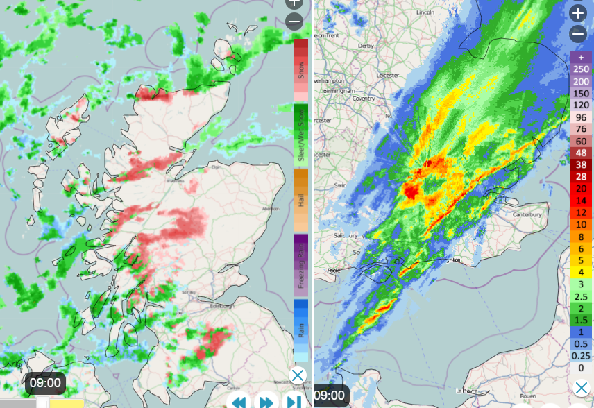
There are already snow showers over Highland moving in on that wind. There will be further hail, sleet and hill snow showers with snow reaching lower levels in heavier ones for northern and western Scotland, also Cumbria. The feed of wintry showers is shown on the Radar image below, the pink and green. Along the frontal band, there are still signs of line convection. The intense echoes where there is heavier rainfall and gusty winds. The front has produced some sleet and wet snow for the very tops of northern hills in England as it moved south overnight and it continues southeastwards, clearing Kent by lunchtime.
The colder air lasts through the night with a nippy start for Saturday. However, there is a new incoming frontal system, a warm front from the west. This will introduce mild air in the warm sector with temperatures of 8 to 10C. However, the following cold front will work its way down from the northwest with a cold afternoon and evening for Scotland. It will turn colder for the northern half of the UK, particularly so for northern Scotland with lying snow over the high ground and the westerly wind picking up. Still mild to the south.
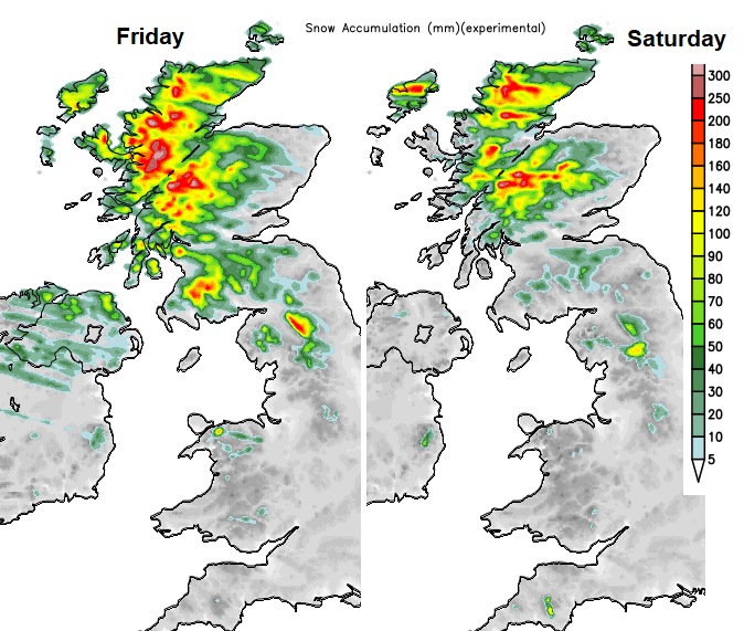
Areas forecast to see lying snow, LHS showing snow from the overnight frontal band as well as today's snow showers. RHS, from showers.
Today, the brisk west to northwest wind will add to the chill as the low centre near Norway continues to throw trough lines of heavier showers in from the northwest. A few extra gusts included with the wintry showers. By Saturday morning, there will be increasing cloud for Northern Ireland and western Scotland as the warm front heads in. The winds strengthen with heavy rain arriving before dawn. Coming up against the cold air there will be snow over the hills and mountains of the NW Highlands spreading into Cairngorm National Park. The frontal rain will reach over Northern Ireland, into NW England and the Pennines but there will be some shelter for eastern Britain. The showery rain will make it through the Central Belt. Eastern and southern England have a dry Saturday morning although with increasing cloud and a brisk wind.
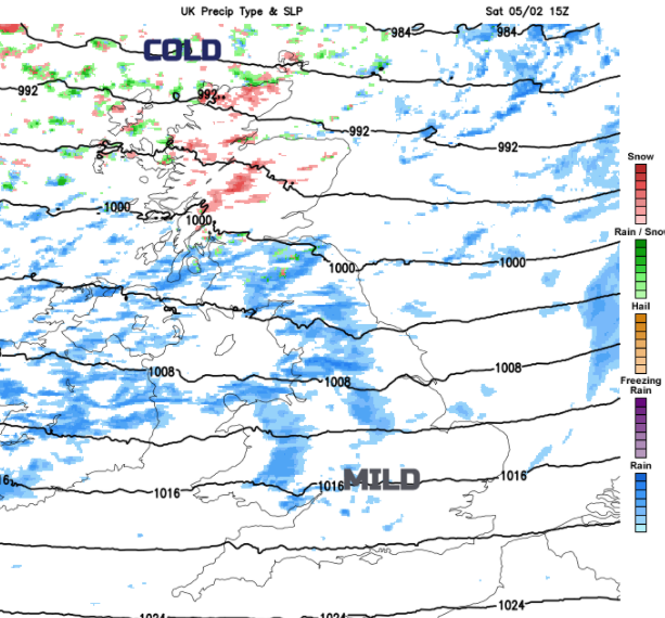
Further bursts of heavy, showery rain feed in from the west over a central swathe of the UK, with the mild air in the south but more snow showers further north. It will be very windy at times on Saturday for northern UK with coastal gales in the north and west, even severe gales with gusts around 70mph for the far north. The winds ease down for Sunday night as the Azores high noses in.