A low pressure over Iceland will bring windy weather to the far north of Scotland for Burns Night. By Wednesday night another low pressure will have developed, a bit further south, and bring severe gales Orkney and wider changes with a windy spell midweek.
Today there have been yellow and orange warnings over Iceland for snowstorms and severe gales.
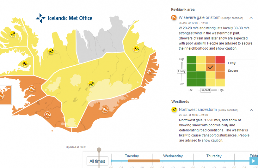
“Westerly severe gale or storm today, strongest wind in the south part of Iceland. Risk of damages due to flying debris can be expected and people are advised to secure their surroundings, fasten loose items and show caution. Traveling is not advised where weather warnings are in effect.” Vedur- Icelandic Met Service
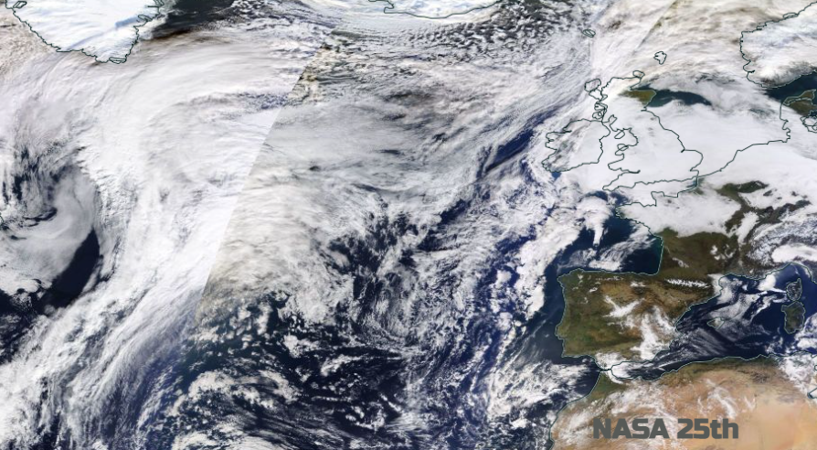
The Jetstream across the Atlantic started the week with a huge split around the high pressure which has kept the UK weather steady and dull. One arm right down over north Africa, enhancing the wild, winter weather over Greece and Turkey and another arm over Iceland to Scandinavia.
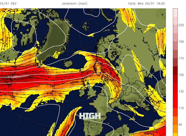
By mid-week a more powerful zonal pulse barrels across the north Atlantic, without the great meanders and this will develop the Wednesday low pressure. It’s almost like a “Coming through!” moment. The high pressure is finally disrupted although it will claw back in for southern Britain by Friday. With a huge dig of cold air through the United States, this temperature gradient strengthens the Jetstream, and a succession of low pressures move across the Atlantic. They will keep the weather over Scotland, and at times other parts of the northern half of the UK, unsettled and windy.
By the weekend the strong jet core overhead will prove to be enough competition against the lingering high pressure. It still stays nearby, lurking to the south or SW but pulses of cold air manage to reach down from the north behind the clearing low pressures.
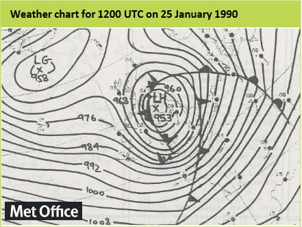
Back in 1990, Jan 25th Burns Night brought a devastating storm. The centre moved over Ayr, the birthplace of Rabbie Burns and 47 people died in the British Isles, 100 people in total from the event over northern Europe which became known as the Burns Day Storm. This winter we have only seen two named storms so far. Storm Arwen at the end of November 2021 led to a rare red warning from the UK Met Office, with transport links closed, long-lasting power outages and swathes of trees fell in NE England and eastern Scotland due to the unusual direction of the storm winds. Storm Barra followed in early December hitting southern Ireland, again with power outages before the wild, wet and even wintry weather spread over the UK.
The midweek windy weather includes gales for Shetland on Tuesday night. The Inshore Waters forecast for Shetland tonight – SW 5 to 7 veering west 6 to gale 8 for a time. Sea state Moderate or rough becoming very rough or high in N/W/S.
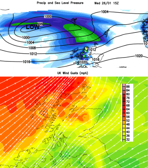
Through Wednesday the weather becomes more windy across Northern Ireland, Scotland, northern England and north Wales.
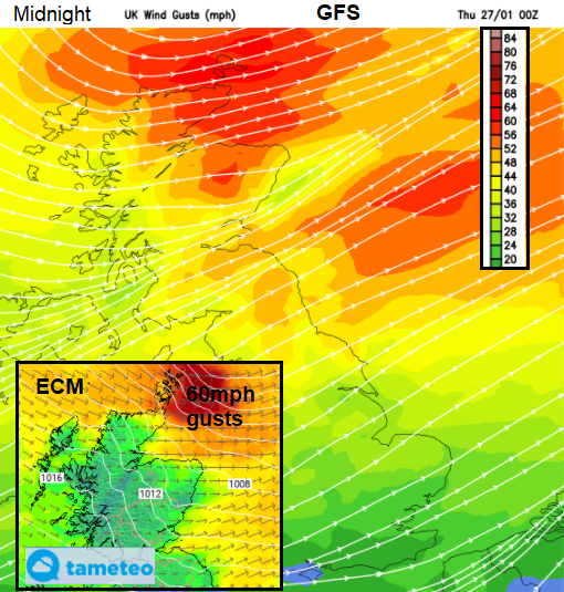
The strongest winds with gusts over 60mph will be around midnight, centered on Orkney along with the risk of severe gales. This then pulls away in the early hours of Thursday leaving a chilly brisk wind for the walk to school, station or bus stop.
This isn’t a particularly severe low pressure, and the Northern Isles and north coast Scotland can cope with gales, but it is a change from just being at the edge of high pressure. The ongoing gloomy skies and grey chill for England and Wales will shift as the low pressures in the north give everything a bit of a shake.
Loading recent activity...