High pressure continues to dominate the UK weather scene in the days ahead, some fronts moving southeast will bring a little rain in the north tonight, followed by a cold northerly bringing arctic air for Thursday, then back to settled and dry.
Much of Britain has seen some long spells of sunshine over recent days thanks to high pressure, which is likely welcome for many after the very dull December. Monday saw plenty of sunshine across much of Britain, 7.7 hours at Wisley in Surrey, with blue skies for many, however, there will be more in the way of cloud today, combined with fog across central and southern slow to clear, but still some sunny spells. A cold front approaches the northwest bringing some rain later, before rain spreads southeast across northern areas overnight as the front clears southeast.
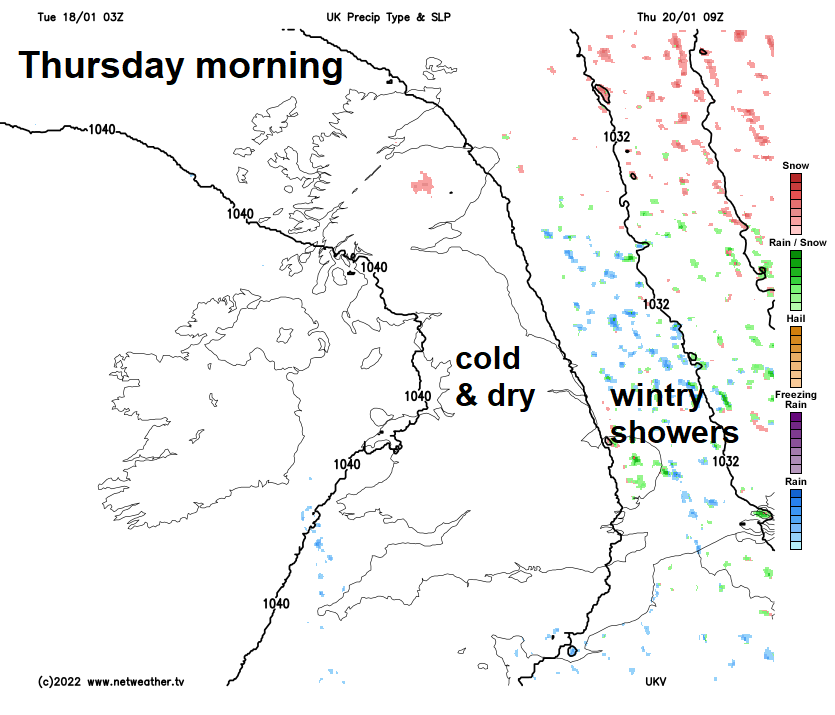
Cold front clears the south by early Wednesday afternoon, colder arctic air following for Thursday
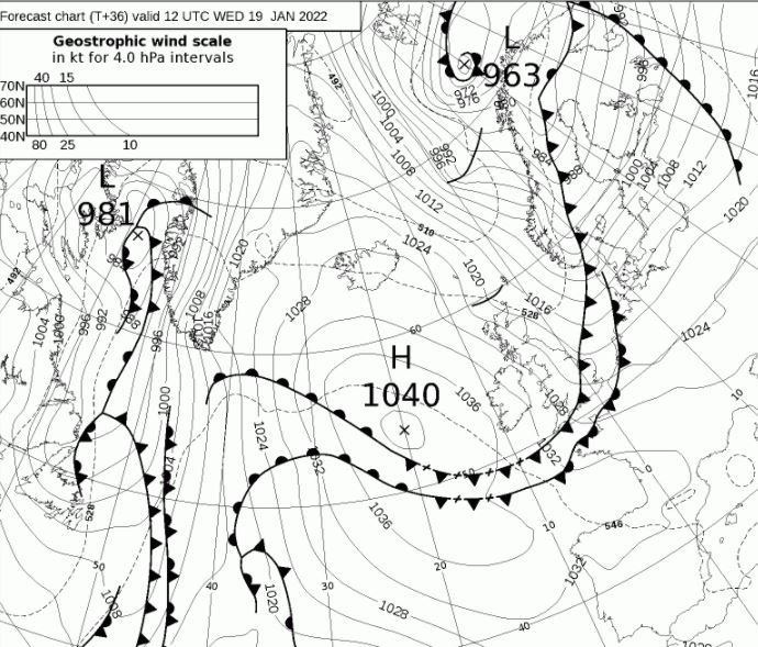
The cold front will then sweep southeast across England and Wales on Wednesday morning, little rain left along it when it reaches the south by early afternoon. Following the front will be a sunnier but increasingly cold arctic northerly flow moving down across all parts and continuing through Thursday. The northerly wind will also feed in wintry showers across northern Scotland and down along eastern coasts. Friday will see high pressure to the west build back in across the UK, so the northerly eases and it’ll be settled and dry for most, with the same theme continuing through the weekend too.
For now, clear skies overnight featuring the Wolf Moon has led to a widespread frost to start the day away from western Scotland and N. Ireland. The lowest temperature at dawn -6C at Benson in Oxfordshire. Fog has formed overnight too across parts of England, some dense and freezing fog patches could lead to hazardous driving conditions for the morning commute. A Met Office yellow warning for fog is in force until midday.
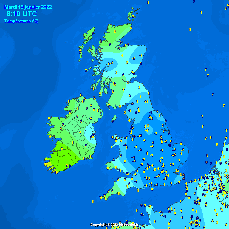
The fog patches will be slow to lift where they have formed overnight, while a southwesterly breeze picking up will bring more in the way of cloud to southern and western areas later. It will turn windier with patchy outbreaks of light rain moving into western Scotland and N. Ireland by the end of the afternoon. The best of the sunshine across more eastern and northeastern areas. Most places will stay dry. After the cold start, temperatures reaching 6-9C generally, but across the far west a milder 9-10C.
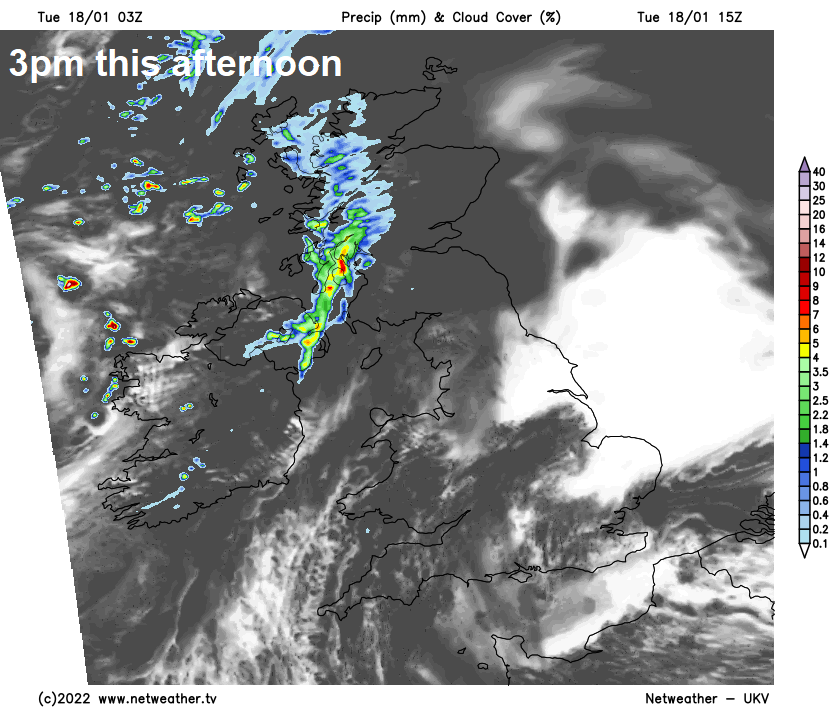
A set of cold fronts will move steadily southeast across Britain tonight, the first front bringing a little rain to the northwest later today will be rather weak with little rain as it moves down across England and Wales overnight, but the front following will bring a spell of rain southeastward across Scotland and N. Ireland before reaching northern England by dawn. Dry with some patchy clear spells amongst the cloud across the south, which may allow temperatures to dip low enough to bring a ground frost in places along with some fog patches.
After a bright and chilly start across southern England, with some local fog patches, clouding over from the northwest with a little patchy rain around lunchtime, before clearing south to sunnier conditions already across the north, as the wind turns northwesterly. Most areas dry and sunny in the afternoon but with a cold wind, with the colder air digging in across the north wintry showers will push south across northern Scotland and later NE England. Temperatures reaching 5-8C in the north, 7-10C in the south.
A cold start with a widespread frost on Thursday leading into a cold day, with a keen northerly wind towards the east, which will feed in wintry showers for a time along eastern coasts. Most places will be dry and sunny though, with high pressure close to the west. Temperatures reaching 4-5C at best in the east, 6-8C in the west.
High pressure builds east across the UK on Friday, so for most it will be dry and less cold, best of the sunshine across England and Wales, cloudier for Scotland and N. Ireland with the flow off the Atlantic.
It looks to remain mostly dry and settled through the weekend, with high pressure centred across the southwest. Sunny spells for many with a risk of frost and fog overnight for England and Wales, milder for Scotland, cloudier and windier across northern and western Scotland with a little rain possible.