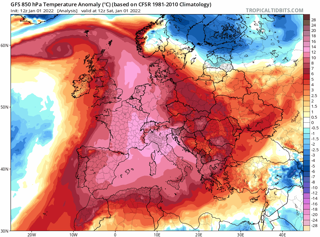
The warmest New Year's Day on record today, but it look to turn much colder next week, as winds turn northerly and it likely to stay more seasonal thereafter, with temperatures more typical for January.
It was an exceptionally mild end to 2021 and start to the new year. The record for the highest temperature for New Year’s day was previously set nearly a century ago in 1916, with 15.6C recorded at Bude in Cornwall. That record was broken today as early as 9am at Kinlochewe in the northwest Highlands, with a temperature of 15.7C, but provisionally the highest temperature of today was 16.2C at St James Park in London, setting the new New Years Day record.
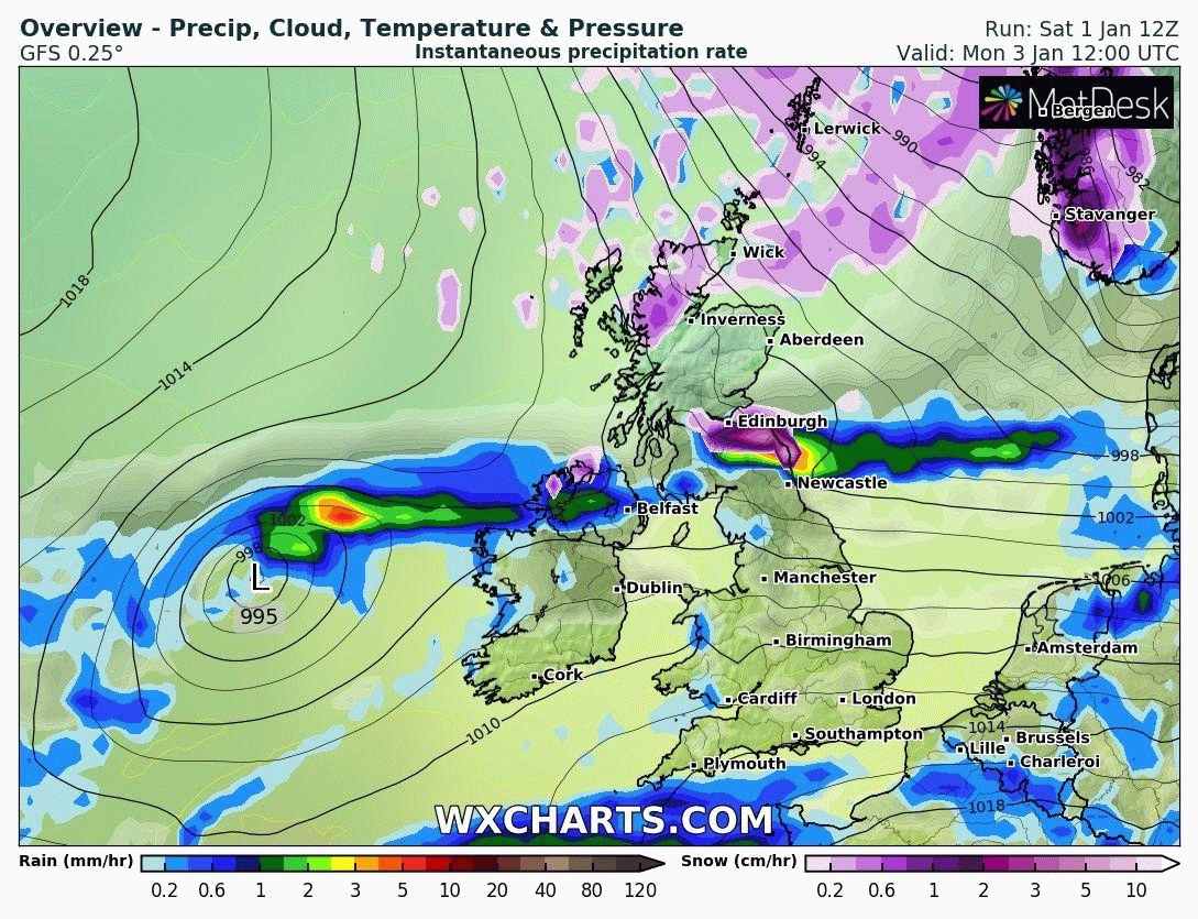
However, the mild weather is on the way out over the next few days, replaced by much colder arctic air on Tuesday, as a brief northerly flow develops. The cold arctic air looks to spread south across all parts during Tuesday. Some back edge snow is possible along an occluding cold front moving south across northern England, Wales and the Midlands. Snow showers following across northern Scotland and close to eastern and western coasts of Scotland, towards north coast of N. Ireland and along North Sea coasts of England.
To the south of the cold air, an area of low pressure emanating between Bermuda and the Azores this weekend, tracks northeast close to southern England, bringing spell of rain here. The American GFS and Canadian GEM models deepened this low considerably as it approached southern England on their morning runs, the sharp gradient in the back of the low as it clears east pulling in cold air from the north at the surface and turning the rain to snow as the low clears. However, GFS has backed off this scenario, with the low not deepening and thus tracing northeast further south over northern France, with cold and dry enough air for snow coming down from the north too far north to engage to the rain around the southern low before it clears east. Only 12z GEM continues with this deeper further north low engaging the cold air from the north and giving snow. With no support from other models, it is seen as an outlier. A spell of rain across southern England Monday night before clearing early Tuesday, then the cold air spreading south across all parts on Tuesday, with wintry showers in the north and near eastern and western coasts.
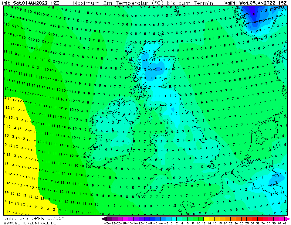
The cold arctic incursion doesn’t look to last more than a day or two. Then after a brief ridge of high pressure builds in mid-week, as the northerly fades, bringing some dry but chilly conditions with overnight widespread frost, it looks to turn unsettled from the west for the rest of the week. A deep low pressure system towards Iceland later in the week looks to drive a strong and showery Polar maritime westerly flow across the UK. The westerly flow will be sourced from a very cold NE Canada, and although the airmass will be modified or warmed by the Atlantic Ocean, it will probably be cold enough for showers to be wintry in nature, particularly over higher ground, with some snow likely over northern and western hills and perhaps even to lower levels in the same area in heavier showers and any precipitation falling at night.
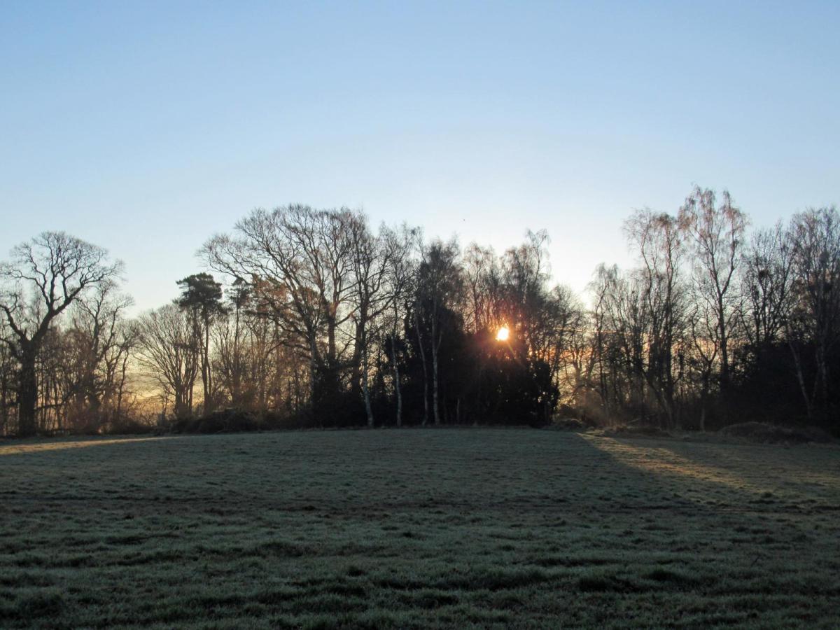
Cold day on Wednesday
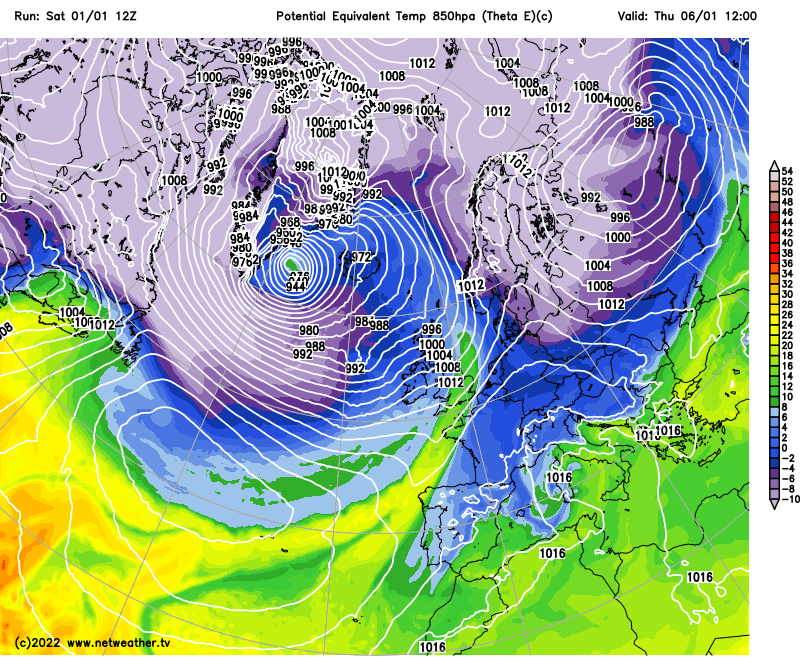
The unsettled theme looks to continue through next weekend and perhaps into the second week of January too, with a strong tropospheric Polar Vortex over Greenland and northern Canada driving a predominantly westerly flow, with alternating chilly/cold Polar maritime and slightly less cold returning Polar maritime airmasses. But it looks like there will be sufficient waves in the strong jet stream for another brief colder incursions from the north.
Unsettled but chilly westerly flow from Thursday, with wintriness in the precipitation at times, more especially in the north and west
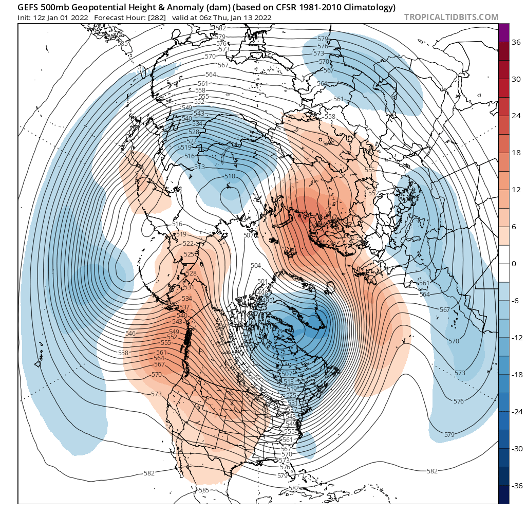
Looking further towards mid-month there are hints from extended runs of the models for high pressure to build in the vicinity of the UK, which would favour more settled and perhaps colder conditions, albeit low confidence on this scenario for now. A build of high pressure could be in response to the lag effect of the Madden Julian Oscillation (MJO) wave of tropical convection that is forecast to move into phase 8 (western tropical Pacific) over the coming days, which tends to promote amplification of the upper flow at higher latitudes of the northern hemisphere after around 10 days in that phase. However, any attempt at amplification will be against a strong tropospheric Polar vortex which will be forcing the flow to stay flat and zonal. Hence low confidence.
Signal from GFS ensemble mean of high pressure / higher heights by mid-month, which could persist into the second half of January