After quiet, steady weather there are changes midweek ready for Christmas travel. Rain, blustery winds and a huge temperatures gradient north-south. Any snow is still uncertain.
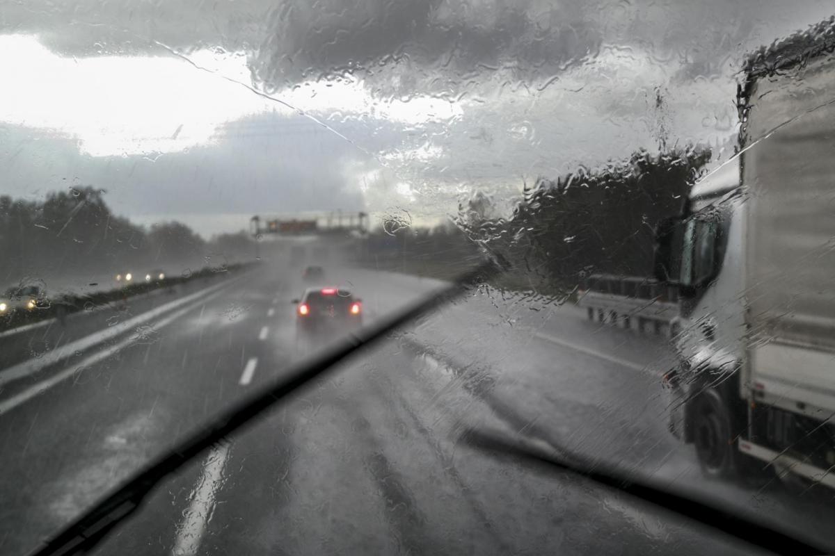
Christmas travel can often be tense and always with the possibility of winter weather upsetting even the best-laid plans. Fog and poor visibilities at airports. Stormy weather with flooding and fallen trees affecting railways and local roads. And then there is snow, always tricky to forecast here in the UK and able to slow motorways down to snail’s pace within an hour. This year there is nothing stand-out in terms of severe weather but some uncertainty in the forecast closer to Christmas.
Most of the schools have now finished, more people are working from home, reducing the commuter traffic and there will be some people who decided not to travel this Christmas because of the pandemic. Christmas Eve has been identified as the peak Christmas travel day. As people finish work on Friday then Christmas the next day. That afternoon and evening are likely to be grim for motorways whatever the weather does, M25, M40 and M60 in particular. The RAC has dubbed it "Frantic Festive Friday". With presents, family and COVID tests added into the mix, it is going to be fraught.
For the past week, the UK has been under an area of high pressure which has brought quiet, settled weather. There has been a bit of fog but with light winds and a lot of cloud there haven’t been any major issues. This continues through Tuesday night and for Britain on Wednesday morning, but things are set to change. The Netweather front page has an update each day, do keep an eye on that as there is still a good deal of uncertainty in the forecast near to Christmas.
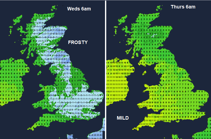
Weds 22nd December
There will be a widespread frost for Britain on Wednesday morning, away from Cornwall, west Wales and not for Northern Ireland. Even the Channel Islands have an Ice warning. There could be patchy freezing fog, so care will be needed if you are setting off early.
The first band of rain and blustery winds moves in midweek. Over Northern Ireland then into Wales and western Scotland by the afternoon. Snow for the Scottish mountains as it hits the cold air which could affect the A9 by Wednesday evening. The frontal rain brings milder air and a southerly breeze.
Thursday 23rd December
A whole host of fronts from the Atlantic will bring more cloud and rain, particularly to western Britain and Northern Ireland. SE Britain should escape with a dry morning as the rain sets in further north and west. Nothing major but just quite a change from the ongoing settled spell. It will then be very mild with temperatures into double figures by Thursday afternoon.
Clear skies follow, so a fair end to the day but it does cool off again.
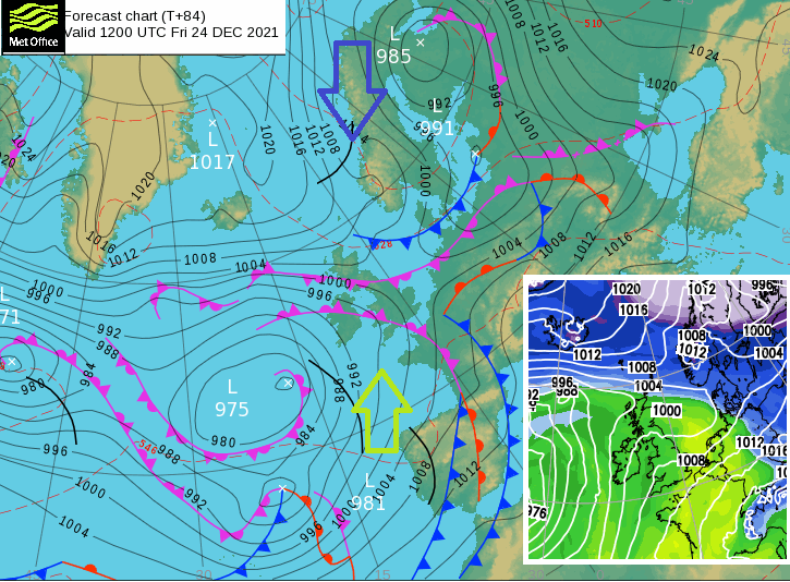
The next portion of the forecast includes a boundary between cold air from the northeast and the mild air in the south. The issue is that the various computer models all have different solutions up and down the UK. Some are not really interested in snow with the milder air taking over and more rain. Others, allowing the cold air to push down over the UK with snow on the north side of the fronts and even snow showers coming down into NE Britain.
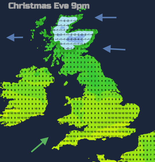
So, for those travelling late on Christmas Eve, the further north you are, it looks more likely that it will be cold with the risk of ice and a chilly east wind. For southern England and London, it does look mild with rain at times. In between, there will also be a band of rain but think of the wider picture. Just looking at symbols will only give a location snapshot. That band could be further north or south, the temperatures vary too.
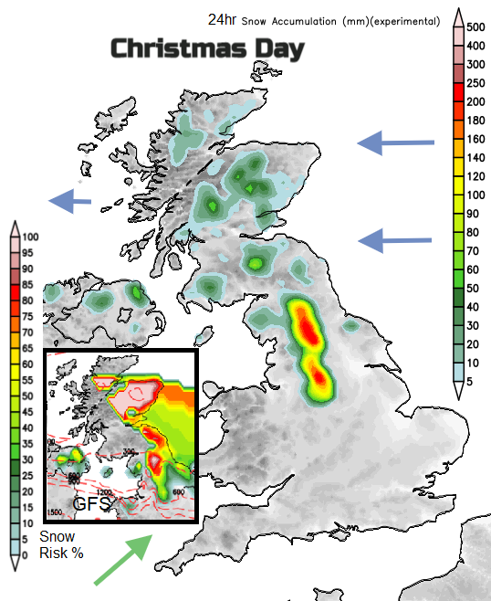
The ECM European model is less keen on snow for Christmas Day with the milder air taking hold. GFS keeps the risk, Pennines
Hopefully, most people will be settled and sorted by Christmas Night. If you do pop to see relatives or friends on Christmas Day or fancy a walk there still looks to be rain and mild air over much of southern Britain. More uncertainty for a central swathe of Britain and Northern Ireland. Colder air but perhaps just icy rain with snow for the Pennines. And to the north, clearer skies and sunshine for Scotland. But a chill east wind and maybe a few wintry showers. Or a cluster of snow showers off the North Sea into eastern Scotland, even Northumberland and snow along the leading edge of a weather front which will bring Christmas snow to northern England and southern Scotland.
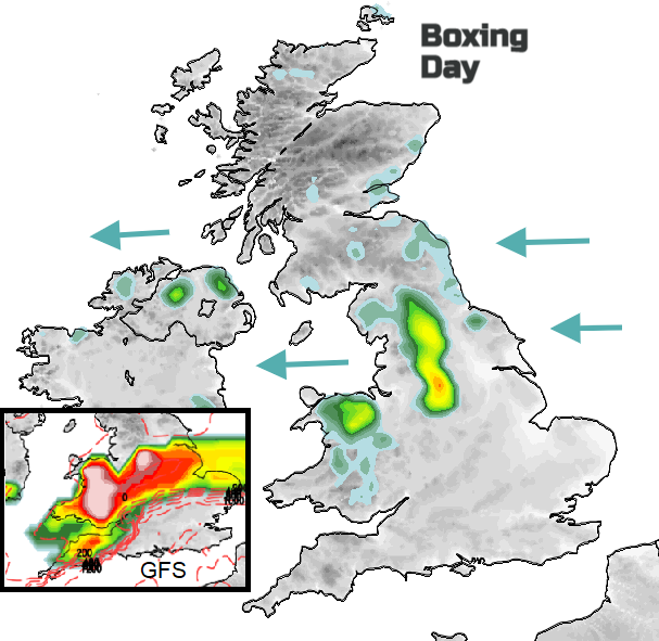
One solution for Boxing Day snow- along the frontal band which may vary in position. And showing wintry showers off the North Sea
A similar battle for Boxing Day, colder air from the north. Uncertainty about the frontal rain and potential snow. Do keep up to date with the forecast, think of the wider picture. The Netweather Radar will show you where the rain bands are and their direction of travel. Also, what the temperatures are and if the precipitation is beginning to turn to snow.
Factor in some extra time, do a few car checks beforehand or keep an eye on the train updates. The weather may not bring disruption but there are already issues due to staff shortages thanks to COVID. It is lovely when you get to your destination and that “when there’s no place to go, let it snow, let it snow, let it snow” feeling sets in and you can relax. Hopefully, the weather won’t interfere to any great extent this year but the cold air lurking to the north is keeping forecasters on their toes for a few more days. Safe travels.