As Storm Barra eases, there are still strong winds for western Wales this lunchtime. More from the Atlantic in with a changeable look to the rest of this week.
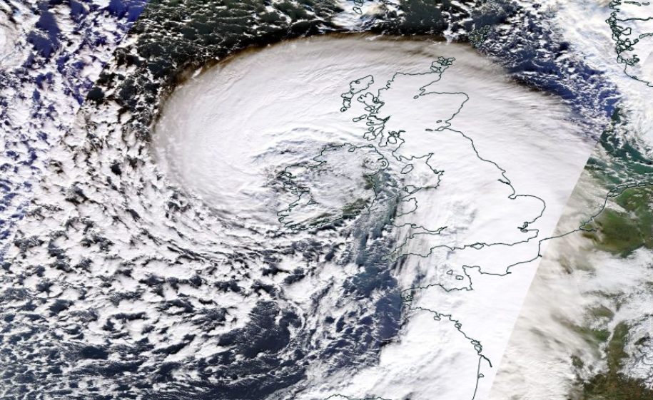
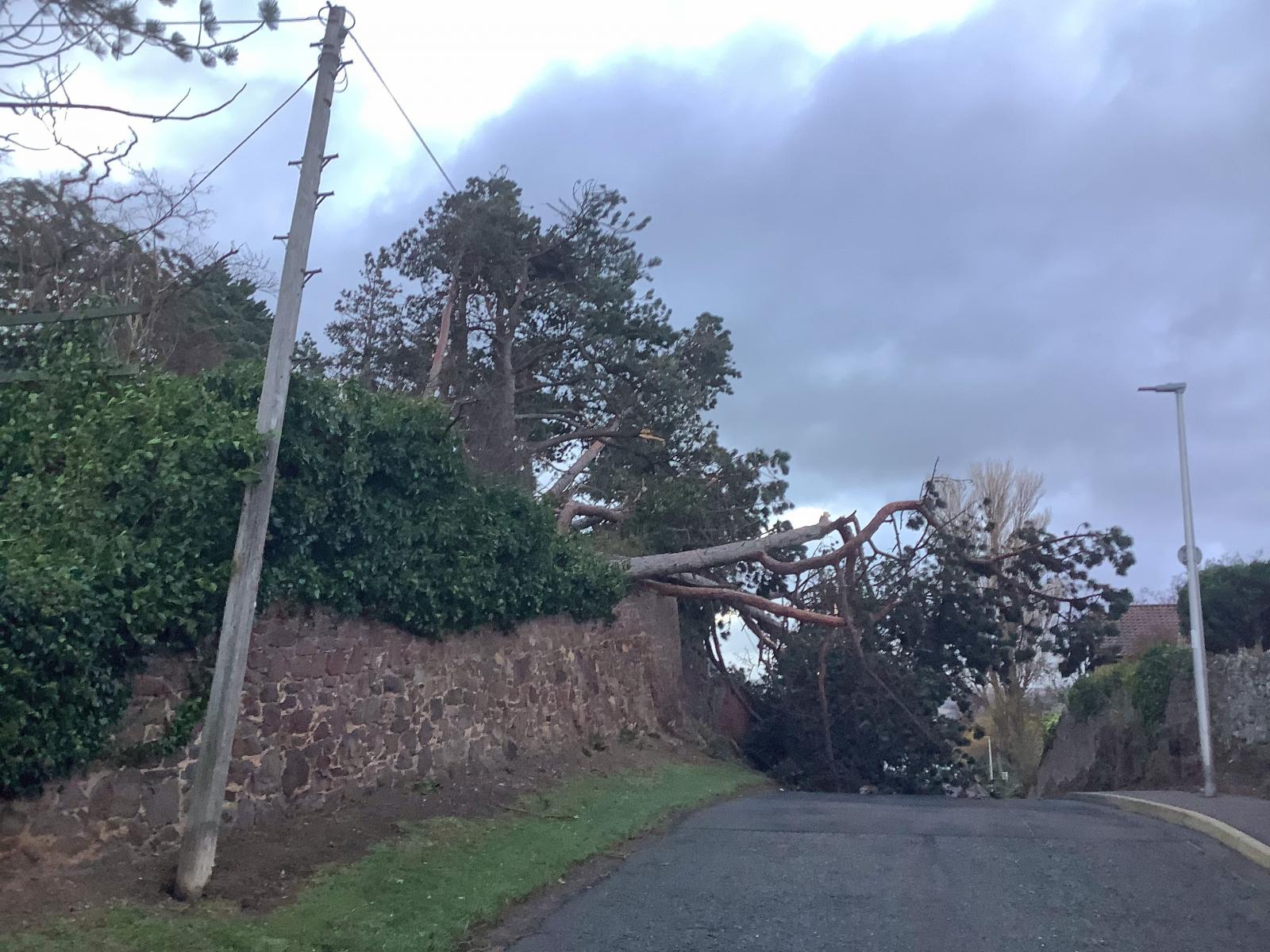
Storm Barra has left thousands without power in Ireland and a number of properties in northern and northeast Scotland only days after electricity was restored for homes hit by Storm Arwen. There was flooding as the huge waves and driving winds coincided with high tides, schools closed, wild conditions for west coast Ireland and even snow over the higher ground of Britain.
Barra has now finished its astonishing deepening and it is creeping eastwards across the UK as it fills now. There are still strong winds, even coastal gales today for Wales and NW Ireland with a host of showers churning around the low pressure. As this low fades, a frontal band of rain moves in from the Atlantic on Thursday. Then a lull for Friday with frost before more weather fronts arrive from the west during Saturday linked to a low centre over Iceland.
It’s all quite changeable and unsettled. There is a sliver of mild air later on Thursday for the south. Then colder on Friday as the winds veer to the NW and a widespread frost overnight with a cold start for Saturday in eastern Britain. Then milder in a broad warm sector from the west on Saturday which lasts over England and Wales into Sunday. Colder to the north but with temperatures in double figures for Sunday night, most bizarre.
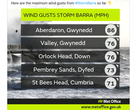
Today temperatures will be around 5 to 8C but with still strong westerly winds for Wales with gusts to around 60mph for exposed coasts and hills. There is a yellow wind warning today for western and southern coastal Wales and SW England along to the Isle of Wight. Met Eireann also still has yellow warnings with an orange warning for Donegal in the northwest into the afternoon.
Storm Barra: Northwesterly winds … with severe or damaging gusts of (up to 80mph), with localised stronger winds likely. Due to a combination of high waves, storm surge and high tide, coastal flooding is expected. Disruption to power and travel are likely. Met Eireann
Wales, Northern Ireland and Merseyside into Lancashire will all continue to see showers driven inland. Wintriness over the hills and Snowdonia and a grim feeling to the day with the rain and gusty winds. There are other bands of rain this lunchtime and more showers coming in on the other side of the low for NE Scotland and Caithness.
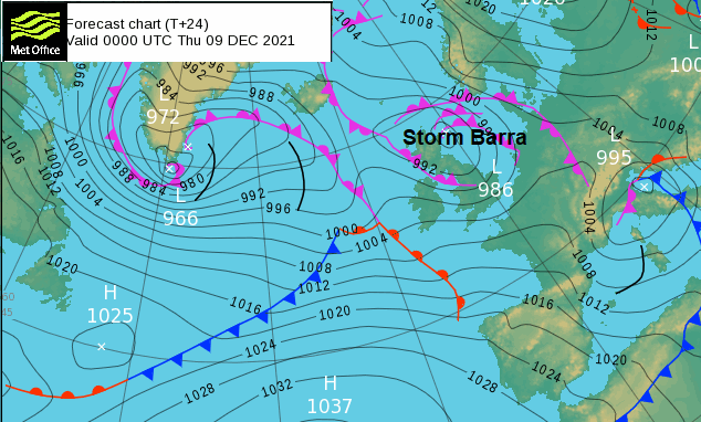
Overnight it will turn clear and cold for Scotland and NE England with lighter winds. Still heavy rain extending from the North Channel, Co. Down and Antrim down the Cheshire Gap reaching the Midlands. Barra fades and pressure begins to rise, so a fine start for many on Thursday. The frontal rain will reach Northern Ireland and SW Britain by lunchtime but ahead of that fine and sunny. As the frontal band moves over Britain there will be more snow for the Scottish Highlands by Friday evening with the rain band moving to eastern Britain by Thursday night.