The November temperature records vary between 22C and -23C. That is quite something. It has been very mild so far but something colder is on the way for the end of the month, with signs of snow.
Winter is the three months of December, January and February when looking at meteorological statistics. Other dates are available but when comparing UK weather data it starts on December 1st and runs until February 28th/29th. Nature doesn’t always comply. The 2018 Beast from the East started in late February and ran into early March, both those months were much colder than average.
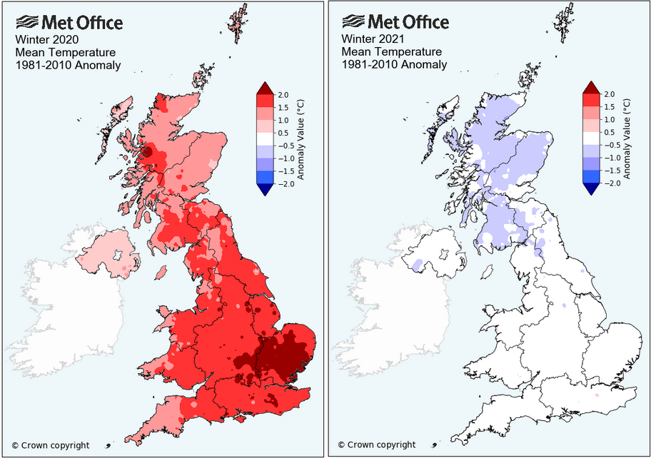
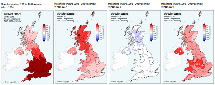
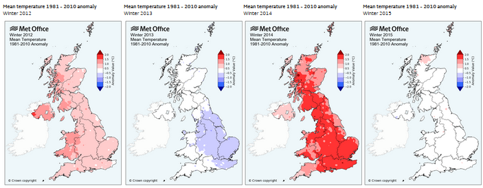
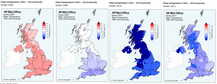
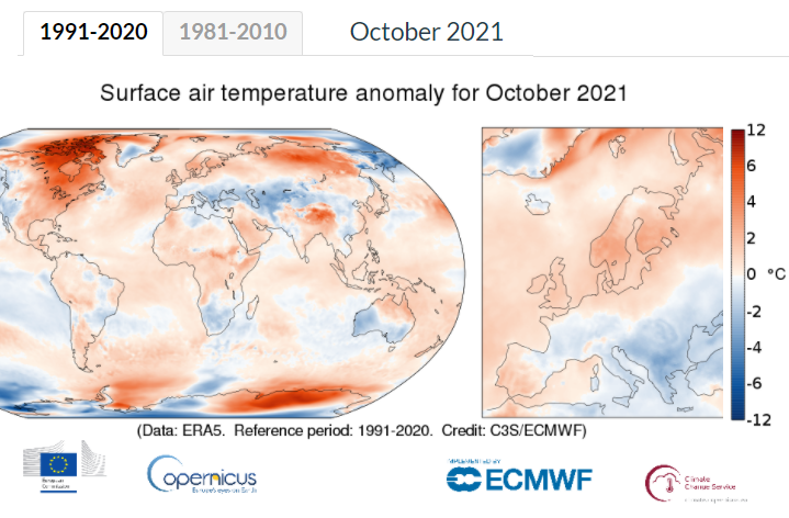
With our warming climate, these anomalies are compared to a 30-year average. An average that shifts in ten-year periods. The Met Office UK comparisons are still showing 1981-2010 but Copernicus World and Europe comparisons do offer 1991-2020 alongside the other. It’s worth toggling between both to see the Arctic warming stand out.
There are trends and anomalies. The gritting season has been slipping in the UK. Less need in November but an extra week or so in the spring. We do have cold snowy winters. Each year charts are poured over and enthusiastically discussed on the Netweather forum, will proper winter weather set in and bring decent snow. There is already some cold excitement for the end of November after what has been a very mild month.
The record high temperature for the UK in November was on the 1st in 2015. 22.4C at Trawsgoed, Ceredigion (72F). The November record in Scotland is 20.6C from 4th, 1946. The very mild air and brisk west wind resulting in Fohn Effect for eastern Scotland is producing high temperatures for the time of year. It has been mild so far this month, but a change is on the way at the weekend. By Sunday 21st everywhere will be feeling colder with Aberdeen on 16C today, yet only 6C by Sunday and feeling more like 1C in the cold, fresh north wind.
Back in 1919 Braemar in Aberdeenshire had a daytime maximum of -11.1C with an early winter spell of extreme cold and snow and the lowest minimum was -23.3C also on the 14th. Imagine that as most of the UK sits in double figures on the 18th. Two shifts of colder weather are on the way.
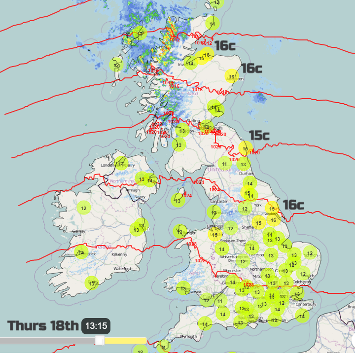
One this weekend as a cold front sweeps south and we see Newcastle fall from 13C today down to 4C on Sunday, plus windchill. Bristol from a mild 14C down to 8C but feeling more like 4C on Sunday in the chilly north wind. Think of this as the starter to a possible colder main course later next week.
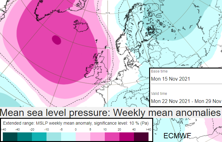
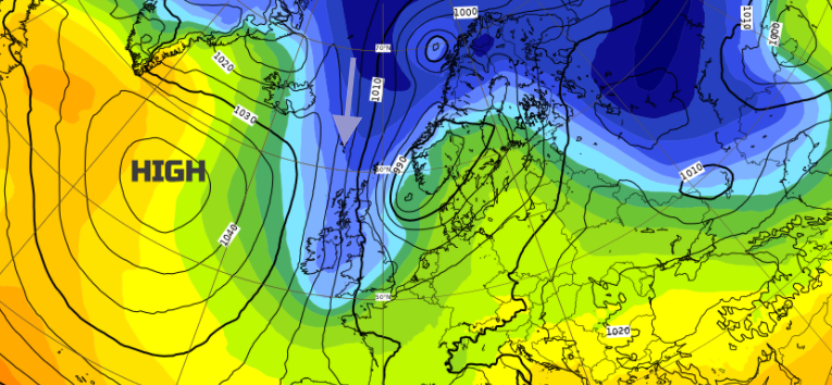
The excitement is coming from high pressure building near Greenland. We do see a Scandi high which also brings cold excitement but a Greenland high with low pressure over Scandinavia will draw down cold Artic air, often for days and can be a snowmaker. The ECM model shows snow showers arriving from the north on Wednesday night and this looks to continue, potentially for a few days. It's that steadying presence of a high which keeps the cold, maybe snowy feed going. That anchor is key, rather than and Atlantic low whizzing by, hitting the cold air giving a snowy start but it's all to slush by lunchtime.
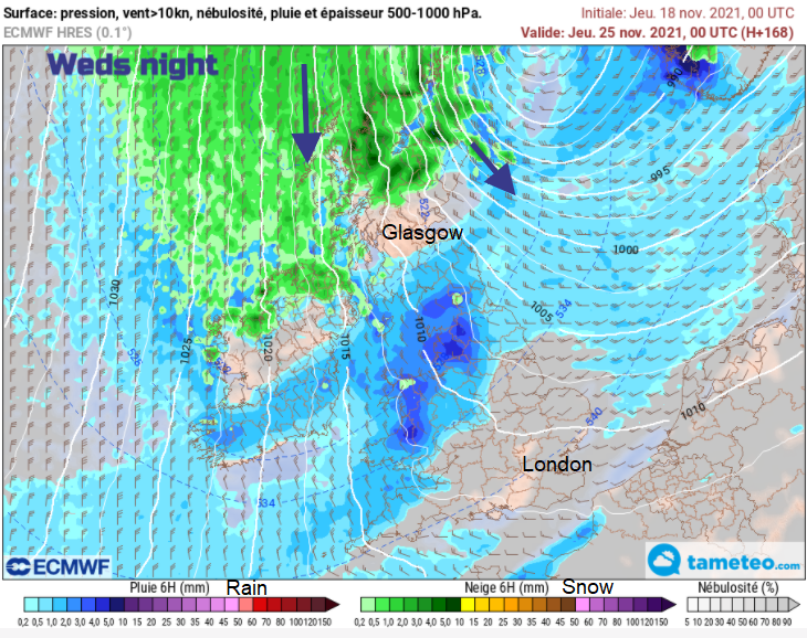
There is low confidence in any detail but the main flow is from a general northerly direction. The air will be would be cold enough for snow. If low pressures form in the flow they could bring areas of heavier precipitation rather than just showers for exposed parts. It is still a week away but after such a mundane November so far, this final week has grabbed plenty of attention.