October has brought a lot of rain and ended with strong winds. The first week of November turns more settled, drier, brighter but colder with frost and a bit of fog.
With the clocks changing and half-term holidays finishing the roll towards Christmas and winter seems to have increased. There will be frost and fog mentioned in the forecast as the week progresses.
The second half of October has thrown quite a mix of weather our way. Heavy and persistent rain with flooding for parts of the UK, warm air rather than frosts and strong winds as a low pressure which is still nearby moved off the Atlantic. This is bringing an unsettled blustery start to the week of northern parts but as it pulls away tomorrow, a colder flow from the north will follow.
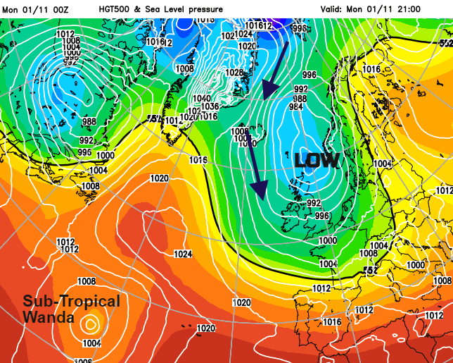
Overall, the first week of November turns drier and colder as high pressure edges in from the west but low pressure holds for Scandinavia. As CoP26 starts in Glasgow the weather is unsettled and breezy. There is a wind warning for the morning for west coast Scotland, through the North Channel and Irish Sea so lively for ferry journeys. Yesterday’s winds and ongoing rain caused disruption to some train journeys north too.
The UK weather is becoming more settled in that it will be drier for the bulk of the country. Coastal fringes exposed to the more northerly flow will still see showers. The clearing skies will allow sunshine by day but more of a chill by night and when the winds do fall light, there will be the risk of fog. All adding to the autumnal picture with the beautiful leaves. It will only be the tops of the Scottish mountains seeing any snow flurries as the inland showers fade in the colder air and rising pressure.
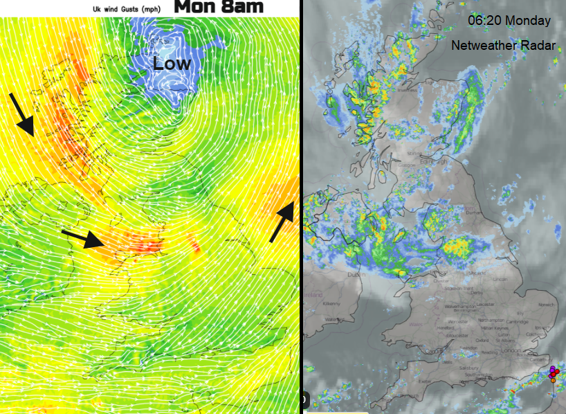
As counties around The Wash experience a brisk SW wind today with a fine morning, northwest Britain has more cloud and outbreaks of rain with a strong cool, NW wind. It is a grim start to the working week for Merseyside and north Wales in the wind and rain. This pulse of rain moves across to the Peak District this morning, but other parts will have bright even sunny spells with a scattering of blustery showers. Daytime temperatures will be 10 to 12C
The wind ease down inland this evening as the skies clear. There will still be a feed of blustery showers into western Britain, a few for Northern Ireland and a convergence line that keeps on going through the eastern English Channel. There have already been thundery showers passing through the Dover Strait. Temperatures fall down into single figures overnight.
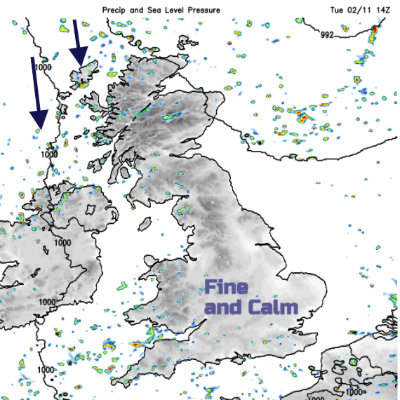
By Tuesday morning it will be brighter and less windy. A cool start with still a scattering of showers coming in from the west. Fine and dry for most though. Temperatures will be 8 to 12C.
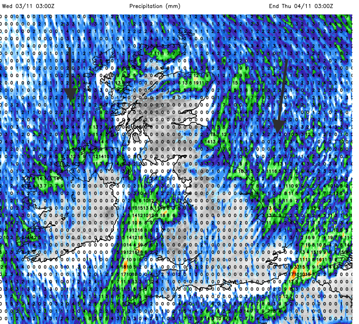
It will feel colder although those chilly but sunny days can be quite lovely. The winds remain light over much of England and Wales but as the flow veers to the north, the areas affected by the showers change. Into Thursday the flow will be NNE off the North Sea so showers reaching eastern Britain by then. Winter wardrobe time.