
With tropical maritime air over the UK currently, it's very mild for the time of year. But that's going to change from midweek as colder air moves down from the north.
We have tropical maritime air over the country at the moment, so it's unusually mild. But, there's also a fair amount of cloud and some heavy outbreaks of rain about, along with blustery winds, all of which will mean we'll not be seeing enough of the sunshine to really push temperatures up. Even so, 20-21c is likely for some in the drier, brighter east of the country.
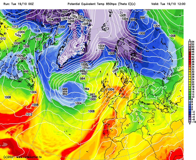
The very mild air isn't going to last much beyond today (Tuesday), with cooler, fresher conditions starting to filter in from the west from this evening. Wednesday will still be mild enough across much of England and Wales, with maxes reaching well into the mid, perhaps high teens. But already, Scotland will be chillier at 9-13c, and by Thursday, we can expect those sort of values countrywide - some 10c cooler than today for some.

There's more going on beyond the swings in temperature as well, with some persistent, heavy rain or showers affecting all parts of the UK at times through the remainder of the week. Thursday and Friday should see less in the way of showers and more in the way of drier, sunnier weather, with Thursday, in particular, looking sunny across many inland parts of the country, with just a scattering of showers likely.
For now, the north and west of the UK will be seeing the bulk of the wet weather, to begin with, on Tuesday, but heavy bursts of rain will move in from the west across southern and central regions later on. That's going to take until Wednesday morning to clear the southeast corner. Following behind will be some further sharp showers developing from the west across England and Wales, along with a band of sometimes patchy rain making a slow move down from the north of Scotland.
That rain in the north will be along a cold front, with colder air tucking in behind it. It'll be cold enough for the high ground of Scotland to see some sleet and snow, with further wintry showers following behind it as well. By Thursday, all parts will be into the chilly airflow, with long sunny spells inland and a scattering of showers that will be most frequent near coasts exposed to the north to northwest wind - they'll continue to be wintry in northern regions as well. The wind will be noticeable and will knock a few degrees or so off of the temperatures.
Winds should be a bit lighter by Friday, but there'll also be more cloud. That's ahead of the next spell of wind and rain, which will start to spill in from the west during Saturday and into Sunday.


