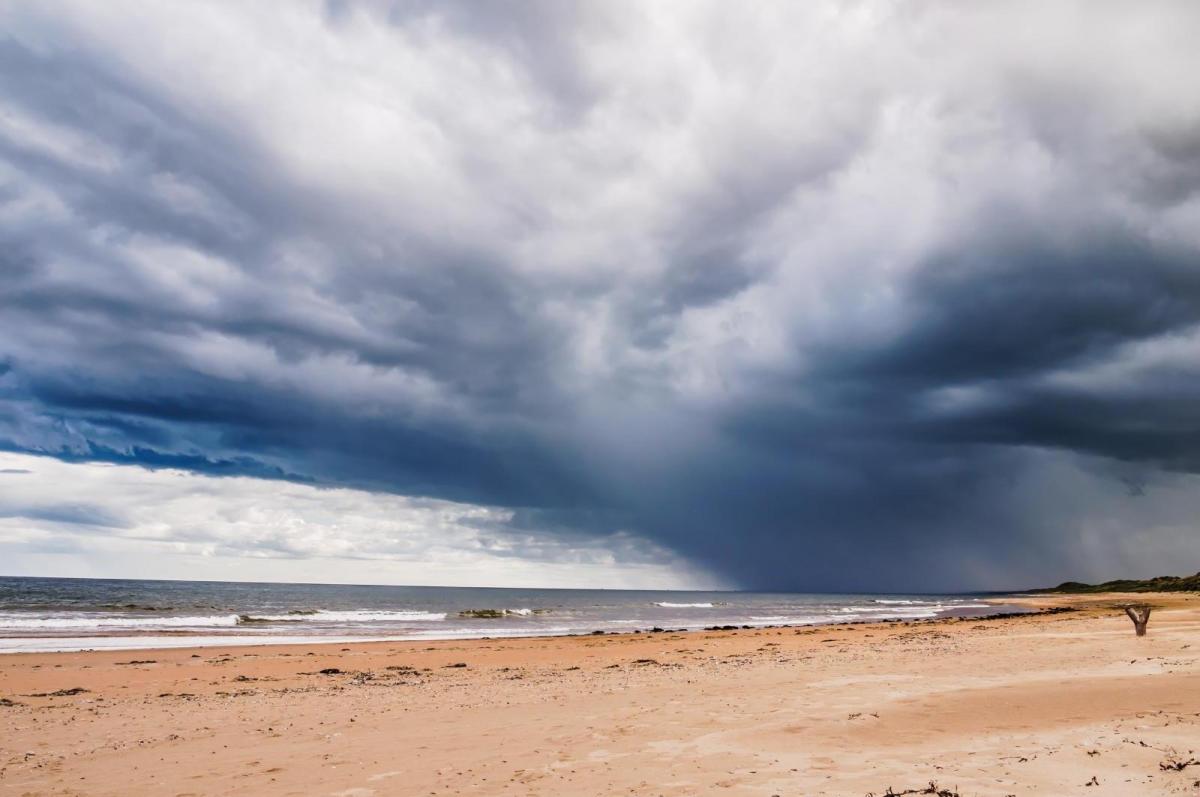
After the heavy rain yesterday, many parts will see sunshine and heavy, thundery showers on Sunday and Monday.
After the heavy rain yesterday, the depression responsible continues to deepen to the North of the country. This'll bring severe gales to the Northern Isles, where a yellow weather warning is currently in operation, as the particularly unsettled and wet start to October continues.
Yesterday's rain is across the Northern Isles, where it'll remain wet and windy, but any still left over Kent will clear through the morning, leaving most parts with a brighter day in a brisk, showery South Westerly flow. After a chilly start, expect a day of sunny spells but also blustery showers. We already have showers across Northern Ireland, northern England and the in the West, that'll spread to other parts through the day.
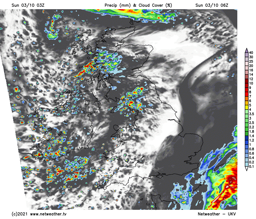
Some will be heavy, giving local hail and thunder, with sudden falls of temperature making it feel quite chilly when a shower comes along. But more sheltered eastern areas will see more in the way of sunny spells and fewer showers with a few places staying dry, but if you're venturing out, take a brolly just in case.
There'll be a severe South or South Westerly gale over Shetland where winds could gust to 70mph at first. Also, expect strong to gale force gusts in the heavier, more squally showers across the North and West and towards the South coast, where the showers may also become more frequent through the day. Top temperatures a chilly 11 to 13C in the North and 15 to 17C further South.
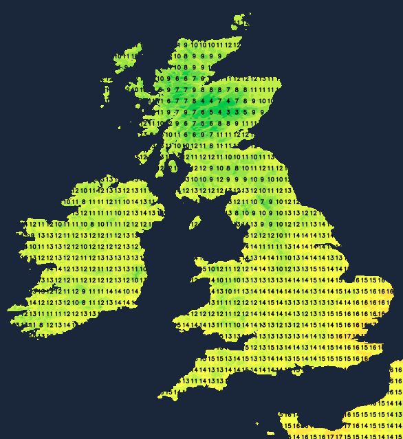
Further showers are likely into the early evening and after dark, with longer spells of rain in the far North. The showers will be most frequent in the West, towards the South coast and over East Sussex and Kent, where a South Westerly wind remains blustery. But across more sheltered eastern parts, there'll be fewer showers, somewhat lighter breezes and more in the way of clear spells. This'll allow it to turn quite chilly as temperatures fall into mid-single figures in places, with the thermometer mainly in the range 5 to 9C by daybreak.
With systems queueing up in the Atlantic, the new working week continues unsettled.
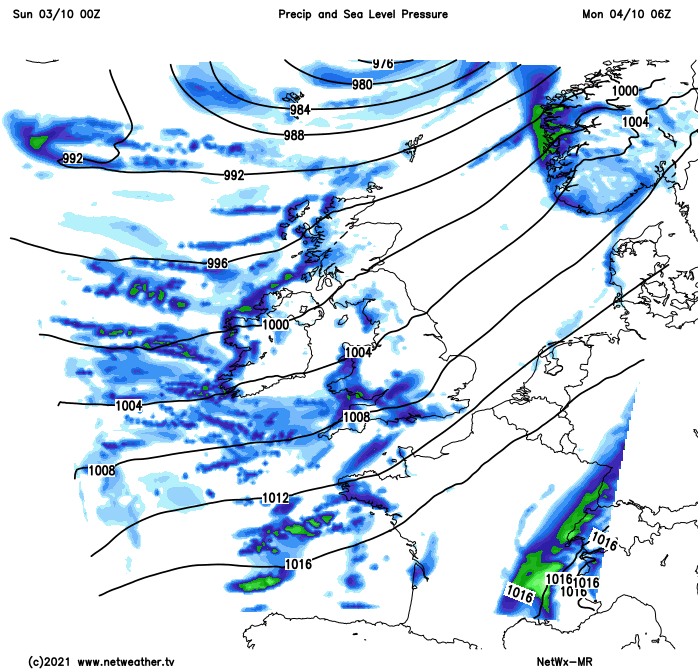
For much of Monday, though, we'll be between lows before the next Atlantic system bringing rain moves into the South West later. So for most parts, it'll be another day of sunny spells and showers, but they'll be fewer in number and mainly in the West and South. Some could still be heavy, though, with the best of the sunny spells on offer again in more sheltered eastern areas where many places should have a reasonable day. The South or South West wind shouldn't be as blustery, with maximum temperatures 11 to 13C and 14 to 16Cin the South.
The wet weather across the South West spreads to most of England, Wales and Northern Ireland after dark, some of which could be heavy and persistent. But over Scotland, you'll probably escape with just a few showers, mostly in coastal areas. Here clear intervals and lighter breezes could allow it to turn a little chilly and misty later in places later, but for most, it'll be a relatively mild night in gusty winds, with lowest temperatures mostly between 8 and 13C.
It remains unsettled, at least until Wednesday, but then we may begin to see a change as pressure rises to the East. This could bring drier, quieter conditions later in the week, while in the West, further systems perhaps containing the remnant s of ex-hurricane 'Sam' may continue to bring showers.