A cool start again today with a NW wind. Showers then rain move in as the unsettled theme continues. We're watching a developing low pressure for the weekend.
All eyes on the weekend low pressure which looks to bring a spell of very windy and wet weather across the UK.
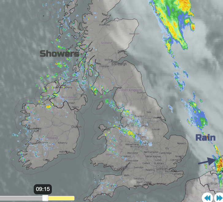
It’s felt cooler for the past two mornings and Highland Scotland saw a frost today. A colder northwest flow is taking hold and is bringing sharp showers to western Britain and Northern Ireland. Last night’s rain is swinging away over the North Sea after lively showers and thunderstorms in the southeast. Away from eastern England, temperatures are well down into single figures. It’s adjustment time for the central heating timer, clothing and bedding.
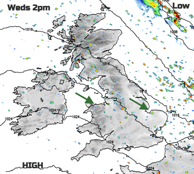
Today the Azores high managed to nose up from the southwest. This is the midweek respite before a series of low pressures arrive, some linger in the north, others sneak by bringing more rain and plenty of blustery winds. Looking at the synoptic snapshots from 00Z and 12Z there are various low centres passing by but one main area just to the north which stays and oversees the unsettled cyclonic setup. If you have outdoor plans for the weekend don’t hold too tight to any weather app timings of when it will and won’t rain. The low showing for southern Britain on Saturday may end up being earlier or later or deeper, so further north or flatter, less developed and staying over the Channel.
Today will feel cool even in the sunshine. The NW wind keeps going, with further heavy showers feeding in. These fade for SW England during the day as pressure rises and most of the UK will be dry. The winds ease down this evening and it becomes chilly, before cloud begins to arrive from the west.
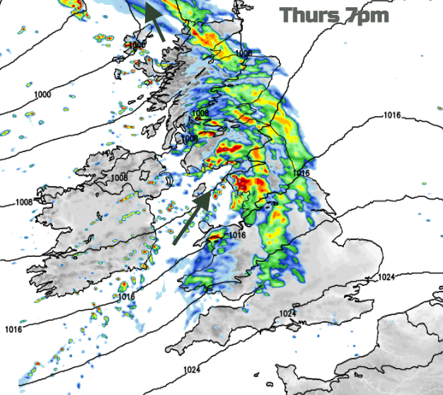
Overnight the southerly winds will strengthen, gusting over 60mph through the Irish Sea and for western Scotland. Heavy frontal rain will set in, and milder air will be drawn up through Ireland briefly in the warm sector.
Thursday
There will be heavy rain for western Scotland, Wales and NW England, particularly Cumbria on Thursday. The fronts push eastwards but don’t really affect SE Britain during the day. Heavy showery bursts line up from the Bristol Channel through the Midlands to Lincolnshire. Clusters of heavy showers flow in further northwest as colder air returns. It will be a blustery day.
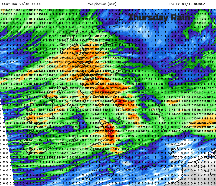
The main low will be south of Iceland during Thursday night but another low pressure looks to develop as it head over the UK. This will bring another spell of rain and blustery winds. It could mean a wet start for southern and south-eastern England and also the far north of Scotland.
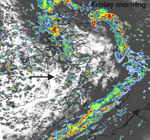
Friday
Heavy showers with hail and thundery pack into the northwest of the UK on Friday and there will be a nip in the air. As a low centre heads in there could be gales for NW Scotland during the day and overnight for the far north. For the rest of the UK, there will be a fresh SW to west wind making it feel colder. Things ease down in the south by Friday evening.
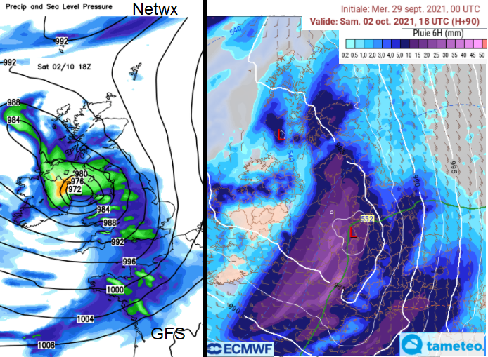
The weekend
Low pressures are keeping us forecasters on our toes. This has been a very different week from the slow, settled and sunny days for the rest of September. A new low pressure moves in from the SW on Saturday bringing rain and strong winds. This low looks to deepen as it heads to NE Scotland by Sunday.
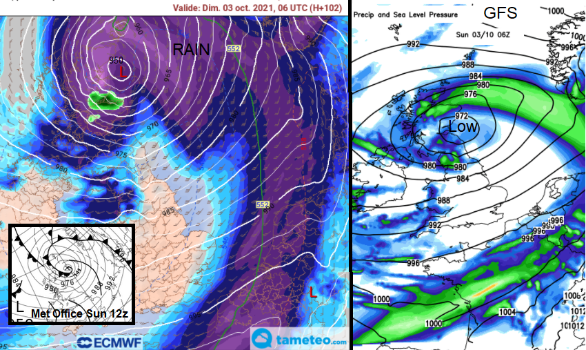
This movement means that this low pressure will affect the whole of the UK at some point this weekend with wet and wild conditions wrapped around it. Maybe it will become the first named storm of this season?
Further discussion in the Netweather community forum