Quite some rain for Monday morning. Vigorous line convection as a cold front heads east. Behind that, cooler air, blustery showers with some hefty downpours but brighter. Unsettled this week.
It’s raining, it’s pouring. It’s quite a change! The rain set in over Northern Ireland later on Sunday and this morning it has been chucking it down over parts of Britain. Some areas haven’t seen proper rain in ages, it has been dry, and warm. This band of rain is an active cold front that includes line convection and will bring a distinct change to cooler air this week.

The red coloured banding running north-south shows the torrential rain, the line convection. As this moves by, it’s edging eastwards, there will be much heavier rain and sudden gusty winds. Visibility on the roads will become poor with extra spray and for those heading out who think, ah it’s not too bad at the moment- do check on the radar where this line is.
Today's Convective Forecast shows action once the cold front has cleared. The Polar Maritime airmass brings colder air at mid-levels, the sea is still relatively warm and there will be sunshine heating the ground.
"This will support scattered heavy showers and thunderstorms across western areas. Showers/storms moving inland from western coasts and supported by surface heating. Hail and gusty winds are possible with these showers/storms. Isolated coastal storms may continue in the northwest overnight."
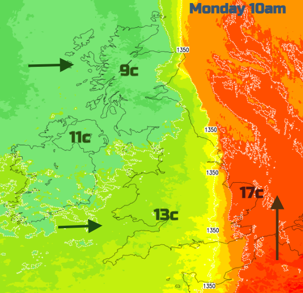
Ahead of the frontal band, it is still warm this morning with temperatures of around 17C to start the day. Behind the front, it is only 7 or 8C. The colder flow will remain for this week with further bands of rain or blustery showers heading in from the west.
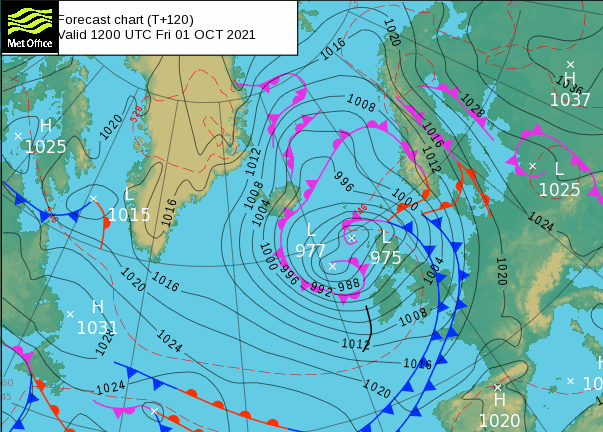
The next few days stay colder than average with temperatures mostly in the low to mid-teens. The flow swings from south-westerly to north-westerly by Wednesday and there are signs of potentially very windy weather later this week. Low pressures keep running in from the Atlantic. Some parts of northern Britain need the rain with water scarcity notices which have been out for months. Autumn rain is really important.
Today’s rain band will be clearing most of eastern Britain by lunchtime. It pivots slightly and looks to develop over Grampian and there is a Met Office rain warning here with 25 to 60mm being mentioned. There are concerns for localised flooding, including for Aberdeen. The line convection will also soak eastern England as it clears.
Behind this front will be brighter skies with sunshine. The fresher feel and a scattering of showers, some could be heavy even thundery in the west. Sheltered eastern areas could still manage 17 or 18C this afternoon with a moderate west wind across the UK.
Tuesday
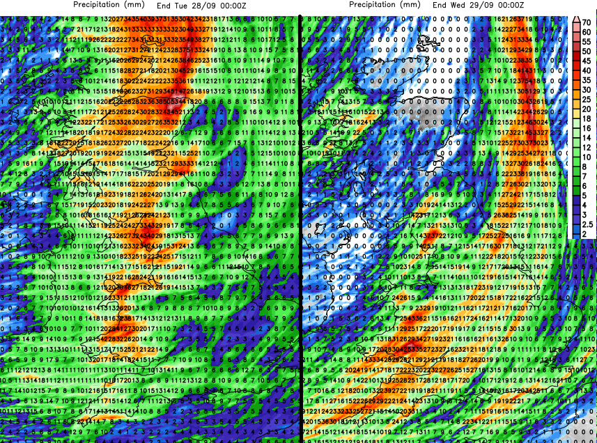
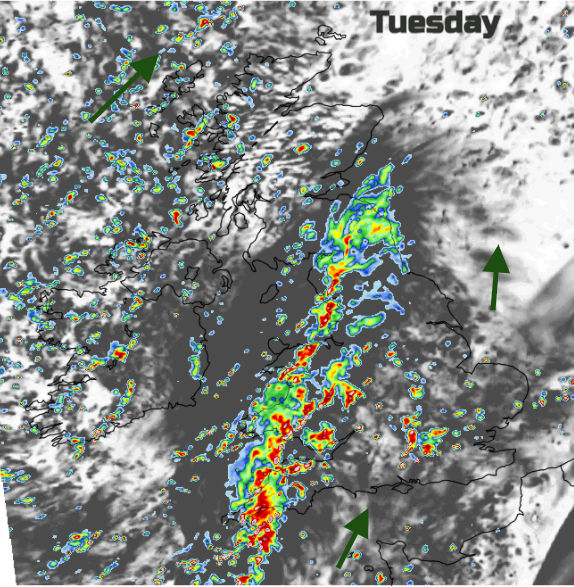
Heavier showers begin to break out early on Tuesday for western parts. These become more organised around an incoming front for SW Britain. This area of wet weather extends north-eastwards through the day with heavy bursts and the whole lot edges eastwards into the evening. The heavy showers along the south coast of England may need to be kept an eye on.
Cool air mid-week in a northwest wind but with plenty of sunshine on Wednesday. Then some warmer air caught up with the next frontal system from the west. This Atlantic low pressure will bring strong winds and another band of heavy rain, even some thundery bursts embedded on Thursday. Heavy rain marching across the UK followed by hefty showers but not really reaching SE England.
Later in the week, the mobile setup continues with further bouts of wet and windy weather whistling through. Don’t try to plan weekend timings off weather app symbols at the moment. Just keep in mind that the weather has changed now. It’s blustery, there will be more rain from the west and the temperatures are lower, down into single figures by night in the north.