Temperatures stay in the high teens to low 20sC over the next few days. For many, it will be a fine, warm weekend, often dry before a shift to unsettled weather for the new week.
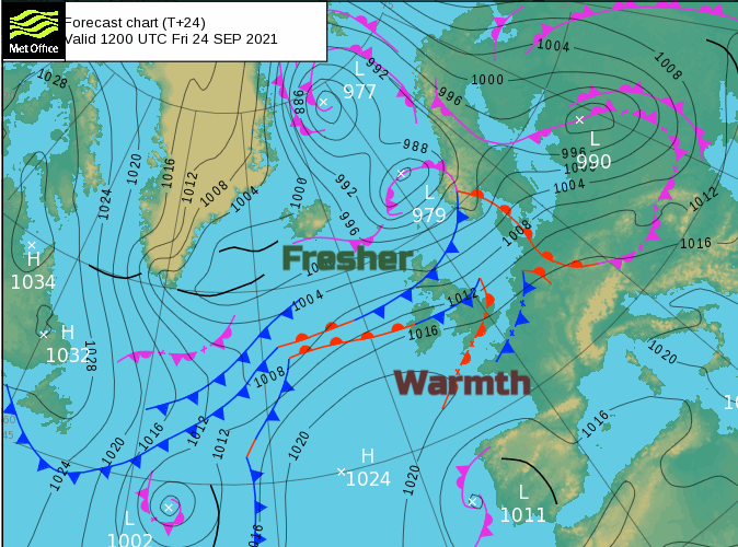
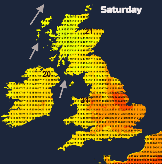
There is a long striking frontal boundary stretching from the Atlantic to the UK and then across the Baltic Sea. Many parts of the UK have been enjoying some September warmth and sunshine and that will be the case on Saturday. It will feel warm but with a bit more cloud about. However, by Sunday the fronts line up north-south and looks to sweep across Ireland on Sunday and the rest of the UK by Monday morning. This will bring a spell of proper rain, always heaviest in the west. Once that is through it leaves the UK in a fresher, unsettled westerly flow for next week.
Ahead of Sunday’s cold front, bringing the rain from the west will be a scattering of heavy showers for SE England and parts of Scotland. If you are looking to book a round of golf there could be a clear difference in the forecast. As the Ryder Cup begins at Whistling Strait WI overlooking Lake Michigan, there will be sunshine and fine weather for this part of the United States. Temperatures up to 73F with light to moderate winds from the west, feeling a bit fresher at 67F on Saturday (23C to 19C).
Today
This morning there are areas of Britain with sunshine and others under thick cloud which are grey and murky with poor visibility on some higher routes. NW England and Strathclyde is damp and cloudy with a breeze off the sea. Also, Northern Ireland. Through the day various bands of cloud and light patchy rain topple in from the northwest. So, these same damp, grey areas get more murky weather. Elsewhere there will be brightness, and warm sunshine appearing for SE Britain, but cloud reaching western Wales and Cornwall. Much of eastern Britain will do well although more cloud reaching across to North Yorkshire.
Once again it is blustery for northern Britain and Northern Ireland but hardly any wind further south. High pressure clinging on to the southwest and a little low moving eastwards north of Shetland.
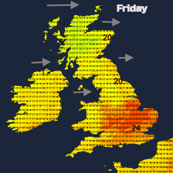
Yesterday the West Midlands saw 23.5C which is similar to where the UK temperatures have been peaking this week. Today London could see 24C with very light winds and plenty of sunshine. Eastern areas being warmer today. By Saturday, the temperature forecast is being affected by increased cloud cover for southern Britain but if gaps appear then 23 or 24C is likely again. With a more southerly flow areas to the lee of high ground will also see higher temperatures but overall, it looks to be a fair Saturday.
Through Saturday night a few showers begin to appear with perhaps the odd heavier cluster reaching across SE England by dawn on Sunday. Also a few sharp showers over southern and western Scotland.
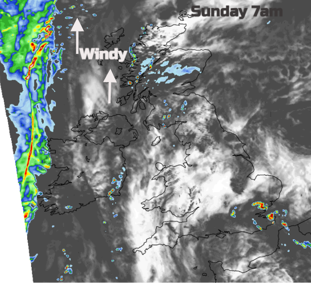
The nights look mild this weekend, particularly in this southerly flow. A fine start on Sunday but gradually this frontal rain will reach across Northern Ireland during Sunday as it becomes wet and windy. Currently, the rain looks to reach western Scotland by late afternoon but not much more of Britain. So potentially another fine day with similar temperatures.
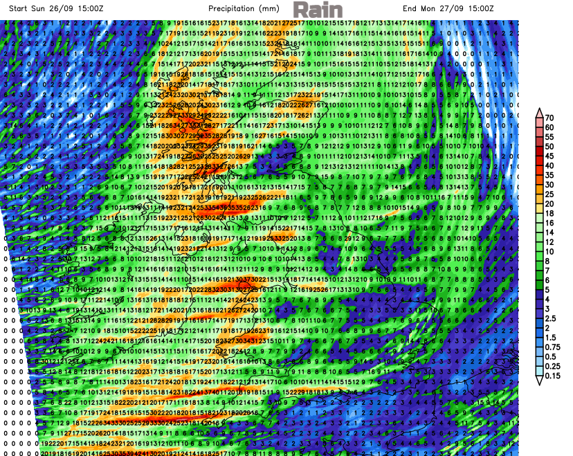
Rain later Sunday into Monday
After that, next week is looking much more mobile with blustery winds, spells of heavy rain sweep in from the west and a fresher feel for everyone. Autumn is arriving, like the geese and those falling leaves.