A Low to the north, high pressure to the south with great contrasts in the weather across the UK. There is more warmth in the forecast but also some blustery winds.
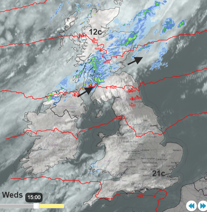
There is a huge difference in the weather across the UK midweek. Really windy for Scotland but hardly any breeze for southern Britain. Low pressure away to the north and high pressure clinging on in the south. Southeast England has seen temperatures tipping into the low 20sC and although Aberdeenshire was the warmest place in the UK on Tuesday with a Foehn assisted 23.5C, it has been cooler, cloudier and wetter for the north-western half of Scotland today.
We have got several more bouts of windy weather moving through this week. Often peaking by night and affecting northern parts more than the south. For those enjoying the later September warmth and sunshine, is it going to last? What about the weekend or will the wet and windy conditions in the northwest become more widespread?
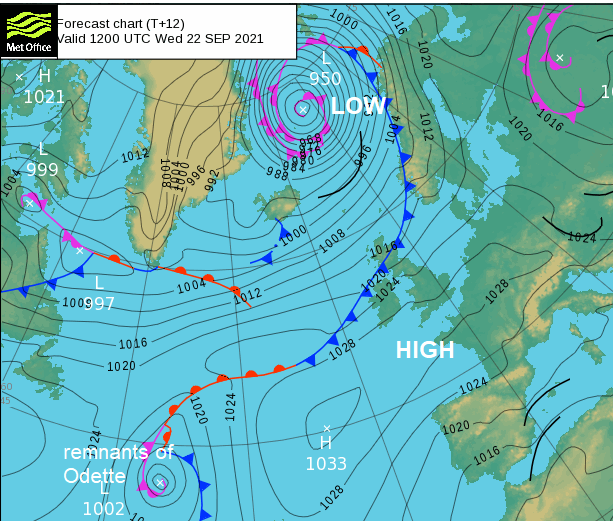
Two key players in our UK weather have been a significant low pressure which moved across Iceland yesterday bringing storm force winds with heavy rain and snow. This has been responsible for the windy weather over Scotland too. The fine, settled and warm weather is thanks to a lingering high pressure. This high has brought many areas a lot of dry weather recently but it retreats back towards the Azores and is gone by the weekend. Low pressures seems to multiple but high pressure through the Mediterranean could exert some influence our way. The main difference across the UK now is a frontal boundary between the Icelandic low and one away in the Atlantic. This one continues the remnants of Tropical Storm Odette and is still a feisty low pressure being kept ‘on the radar’ as it were, by NHC
That boundary, as a cold front moves right down through Britain during Thursday morning. Although that will bring more cloud and dampness to the west, it is fading. Eastern England, into the Midlands, should still temperatures around 20C and feel warm. Another front follows further north and cooler air into Scotland.
Warm air floods in from the southwest by Friday. Again plenty of fine dry weather for the southern half of Britain and eastern Britain. More cloud and patchy rain for the NW of the UK.
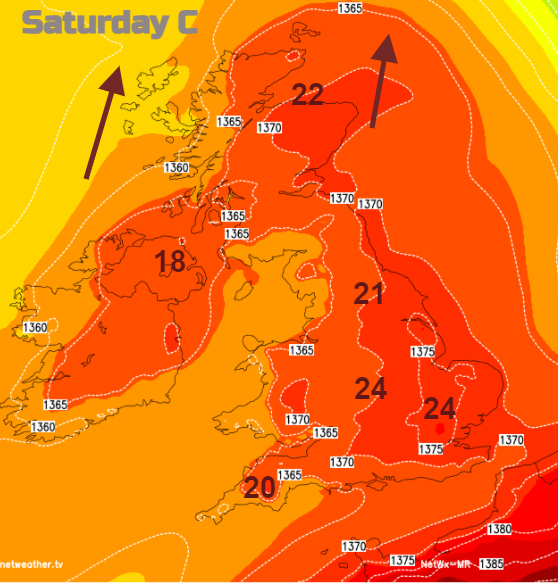
Another pulse of warm air on Saturday although with more cloud and showery outbreaks for western areas. And Sunday could bring a switch. Rather than the north-south divide, by the end of the weekend, it could be an east-west split.
Still warmth and sunshine in the east with a southerly breeze picking up. Out west, with low confidence around the timings, will be a band of proper rain and strengthening southerly winds.
So through until the beginning of next week, many areas will continue with the fine dry weather, seeing more of a breeze as the week goes on. Northwest and then western parts see more cloud and the risk of rain.
What we have seen in the brisk SW winds are beautiful ripple patterns appearing in the clouds such as Altocumulus Stratiformis. Regular lines or ripples with gaps allowing sunshine through and stunning sunsets.