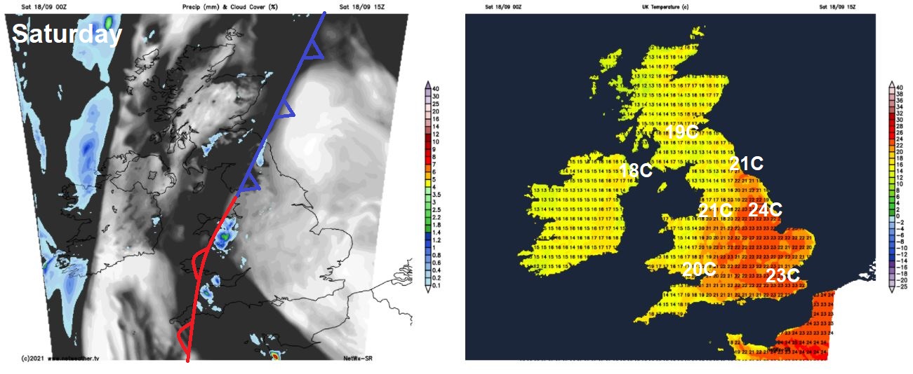
Dry with sunny spells for many on Saturday, though a band of showery rain for parts of the north and west. Heavy rain moving into eastern areas on Sunday, turning brighter in the west. Fine first half of next week, unsettled second half.
The weather has been generally rather quiet, settled and dry since Tuesday, with high pressure in control close to the east. High pressure is still close by to the east on Saturday, so for many it will another dry day with some sunshine in places, though a slow-moving weak cold front lying from Scotland down to the southwest will bring a band of cloud and some showery rain. Sunday sees this cold front edge eastward and become more active – with a slow-moving band of heavy and perhaps thundery rain affecting the eastern side of Britain. Brighter across the west, but a few showers too.
High pressure builds in briefly across the south early next week, before a strengthening jet stream, fuelled by Tropical Storm Odette off New Foundland, blasts into the UK from mid-week, bringing more unsettled conditions:
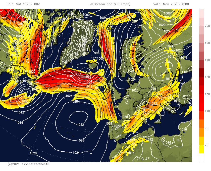
High pressure rebuilds in from the southwest across southern Britain early next week, so apart from a few showers in the far east and far northwest on Monday, for many it will become dry and fine with sunny spells through Monday and Tuesday. But from mid-week onwards, it looks like the Atlantic is stirring, with the remnants of Tropical Storm Odette churning northeast off coast of New Foundland early next week injecting extra energy into the trans-Atlantic jet stream. This will in turn bring more unsettled and windier conditions for all during the second half of the week, with a more autumnal feel.
For now, after a misty start – with low cloud in places, for many Saturday will be a dry day with sunny spells. However, a slow-moving weak cold front draped across eastern and southern Scotland southwestward through Wales and SW England will bring a band of cloud and some showery bursts of rain here through much of the day, with a few showers breaking out across some central southern areas of England too. Some showery rain could move in the Western Isles and far west of N. Ireland by the evening too. To the east of the cold front in the sunnier skies across central and eastern England temperatures will reach a respectable 21-23C, to west of the cold front across Scotland and N. Ireland – it will be cooler, with temperatures reaching 16-19C.
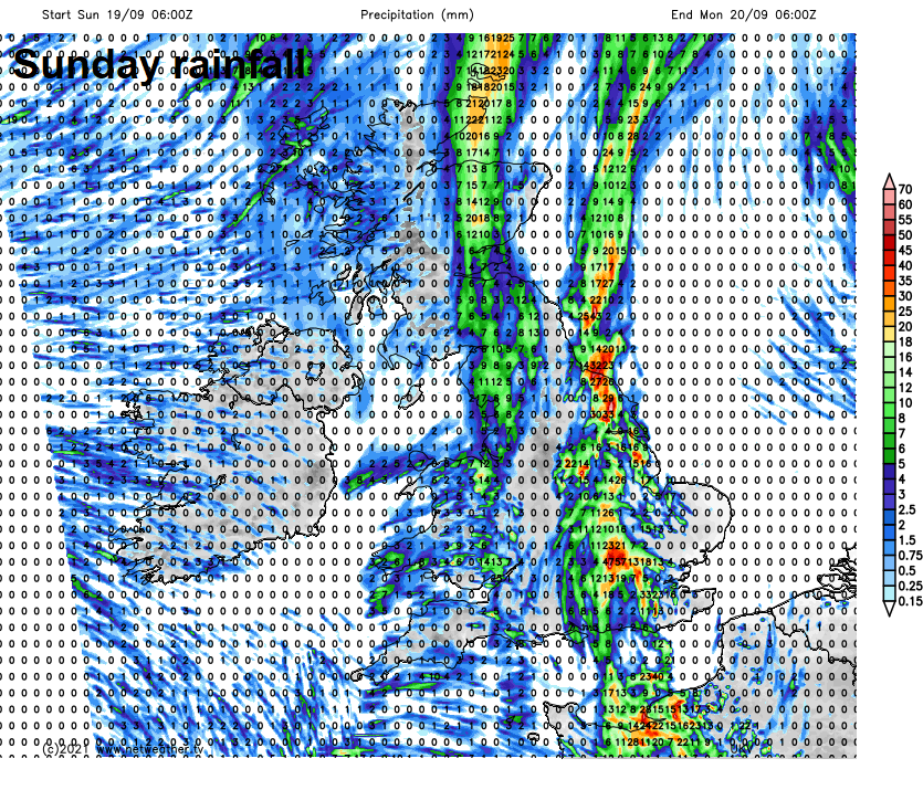
The slow-moving cold front lying from eastern Scotland down across northern and western areas of England along with Wales will become more active overnight – with a band of increasingly heavy rain developing along it. Either side of this, mostly dry with some clear spells allowing mist and fog patches to form, though another band of rain moving in across N. Ireland and the far west of Scotland.
Sunday sees a band of cloud with spells of heavy rain creep slowly east to the eastern side of England during the morning – lingering across the eastern side of England through the afternoon, with a Met Office yellow warning for rain in force here. Brighter skies with sunny spells following from the west through the morning and into the afternoon further west across Scotland, N. Ireland, NW England, Wales, Midlands and SW England, though not dry for everyone – with some scattered showers spreading from the west. A cooler day across the board, temperatures reaching 16-19C generally, perhaps 20C across southern England.
A ridge of high pressure starts to build in from the southwest on Monday, so for many it will be dry and fine with sunny spells. But a weakening front still lingering across eastern England will bring more in the way of cloud with a few showers here, while another front moving into the far northwest will bring cloud and some showers while it will be windy here too.
Tuesday should be drier with more widespread sunny spells across England and Wales, as that ridge of high pressure continues to build in. Increasingly windy across the north, with weakening fronts moving in off the Atlantic bringing cloudier skies and some rain to western Scotland and N. Ireland, eastern Scotland dry and bright.
Spell of heavy rain along a cold front moving southeast across Scotland and N. Ireland Tuesday night, the front perhaps weakening as it crosses England and Wales on Wednesday, but bringing a brief spell of rain across most areas. Blustery showers following across the north and generally it looks like a windy and cool day.
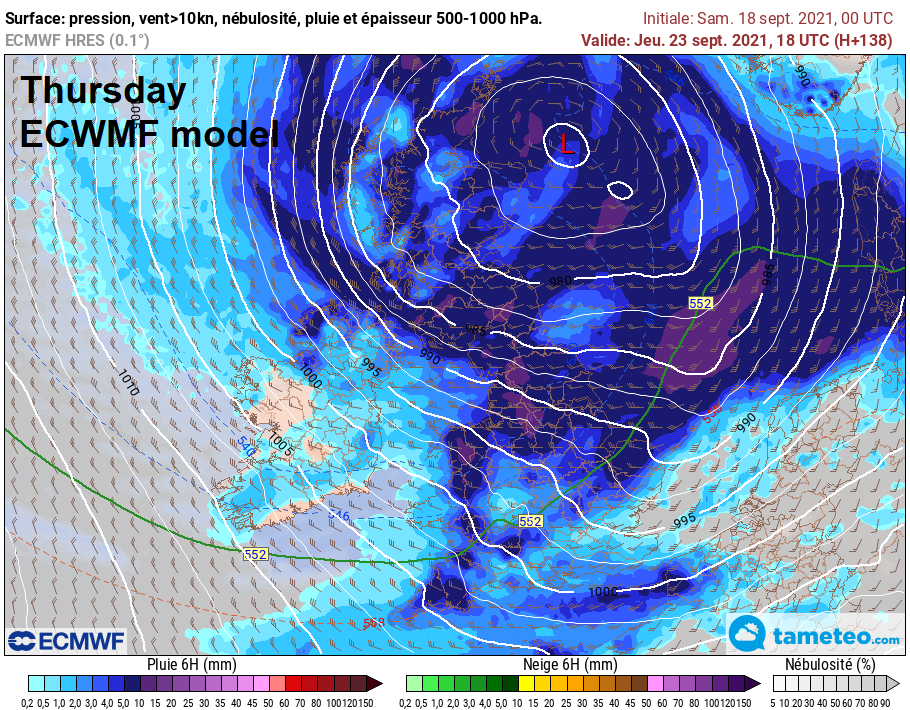
Some uncertainty this far out, but a few models showing a potentially wet and windy day for all on Thursday, as deep low crosses Scotland from the west, models less keen on the deep low still show a cool and windy day with rain in the north and showers elsewhere. A cool northwesterly flow for Friday, with showers in the north and west.