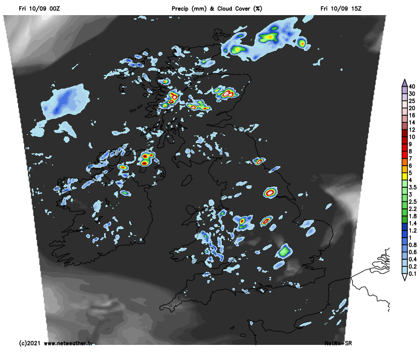
Another day of widespread showers developing on Friday, heavy with thunder in places. Still a few showers Saturday, but lighter, while northern Scotland stays wet. Sunday generally dry. Turning cooler and fresher over the weekend.
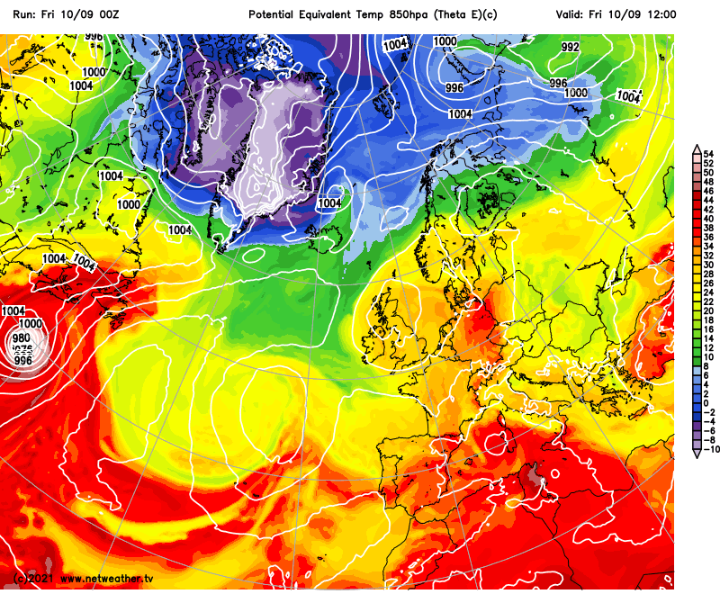
After a hot first half to this week, where temperatures reached 30C in a few spots, temperatures have been on a downward trend since, as low pressure moves in from the west bringing heavy and thundery downpours. Eastern England still hung on to some heat and sunshine on Thursday, with 26.6C reached at Santon Downham in Suffolk. But cloud and heavy thundery downpours subdued temperatures elsewhere, with a similar story today of increasingly widespread heavy showers and thunderstorms developing, though sunny spells developing too between the showers.
Cooler and fresher polar maritime air moving in from the northwest over the weekend will remove the humid conditions of late
Turning cooler and less muggy this weekend as winds turn northwesterly then northerly, but also turning gradually less showery, as low pressure moves away towards Scandinavia. Low pressure still close to the northeast of Britain on Saturday, centred between Scotland and Norway, which will feed in cloud and persistent rain across northern Scotland for much of the day. Elsewhere, sunny spells but also scattered showers developing – but not as heavy or frequent as today. Sunday looking largely dry with some sunny spells, best of which in the south and east of England, some showers possible in the north and rain later for the southwest. Cooler than recent days.
For now, a cloudy, misty and murky morning so far for many this Friday morning, thanks to a warm and muggy airmass with us. Showers from the word go in places and these showers will become more widespread through the day. But sunny spells should develop between the showers through the morning and into the afternoon – more particularly across central and eastern areas. But the sun’s warmth will build cumulonimbus clouds higher and higher, so some thunderstorms are likely to develop amongst the increasingly heavy showers too. Although temperatures won’t be as high as recent days, still feeling humid, and where the sun comes out it will feel quite warm. Highest temperatures, like yesterday, across sunnier eastern England – where we could reach 23-24C, elsewhere 18-22C, feeling humid though.
Cloud & precipitation at 3pm this afternoon
Netweather Thunderstorm Watch map:
.png)
Cloud and outbreaks of rain, heavy in places, persisting across northern Scotland through much of Saturday, courtesy of a slow-moving front wrapping around low pressure close to the east. Further south, sunny spells but also some showers developing - but fewer and lighter than today. Many places escaping with a dry day. Temperatures only reaching 14-15C under the rain in the far north, but further south across the north reaching 18-21C in the sunshine, 20-23C in the south. A fresher feel across northern and western areas, as a northwesterly breeze sets in.
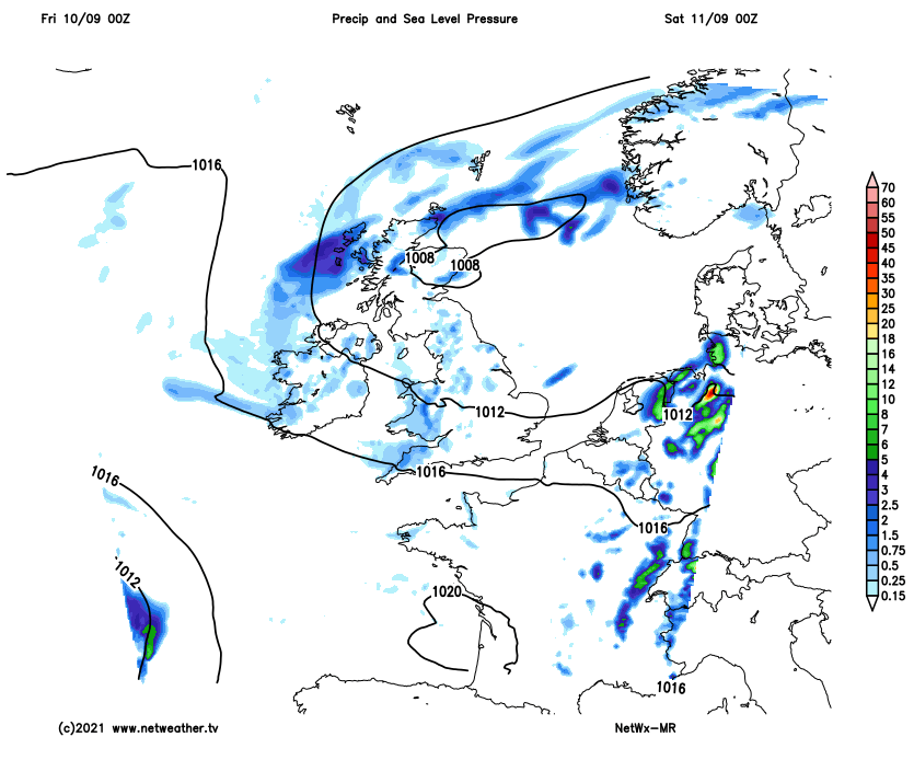
Sunday’s looking a generally dry day, but not everywhere. A cool northerly breeze will feed in cloudy skies at times across northern areas which may bring a few showers here and there, but mostly light. Generally dry across the south with some sunny spells, but also cloudy at times. We are keeping an eye on area of rain approaching SW England and Wales in the afternoon, some uncertainty how quickly and how far northeast this rain will spread, but perhaps turning wet here through the evening. Cooler on Sunday, temperatures reaching 15-18C in the north, 18-21C in the south.
Generally unsettled next week. Though eastern areas of England are looking largely dry and bright or sunny on Monday, western and northern areas of Britain will be cloudier with outbreaks of rain spreading northeast. Tuesday looks likely to see unsettled conditions spreading east across all parts, with heavy and perhaps thundery downpours developing in places. Still some showers, perhaps heavy with thunder, across eastern areas on Wednesday. Drier and sunnier in the west – as a ridge of high pressure to the west builds in. This ridge sliding east on Thursday, bringing a mostly dry day, before unsettled conditions, with rain and showers, return from the west to end the week.