Meteorologically, that is the end of summer. However, it looks like there will be higher temperatures for southern Britain finally by the weekend and warmth managing to reach the east coast next week.
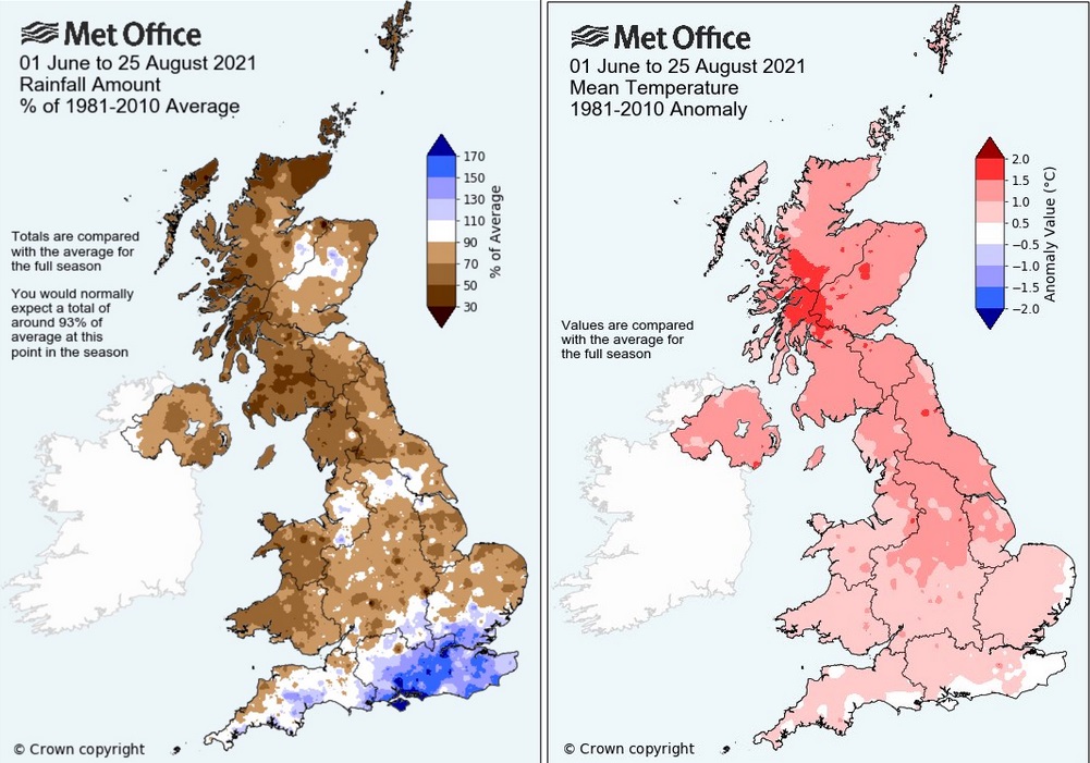
It’s the first day of meteorological autumn. How was your summer? Back to school time now. The summary for the three summer months (the dataset used for climate studies) will be issued midweek by the UK Met Office. We were given an early peek last week which showed much of the UK was warmer than average and also drier. Much drier in places, western Scotland has seen some incredible weather recently and plenty of sunshine. The Scottish Environment Protection Agency has water scarcity notices in places as it has been so dry. "Due to sustained very low flows and dry ground conditions." SEPA. Wait for it, southerners with your jumpers on, that bright blue bit is coming up.
The early peek at Summer 2021 data
July was very warm, hot for Northern Ireland with the run of 30+C temperatures with an extreme heat warning for SW Britain too. But there were southern parts of Britain that saw a lot of rain this summer (see the dark blue areas on the rainfall map) and have remained at or below average with their temperatures, particularly in August. The high pressure which has been sitting over the UK for more than a week now has continued to feed in cool air off the North Sea with a whole lot of cloud.
For the rest of this week, the high pressure remains close to northern Scotland but will edge eastwards over Scandinavia by the weekend. It has been blocking all other weather. A shield that has kept Atlantic low pressures at bay. Hence the endless anticyclonic gloom for eastern Britain with all that cloud and dampness off the sea. Yet western Britain and Northern Ireland have been brighter, even sunny at times and felt warmer. A change is coming.

Scotland will see more sunshine today. There has already been a cool but sunny start for most and the patches of low cloud will break. Northern Ireland should also see things brightening up, with sunny spells appearing. Light winds and temperatures of 18 to 20C, even 22C or 23C for Glasgow to Stirling. Gwynedd and Cornwall are managing to poke out of the cloud cover this morning. Elsewhere there is still the cloak of cloud and dampness in the east. Around the Humber, there is patchy rain to start the day and along the east coast, temperatures will stay in the mid-teens and a north to NE breeze. Other areas will see high teens, maybe 20C with a NE to easterly light breeze.
Through Thursday and Friday, it is a similar story. Chasing cloud under the high. It looks to break up more for England and Wales on Thursday by the afternoon. And again, western parts seeing more sunshine on Friday along with southern England to end the working week, so feeling a bit warmer here.
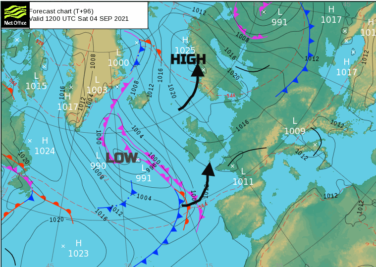
Through the weekend the easterly wind begins to pick up. The high is shifting away as an Atlantic low pressure begins to squeeze in. Then a waiting game for a complex set of weather fronts to swing in from the southwest. There looks to be some warmer air caught up in all this with temperatures shifting up into the low 20sC for areas that have been struggling. Although NE Britain continues with the cool breeze off the sea.
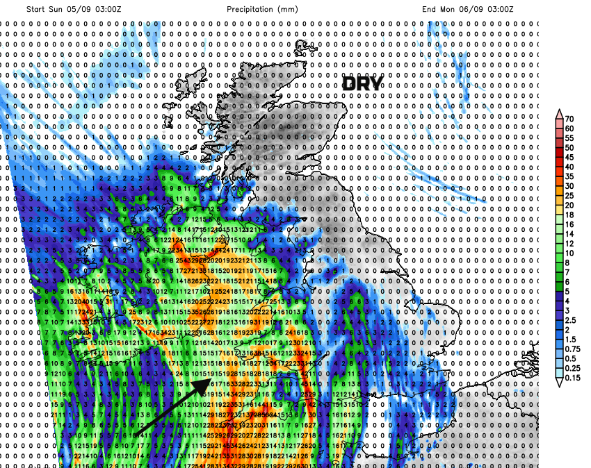
There is some uncertainty about timings and reach northwards but there will be a spell of rain moving in from the Atlantic Sunday into Monday. There will be heavy bursts, even thundery ones as this takes its time edging eastwards. After such a lengthy settled spell of stagnant weather, this will be quite a change when it comes.