Low pressure is in charge of the UK's weather to start this weekend, with heavy, thundery rain affecting much of the country. High pressure will start to build from Sunday though.
With low pressure coming in from the North Atlantic, today is set to be cloudy and wet for the majority of the UK, with outbreaks of rain spreading northwards for much of the day.
The fronts will clear Wales and central and southern England from midday onwards, allowing some sunny intervals to develop. There is the potential for some heavy and thundery showers to break out in these brighter conditions, particularly away from west and south-facing coasts. These may also penetrate into northern parts of England later in the day.
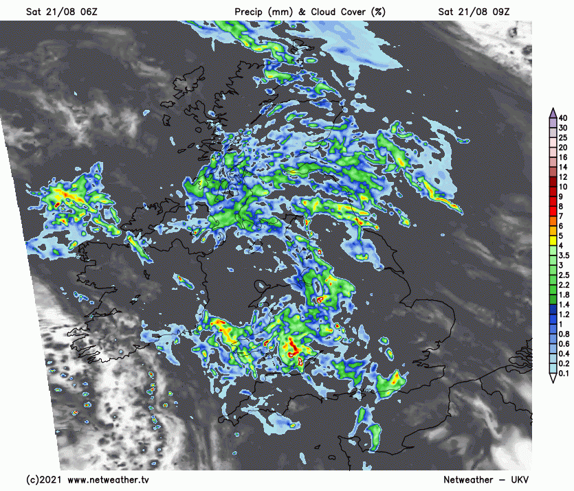
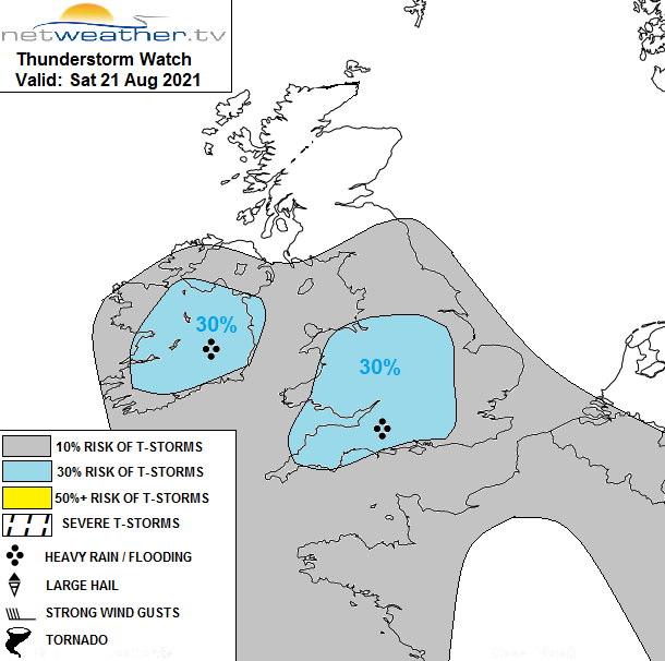
The Met Office has issued a yellow rain warning extending as far north as southern Northumberland, indicating the potential for disruption to arise from localised heavy thundery downpours. A Netweather storm forecast has also been issued for today.
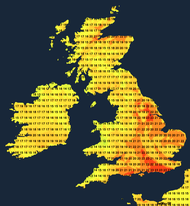
Temperatures will be close to or just below the seasonal average, with a generally muggy feel. Temperatures will reach highs of between 20 and 22C in most central and southern parts of England and South Wales, but elsewhere highs between 17 and 20C will be typical. A rather warm night will follow, with minimum temperatures typically between 12 and 15C.
High pressure is set to build behind the low pressure system that is currently crossing the country, producing a fine spell of weather. Temperatures will be more moderate than during the hot and sunny period that most of us experienced during mid to late July.
There will be plenty of cloud to begin with on Sunday, especially in eastern parts of England, but this will tend to break up as the day progresses, especially in western areas, with increasing amounts of sunshine coming through. This will set off from scattered, locally heavy and thundery showers in central and western regions, but many places will stay dry. It will generally be warmer than today, with highs between 21 and 24C, but cooler near North Sea coasts due to an onshore breeze.
From Monday to Wednesday, the weather will increasingly turn clear and sunny for most of the country, with high pressure dominating the weather. Temperatures will rise a little further, peaking at 22 to 25C in most parts of the UK, but it will be cooler near North Sea coasts due to onshore breezes, with the potential for these to bring some low cloud and fog into eastern coastal areas. With clear skies and light winds, temperatures will tend to fall more overnight, dropping to around 10 to 13C for most parts of the country.
Towards the end of next week, it looks probable that we will pick up a northerly airstream with low pressure developing over central Europe. It will remain generally dry across the UK. But we will see cooler temperatures and more widespread cloud coming into eastern areas, especially the east side of England, perhaps penetrating into central regions of the UK at times. Northern Ireland, Wales, and the west of both England and Scotland will remain mainly sunny, but with temperatures a little lower, reaching highs of 20 to 23C.
The Greenland ice sheet has seen a second major melting spike. After the spike in late July, associated with Greenland blocking, another major melt event has occurred from 14 to 16 August, with rain and melting observed at the Summit Station. It is the latest time in the year that above freezing temperatures have been observed at the summit, and the first time that rainfall has been observed there.
In other news, Storm Grace is now a Category 3 hurricane - the first major hurricane of the 2021 hurricane season - with sustained wind speeds of 120mph and may be heading for Mexico, where significant disruption is possible due to heavy rain and strong winds.