The weather is slowly but surely on the change. Initially, that's going to mean less in the way of showers across the southern half of the country, but ultimately Atlantic low pressure is going to be making a return, starting this weekend.
The weather is slowly but surely on the change. Initially, that's going to mean less in the way of showers across the southern half of the country as we move towards the end of the week, but ultimately Atlantic low pressure is going to be making a return, starting this weekend.
It's still a showery picture in southern England and East Anglia over the next couple of days, as our slow-moving low gradually eases away to the east. Then, during the remainder of the week, high pressure will continue to dominate across the north of the country, but it will extend its influence further south, lessening the shower risk.
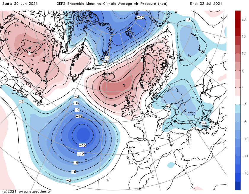
In the image above, those blues (lower pressure) in the Atlantic give an indication of what may be to come. By the weekend and into the start of next week, that lower than average pressure has shifted east to be over a good part of the British Isles, leaving just northeast Scotland still close enough to be influenced by high pressure.
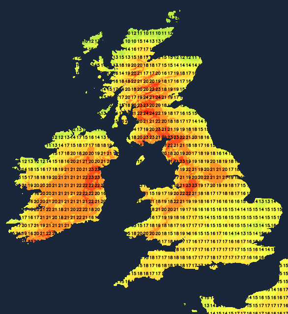
For today, the showers in southern and central parts will drift in from the east, which puts Wimbledon at risk of catching one. But head north, and it's a totally different picture with bags of sunshine and warm temperatures (away from east and north-facing coasts). Maximum temperatures today are likely to reach 24-26c, with western Scotland or northwest England likely to top the charts.
Tomorrow (Wednesday) will see the shower risk in the south become more limited to eastern regions - particularly East Anglia. That doesn't rule out the chances of one popping up elsewhere, though, and we'll need to keep an eye on a potential convergence zone through Wales and down into southwest England, where some sharp downpours and perhaps even thunderstorms may develop.
Elsewhere, west will still be best for sunshine and therefore the warmest temperatures but there will generally be more cloud than there was on Tuesday, so temperatures will be a few degrees down. Thursday keeps a fair bit of cloud in eastern parts, but elsewhere there should be long sunny spells, allowing temperatures to rise into the high-teens or low-twenties. The warmth may help to trigger some showers in the south, but for most it will stay dry.
Friday then brings more warm sunshine and just a few well scattered showers here and there. Even eastern regions are likely to see more in the way of sunshine, but on the flipside, cloud will be starting to fill in from the southwest through the day as an Atlantic weather front approaches. The cloud will eventually thicken enough to bring some rain into the far southwest before the day is out, which will move northeast overnight and into Saturday.
The rain will become more showery on Saturday but there will be a lot of cloud across England and Wales. For Scotland though, there'll be plenty of warm sunshine once again, although the cloud and potentially some showers will nibble in from the southwest through the day.