Despite fairly high surface pressure, showers will develop across southern Britain today and eastern areas on Monday. Drier for most Tuesday, but Atlantic fronts will make inroads mid-week before high pressure wins back later in the week.
Although the barometer will show fairly high pressure across much of the UK today, between 1024 and 1025 hPa (or millibars in old money), thanks to a surface ridge of high pressure building in from the Azores, that does not necessarily mean it will be dry and sunny everywhere. As a forecaster, we also need to look at the flow aloft and today it’s southwesterly and weakly cyclonic thanks to upper low to the northwest over the far North Atlantic. This means, despite surface pressure being high, the cyclonic flow aloft will bring in cold enough air in the atmosphere aloft to allow parcels of warm moist air across southern Britain to rise, as the ground warms in sunshine, to allow showers to form today, particularly where surface breeze convergence and higher temperatures will give extra lift to form those shower clouds.
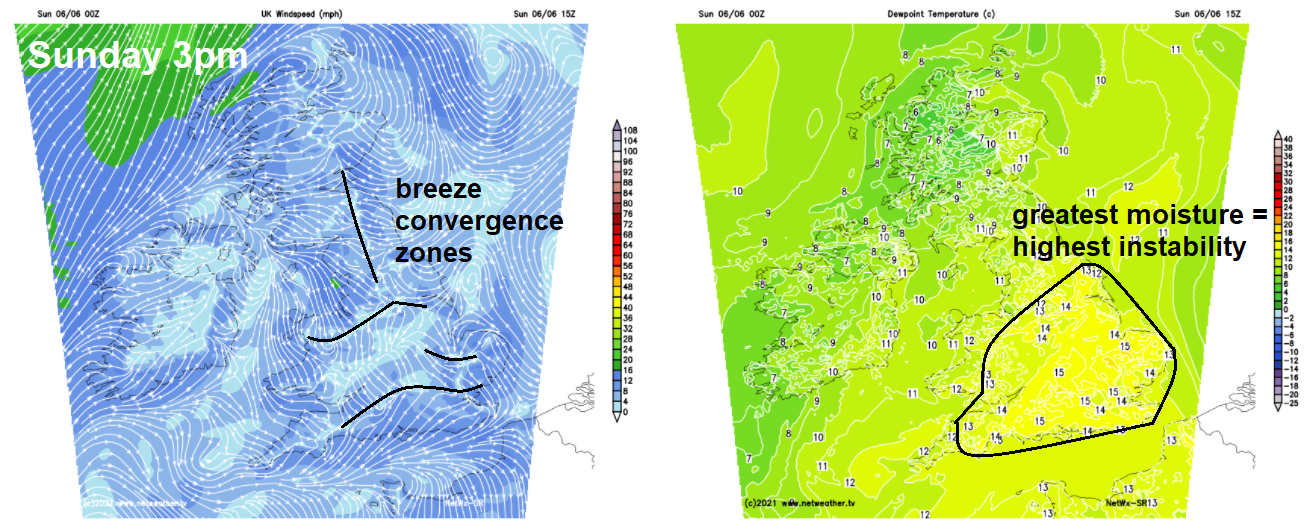
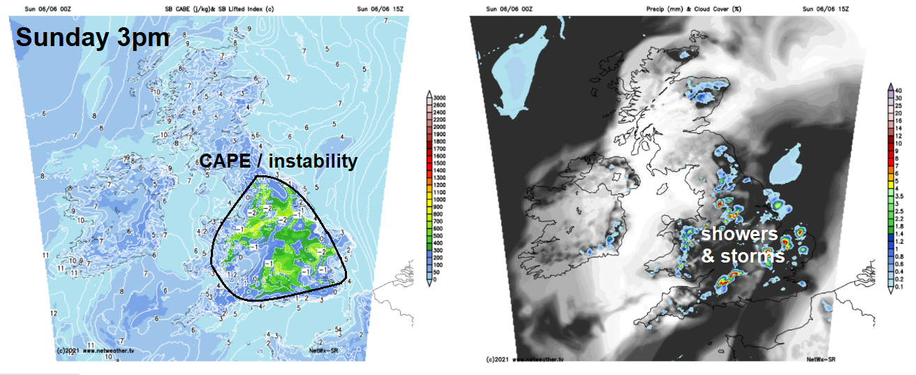
Before these showers develop later, a frontal system moving in from the west overnight continues to weaken as it moves east through surface high pressure, but it still has enough lift along it to bring a band of thicker cloud and patchy mainly light rain to central and northern areas of England this morning. Either side of this it’s a drier and sunnier picture this morning. This cloud and patchy rain will become confined to northern England into the afternoon, while skies brighten to the south across England and Wales, but the increasing sunshine here will trigger heavy showers with help of surface breeze convergence and cooler air arriving aloft from an shortwave upper trough moving northeast. Some of these showers will turn into thunderstorms, though they will be localised and isolated. A Thunderstorm Watch has been issued for today.
The heavy showers and thunderstorms will develop mostly across east Wales, Midlands, southern and eastern England. Cloudy with patchy light rain or drizzle for northern England, staying dry and sunny for Scotland and N. Ireland. Highs this afternoon in the sunshine reaching 16-18C across northern and western areas, 19-21C across southern, central and eastern England.
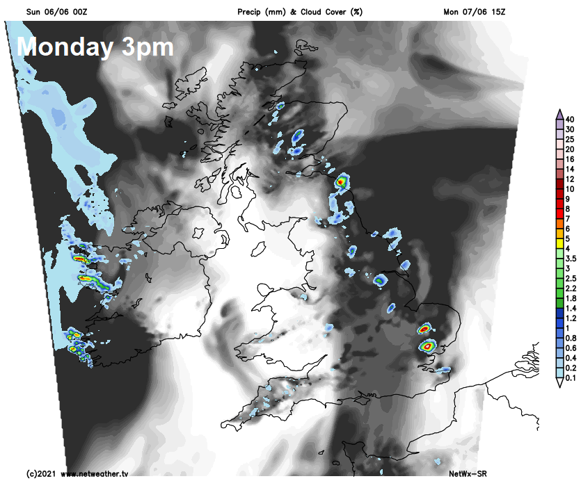
Pressure will still be fairly high on Monday, not as high as today, but still 1020-1024mb. But like today, cyclonic flow aloft bringing in cooler air aloft atop of more humid air and highest temperatures towards eastern England in sunny spells here will create steep lapse rates and support the development of scattered heavy showers and a few thunderstorms during peak heating in the afternoon. Elsewhere will be drier with sunny spells. Temperatures similar to today.
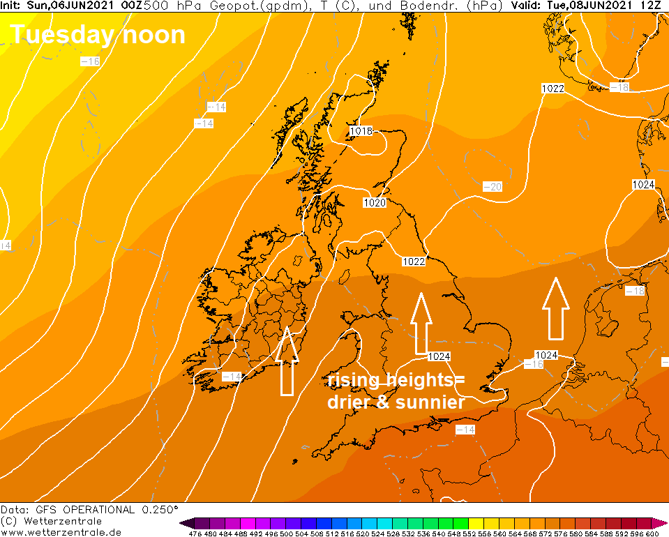
The barometer or your weather station will read similar values again on Tuesday, but aloft pressure or, more technically, heights will be rising across England and Wales – as an upper level ridge increases in strength from the south. This means temperatures aloft will be higher and thus parcels of warm air rising will not get very far aloft, so showers are unlikely to form across southern Britain and so it will be mostly dry, warm and bright or sunny day here. In the north and northwest, a different picture, as frontal systems move in of the Atlantic along with a brisk southwesterly wind, bringing cloud and spells of rain.
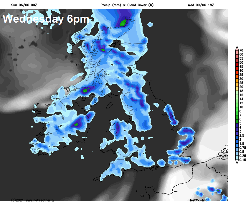
The fronts arriving across the northwest on Tuesday making more progress eastwards across Britain on Wednesday, so a cloudy and breezy day across more areas, with further spells of rain in the north and west, patchy light or rain or drizzle towards the south and east. Best chance of sunshine towards the southeast.
Similar day on Thursday, breezy and often cloudy across many areas, with patchy light rain or drizzle in places, perhaps more persistent rain in the northwest. Perhaps drier with some sunshine across eastern England.
A stronger upper level ridge may build from the Azores northeast across Britain through Friday, so a drier, warmer and increasingly sunnier picture may unfold through the day, after early cloud and patchy rain clears east.
Next weekend, at the moment, is looking increasingly fine and settled, warmer too, as a stronger upper high builds close to the southwest.