Even warmer today with temperatures heading to the high 20sC. There is showery rain in the far SW which will bring heavy downpours and thunderstorms as it edges northwards.
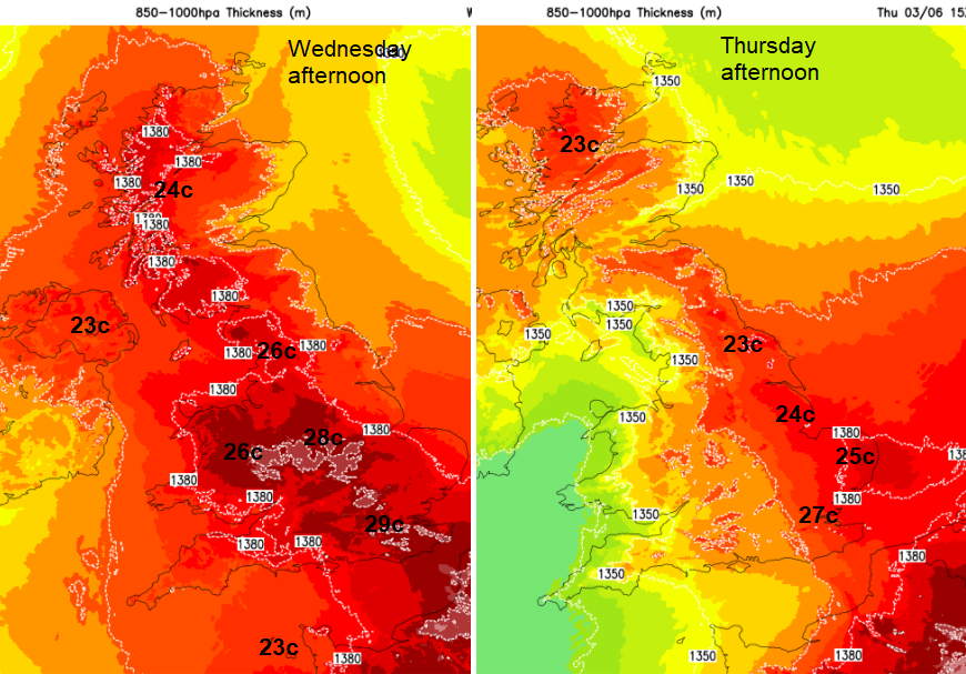
Midweek will see the peak of the temperatures with 28 or 29C possible. There will be plenty more fine, dry weather and sunshine but showery rain is appearing for SW England and the Channel Islands. A cluster of lightning strikes north of Guernsey by 9 am. The first signs of a shift to a less settled picture and as hot weekend,
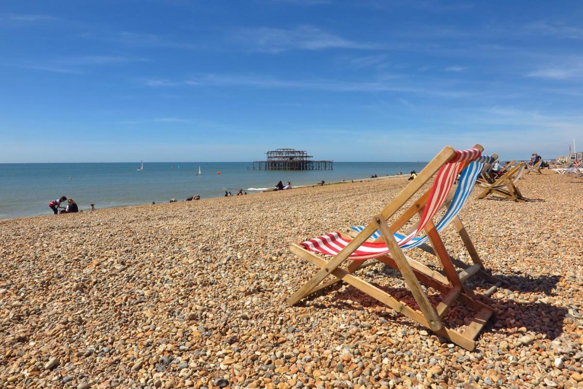
For the first day of June, many locations in England recorded over 25C showing meteorological summer to be warmer than the whole of spring for 2021. However, it was Cardiff with the top UK temperature on Tuesday, reaching 26.1C (79F) with glorious sunshine. Western Britain was more sheltered from the ongoing E to SE wind off the North Sea, which once again brought sea fog in to spoil some seasiders trips.
Scarborough, North Yorkshire on the North Sea coast on June 1st.
Today we have more sunshine but even warmer air. It’s pushing up from Africa across the western Mediterranean through France into the Low Countries over the next few days. A thundery surface low is moving closer to SW Britain and Ireland from the Bay of Biscay with a pool of cooler air aloft, to the southwest. This will bring a change for the UK with fresher air spilling in from the west, but eastern England keeps the heat into Thursday.
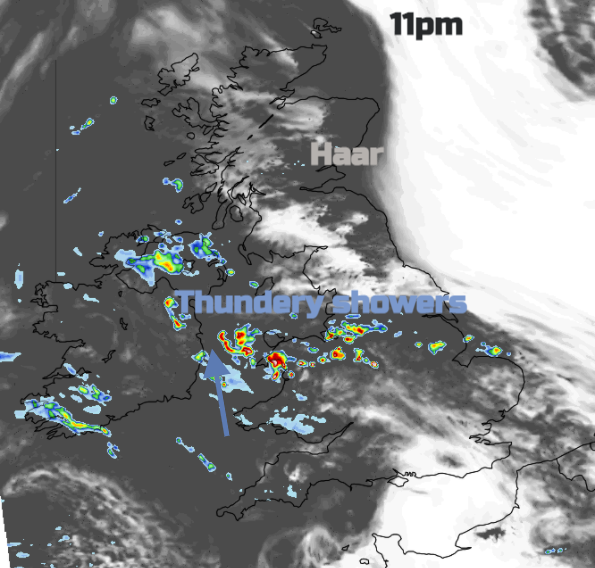
Today
There are three types of weather over the UK today. For many, it’s dry, sunny and very warm today, even hot as temperatures rise into the high twenties. North Sea coasts have an onshore wind again and the sea fog will again be a feature. Then thirdly there is the showery weather in the SW which brings the risk of thunderstorms as it moves northwards through Wales and extends into the Midlands this afternoon.
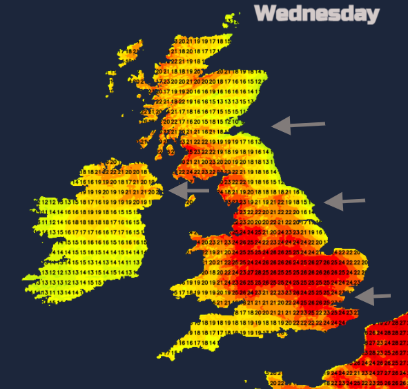
The haar and sea fret will again affect the temperatures. In the breeze and damp fog, it can feel cold. The cloud and heavy showers in the SW will also hold back the temperatures. In between, it will be very warm with temperatures widely in the high teens, low to mid-twenties. For London, along the M4 corridor, for the Midlands and NW England 27c to 29c look likely. (84F)
Low cloud is still lingering from overnight for County Durham, around the Forth and Tay. There is another area out in the North Sea which will extend down from Fair Isle along the east coast of mainland Scotland into NE England then down to Filey.
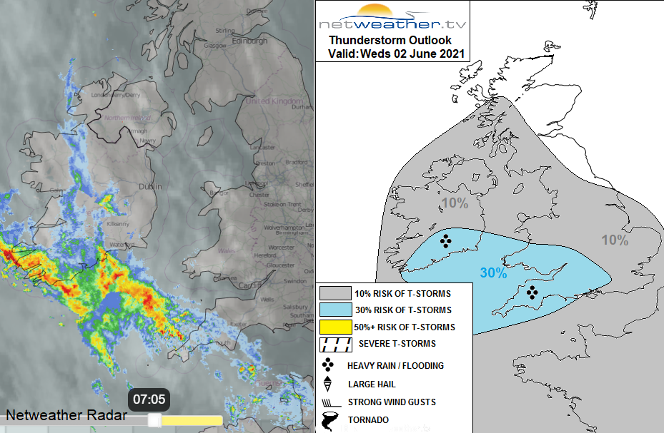
The thundery bit. There is warm moist air pushing out of France towards southern Britain and a line of showers with some heavier ones, reaching from southern Ireland into SW England and the Channel Islands on Wednesday morning. These continue north, mainly affecting Wales but reaching the Isle of Man and Northern Ireland this evening. There will be the risk of thunderstorms within this band and as this weakness interacts with the heat over central & southern England…
“a fragmented arc of heavy showers and isolated elevated thunderstorms looks to develop and push N further east across England from mid/late afternoon and through the evening here after a dry, sunny and very warm day. Forcing will be weaker further east, so storms isolated.” Convective Forecast
There is a yellow warning from the Met Office this morning for SW Britain. However, an extended region could also see locally intense rainfall, surface flooding and lightning.
This band of heavier downpours and isolated thunderstorms continues to north Wales, NW England and Northern Ireland overnight. Then by Thursday morning it will be moving into southern Scotland and weakening. A mixture of sunshine and east coast haar ahead of the showery band.
Out to the west, there is a frontal boundary running north-south. As the low centre settles to the west of Ireland overnight, the cold front will begin to pivot up from the SW. This will take the whole of Thursday to push up to NE Scotland but won’t manage to clear the very warm air from eastern England.
Hardly any breeze for Yorkshire and Lincolnshire, a light SW breeze for East Anglia and this shift will allow temperatures to rise up into the 20sC for eastern England with a very warm Thursday here. Elsewhere, more cloud a brisk southerly breeze for western Wales and Northern Ireland and the risk of a little patchy rain from the incoming front. Inland for Britain, it will be warm with sunny spells. There is a low risk of heavy showers even isolated thunderstorms developing over NE England by the evening but a lot of uncertainty