One more day with sunshine and heavy, thundery showers. A change for the end of the week with a deep Atlantic low bringing wet and windy weather across the UK
Another day of sunshine and showers but a change is on the way. An Atlantic low pressure will deepen as it reaches Ireland tomorrow and will bring wet and very windy weather across the UK. This will clear away over the North Sea early on Saturday.
For today, there are two cloudy and showery areas with sunshine in between. Heavy and thundery showers will develop again this afternoon, focused particularly on eastern England. I liked Marina Hyde's line in the Guardian yesterday. “I’ll have a pint of lager with a hailstone top, please” reflecting the gamble so far that the May weather has inflicted upon us. You'll be missing those showers in the gales.
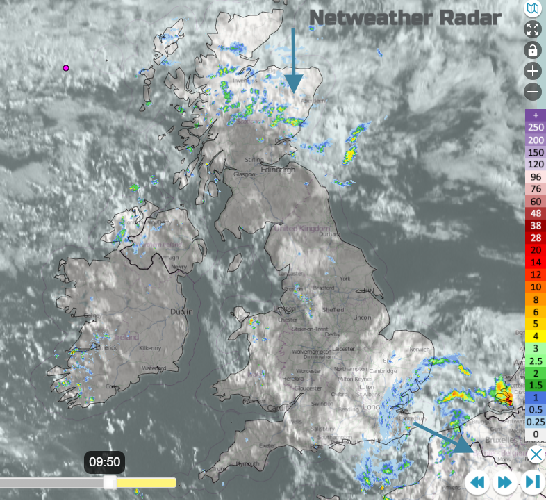
A swirl of showery rain and cloud has moved across southern England overnight and it is still affecting SE England this morning with grey skies, some brightness but also outbreaks of rain. For Essex, Kent, London and across to West Sussex. This will clear away eastwards this morning, taking its time for Kent. Over northern Scotland, a cold front is digging down with more cloud and also showery rain. It is over Grampian and Highland and will falter today bringing a grey, damp afternoon to Perth & Kinross and Angus. For the rest of the UK there will be a lot of sunshine and dry weather this morning, but showers do start to appear.
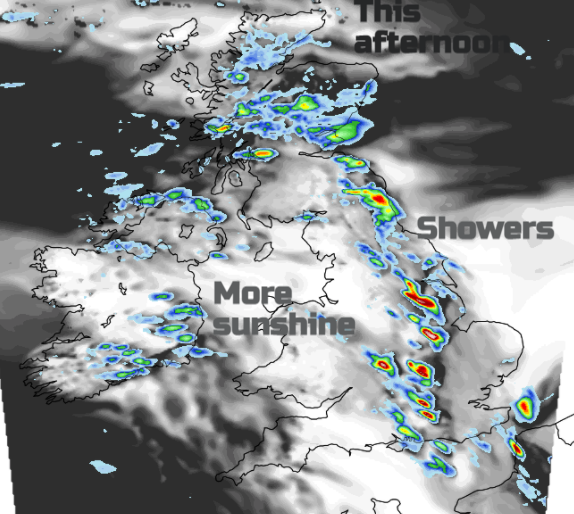
Showers for Northern Ireland and a scattering for Wales but by this afternoon Wales and western England will be dry and sunny. Temperatures will be in the mid-teens, typically 15C. So again, it feels warm in the strong sunshine but as soon as the sun disappears behind a cloud, it feels cool. The winds will be light. The showers then get going over England this afternoon. They will be slow-moving with hardly any breeze and become heavy and thundery. The focus for the heavy downpours will be from Fife, through SE England and down into central and eastern England.
In sunnier spots for England temperatures could reach 16 or 17C, Hull reached 17.9C yesterday. Northern Scotland will be cold behind the front at only 11C. The Jetstream has been away to the south, keeping the UK in the cooler, unstable air. As a buckle appears today, which will deepen the incoming low. Ahead of this low, there will be ridging which will dampen down any shower activity for western Britain and southern Ireland. A trough over eastern UK enhances the convection and as the sun gets to work heading the ground, the overturning produces the heavy showers once again.
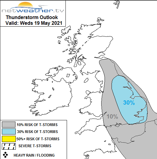
“a few isolated weak thunderstorms almost anywhere. However, the focus for a greater chance of thunderstorms will likely be across E England. “Convective Forecast 19th May
There will be convergence zones as the light westerly flow meets the north to NE flow reaching in from the North Sea. Lines north/south of heavy downpours with the risk of lightning and hail.
A cold night that will be clear and dry for most, even a touch of grass frost in places. Some cloud and patchy rain will linger for Grampian. The other showers over eastern Britain fade as pressure rises briefly.
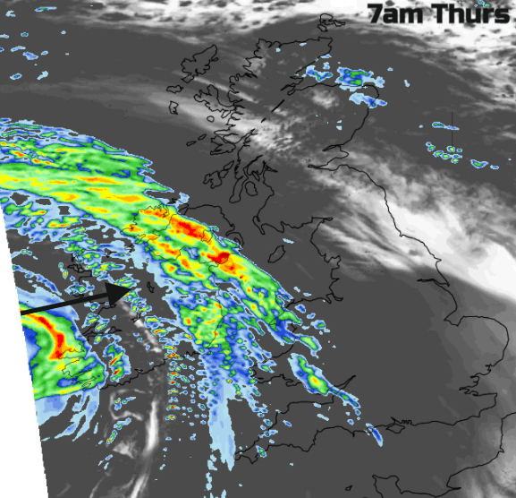
After days of bright sunshine, cool air and heavy showers we will see something more akin to UK autumn. A deep low pressure with frontal bands of heavy rain. Strong winds, even gales and a lengthy spell of wet and windy weather.
Northern Ireland will see a very wet start for Thursday with difficult conditions on the roads due to poor visibility, surface water and spray for the morning rush. It will also be windy with fresh to strong SE winds. Rain will soon reach over Wales and SW England in the morning as southerly winds pickup. Bands of heavy rain push up through northern England into Scotland, although not really reaching the far north. Pulses of heavy rain move over Northern Ireland with some milder air caught up over southern Britain where the rain will be more patchy. Hardly anything for SE England
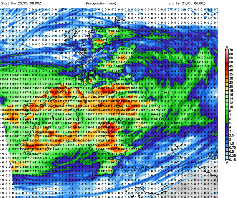
Forecast rainfall totals from Thursday 7am until Friday 7am mm
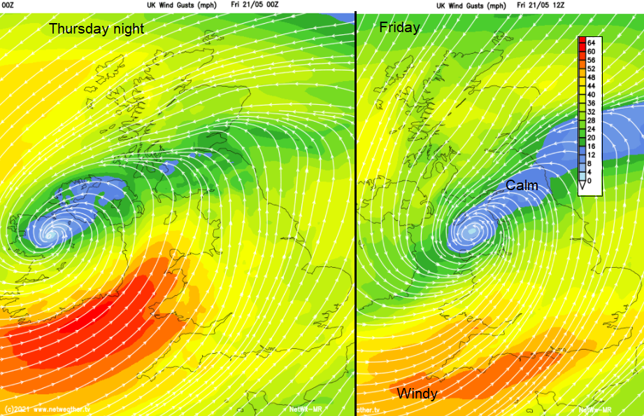
The winds strengthen for southern Ireland during Thursday around the bottom of the low and by Thursday night into Friday there will be strong SW winds with gales for the SW approaches. There is the risk of severe gales for exposed parts during Thursday night. Wales and SW England will have a very windy start for Friday with plenty of showery rain.
Weekend
The low does clear away on Saturday morning with a pull of colder air down from the north. Then something a bit more settled with bright spells and a few showers. Another low pressure looks to head in from the west on Sunday.