If you're hoping for some dry and warm weather, then it looks like you're in for a long wait, as the cool and showery conditions will continue through the weekend and much of next week. Some heavy and thundery downpours for many most days.
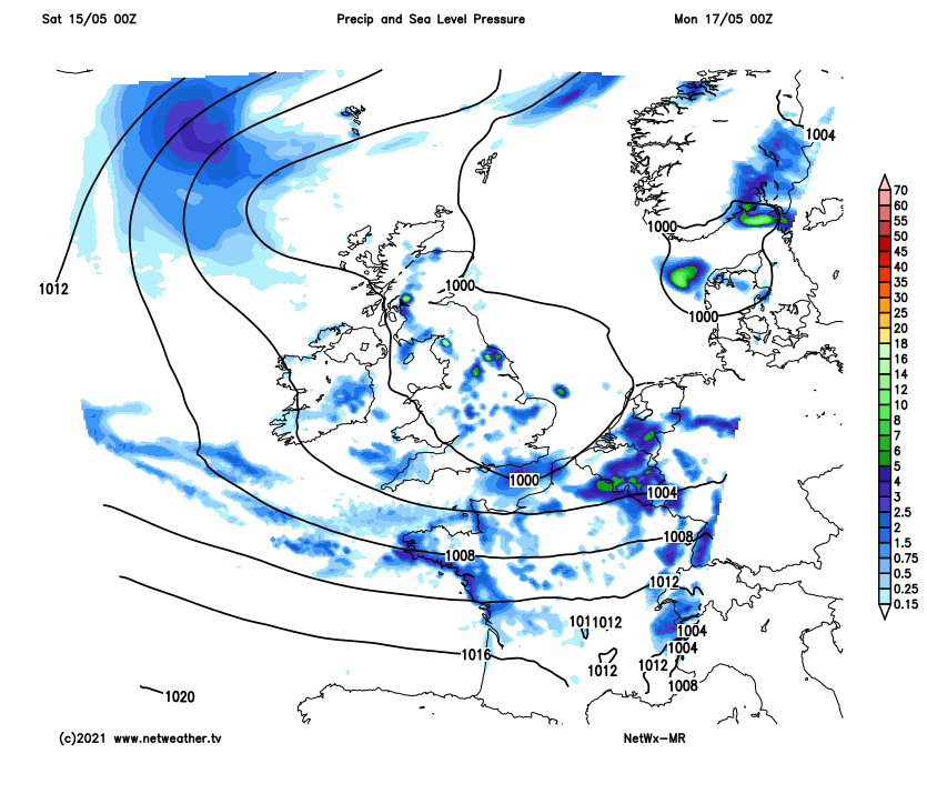
If you’re hoping for some dry and warm weather, then you maybe disappointed to hear that there’s no sign of such weather for the next 6-7 days at least. It looks to remain cool and showery, with some longer spells of rain at times too - particularly in the south. The culprit is the jet stream, which will run east off the Atlantic just to the south of the UK across France and into central Europe over the coming days – keeping warmer air over southern Europe. The British Isles will be stuck on the cool side of the jet stream over the next week, so temperatures will generally stay slightly below average, while the UK will also be under the influence of low pressure – bringing heavy and thundery downpours or longer spells of rain.
For today, a frontal system moving northeast ahead of low pressure moving in to the west of Ireland will cross England, Wales and N. Ireland this morning, bringing cloud and outbreaks of rain across many areas. Sunnier conditions but with showers moving in across Cornwall and Devon will follow the rain across southern England and Wales through the morning, these showers increasingly heavy and thundery by late morning. Cloudy conditions across southern Scotland this morning, bits of showery rain in the southwest will become more widespread through the morning, northern Scotland seeing a dry, bright or sunny morning.
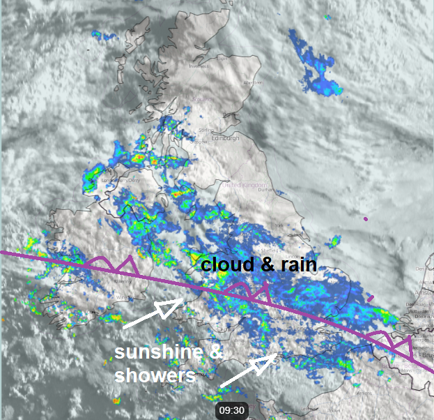
Sunny spells and heavy showers or thunderstorms, with hail and torrential rain locally, becoming widespread across Wales, Midlands, southern England across to East Anglia through the afternoon, a cloudier zone along a slow-moving front with increasingly showery rain across northern England, N. Ireland and southern Scotland for the afternoon, northern Scotland sunnier, but with a few showers towards the west. Temperatures this afternoon rather disappointing for mid-May, reaching 11-15C at best.
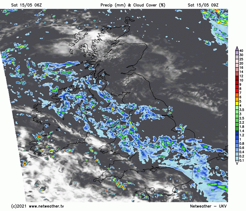
Showers in the south generally fading inland overnight, but continuing in the southwest and along southern coastal counties – where they could be locally heavy with the odd rumble of thunder. Further north, a zone of cloudy skies and showers lingering across N. Ireland, northern England and southern Scotland. Drier with clear spells across northern Scotland – where it will turn chilly.
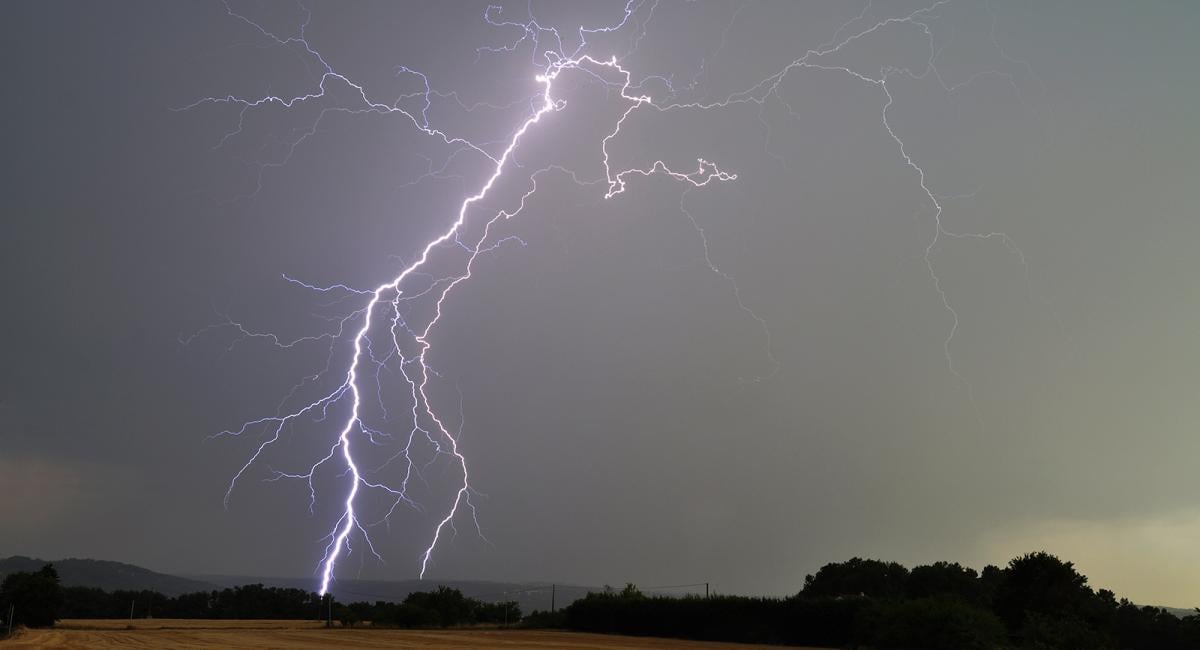
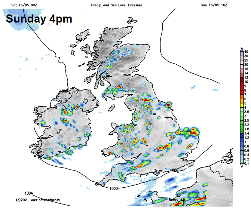
A rather unsettled day on Sunday across England and Wales, as an area of low pressure moves across southern Britain during the day. Many starting dry and bright across England and Wales, but heavy showers from the word go across the southwest and southern counties will become widespread across England, Wales, N. Ireland and southern Scotland through the day. Thunderstorms developing in places, bringing a risk of cloud-to-ground lightning and hail, and as they’ll be slow-moving – some localised flooding is possible too. Gusty winds across southern coastal areas, but winds generally light. Northern Scotland drier and sunnier with just a few showers in places. Temperatures a few degrees below average again, reaching 11-15C at best.
As we head into early next week, low pressure will be close by, with an unstable and cool westerly flow Monday and Tuesday, meaning further heavy showers and thunderstorms will break out during the day, particularly for England and Wales. An area of low pressure dropping south across Scotland may bring thicker cloud and some showery rain later on Monday and through Tuesday.
Perhaps fewer showers and sunnier for Wales, central and southern England on Wednesday, but low pressure close to the northeast will bring a day of sunshine and heavy thundery showers across northern England, N. Ireland and Scotland. On the cool side still.
Some uncertainty on Thursday over the track of a fairly deep low moving in from the southwest, it looks, for now, to move across southern Britain, bringing a spell of wet and windy weather across England and Wales. Scotland and N. Ireland drier and sunnier, but with a few showers. Friday back to sunny spells and heavy thundery showers developing across many areas, cool to end the week.