A showery weekend coming up with downpours and then brighter spells. It stays cool everywhere.
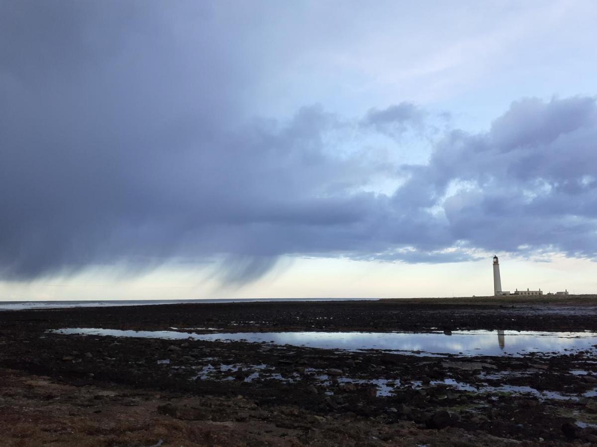
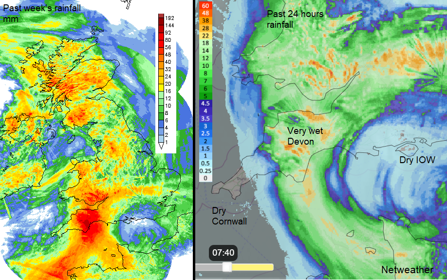
May continues with its cool, unsettled trend. Low pressure in the English Channel yesterday brought a completely wet day for Devon with over 60mm of rain in places. It never stopped. It is now easing, becoming more showery as the low eases away but there will be more rain passing by overnight.
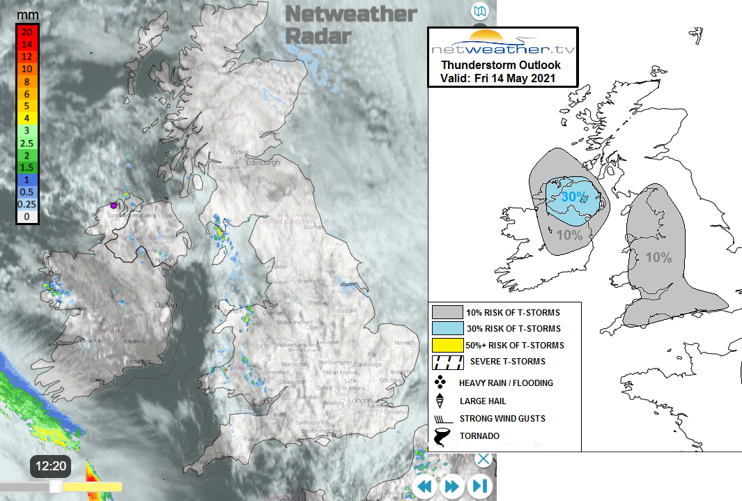
There were also thunderstorms once more with heavy showers for western Britain. Today there will still be heavy showers for western areas. Elsewhere, Friday sees a quietening as the Channel low edging away to the Low Countries and a lull before a new Atlantic low swings in. This will dominate the weekend weather for the UK.
The temperatures remain in the teens. Mostly the mid-teens and occasionally in drier, sunny times up to 17 or 18C at best. The cool theme looks to continue throughout May.
Today
For most, there is a grey, damp start this morning. Bands of showery rain and low cloud off the North Sea which is sneakily soggy. Wales, Devon particularly over the Moors, Cumbria into Dumfries & Galloway all look prone to heavier showers this morning. Northern Ireland will also see showers, with heavier ones for Fermanagh and Tyrone and the risk of hail and thunder. There is a warning today for thunderstorms with a risk of travel disruption. Belfast should become drier and brighter. Through the afternoon, there will also be a scattering of showers over the Home Counties. These spinning off the filling low pressure. Across the rest of Britain, things improve. Still with a lot of cloudy but drier weather. Just a few remaining showers and gradually brighter skies and even some sunshine appearing. Temperatures will be around 12 to 16 but colder for North Sea coasts in the fret or haar.
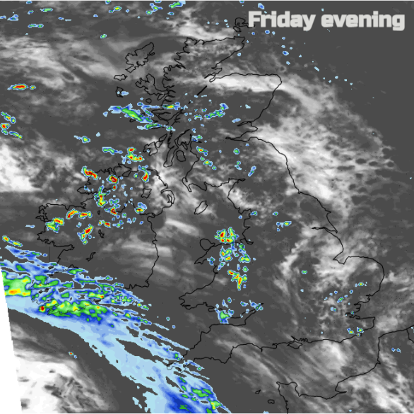
By this evening the showers will be more localised. Continuing for western Britain, a few for southern England and more for Northern Ireland away from Down and Antrim. The weekend low will be extending its first weather front over Cornwall, with a band of patchy rain appearing.
If you are sitting outside at the pub this evening, you already know it will be cold and damp. Inland northern Scotland could see a touch of frost overnight but mostly temperatures stay at 6 to 8C.
Bands of cloud and showery rain work their way in from the SW overnight, pushing up through Wales and heavier pulses moving over the West Country.
By Saturday morning there will be dry, fair conditions with an easterly wind for NE Britain. Scattered showers for Northern Ireland and also Wales and England away from the northeast. These will be in bands with some heavy bursts but also brighter, drier and sunnier spells in-between. Southern England and south Wales will pick up more of a westerly breeze as the day progresses.
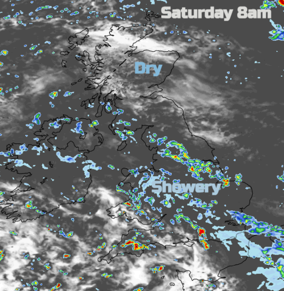
There will be quite a scattering of showers with some heavy ones over southern Britain but fewer for Northern Ireland and northern Britain for the afternoon. Not completely dry though and western Scotland will keep a good chance of showers.
By Sunday there is a signal for heavier, even thundery showers over southern Britain. The low pressure centre moves over Wales and there will be showers for England and Wales during the day. With only light winds, they will be slow-moving and there is the risk of hail and lightning. Northern Ireland and Scotland should see fewer showers but a good deal of cloud. Temperatures will be in the mid-teens but colder around the Firth of Forth with an east wind. Also, a brisk west to SW wind for southern England.
More of the same next week.