February temperatures now into double figures but with strong S to SW winds, gales too and the risk of flooding from melting snow and heavy rain. Warnings now from very different UK weather this week.
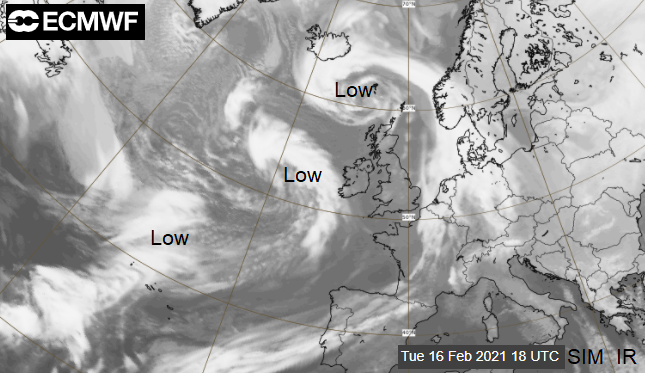
In this much milder Atlantic flow, there will be strong winds and outbreaks of heavy rain. There are warnings for the gales over the Western Isles in the next few days and for rain over southwest Britain Friday into Saturday. It is a huge change from the cold, snowy easterly flow which gripped the UK for much of February. The strengthening jetstream will continue to throw deepening low pressures towards Ireland and western UK this week after a plunge of deep cold reached right down to southern parts of the United States this week. That severe wintry weather is not on it's way to us. Mostly mild here, into next week.
Winds
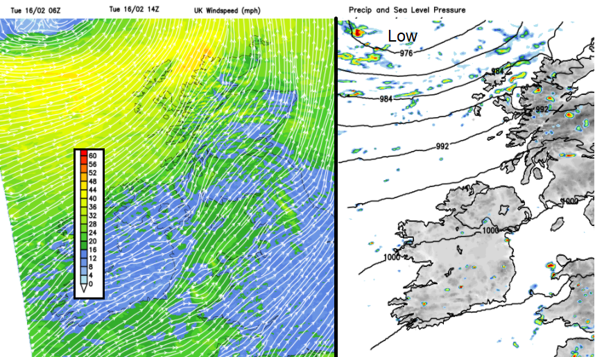
The brisk SW winds are already strong for NW Scotland, more southerly for the Northern Isles with a low centre near to Iceland. Early afternoon gales, even severe gales will affect The Minch and exposed areas with the strong SW winds lasting into Tuesday evening. Gusts over 60mph are likely with these easing away from Lewis and Sutherland after dark. There will also be squally showers and gusty winds for the NW Highlands with snow over the mountains.
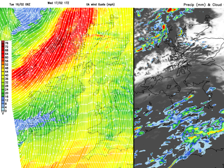
During Wednesday, another low pressure approaches and again brings strong winds and gales from the south or SW. Overnight there will have been a band of heavy rain with gusty winds moving quickly across Ireland then Britain. Behind this, there will be sharp showers and fresh to strong winds for Northern Ireland and Scotland. These reach gale force early Wednesday afternoon for NW Scotland with severe gales force possible during the afternoon and early evening around The Minch and over the Western Isles. Travel disruption is likely with gusts around 75mph possible. As this eases into the night, another low centre heads in, bringing heavy rain to SW Britain and strong southerly winds by Wednesday night.
Rain
Thinking back before all the snow, the ground was already sodden and river levels high. We now have fast-moving bands of rain, with line convection and clusters of lively showers but with snowmelt as well. Thundery showers and hail are forecast in the SW today and Wednesday night into Thursday frontal bands around the next low will bring spells of heavy rain as the whole lot swirls northwards across the UK.
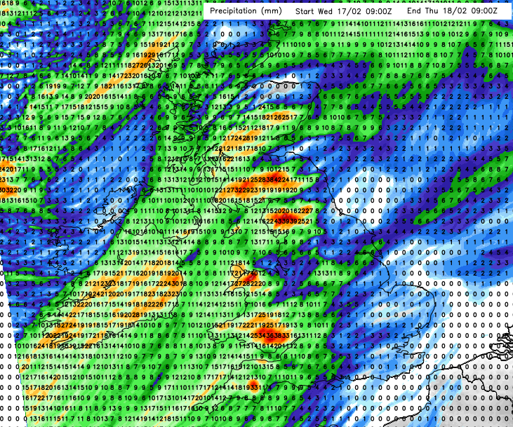
Currently Central, northern and eastern Scotland continue with flood alerts thanks to the thaw. ‘Lying snow will continue to melt at all levels with the potential to cause disruption to essential travel’. By Friday more southwestern parts of Scotland have been identified as being at risk of flooding as even more frontal rain heads in and there is a Met Office rain warning with 25 to 60mm of rain forecast. It will be wet and windy for western Britain and Northern Ireland.
“Further snowmelt is likely across the Southern Highlands, contributing to the flood risk.” MO
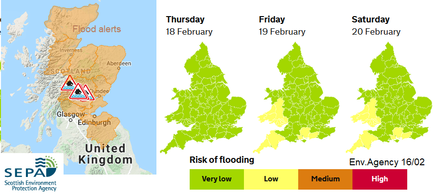
The cumulative effects lead to an early warning of heavy rain for southern Wales and SW England for Friday into Saturday. After the sharp showers and lively frontal bands, Friday’s rain will linger with 75 to 100mm of rain, even more over the hilltops and moors. It will also be very windy so quite miserable conditions if you are on half term.
“Rivers remain high across parts of eastern England and local flooding is possible on Tuesday. Groundwater levels are also high in many places and flooding impacts are expected from Friday in parts of Hampshire and West Sussex, and possible in parts of Brighton. Local river and surface water flooding impacts are also probable across parts of Wales and south-west England on Friday and Saturday.” Env Agency
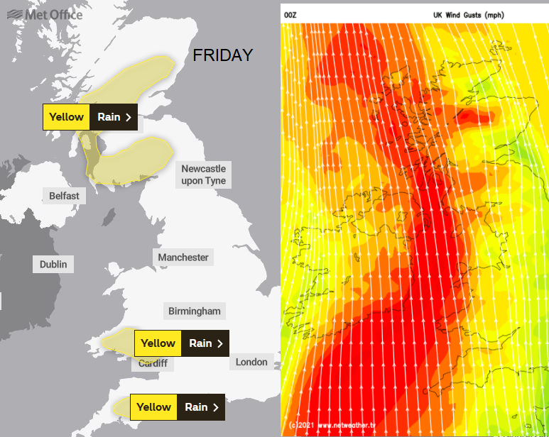
Northern Ireland and Cumbria with more of Wales could also see a lot of rain later in the week. Further east, although blustery it will stay drier for Friday and Saturday so not adding to the ground conditions and river levels here and unusually mild across the UK.