There are showers to watch out for today and on Saturday, mixed with bright or sunny spells. A colder NW to northerly wind takes hold, with a touch of frost this weekend in the north.
As a band of rain moves southwards today a colder northwest to northerly flow follows behind. There will be a nip in the air overnight but gradually the showers will fade as high pressure builds to the west with more fine weather about, especially by Sunday.
Low pressure is steering our weather today, the centre off Aberdeen bringing gales and heavy showers. The narrow frontal band is working its way southwards through England and Wales with some pulses of heavier rain in the west.
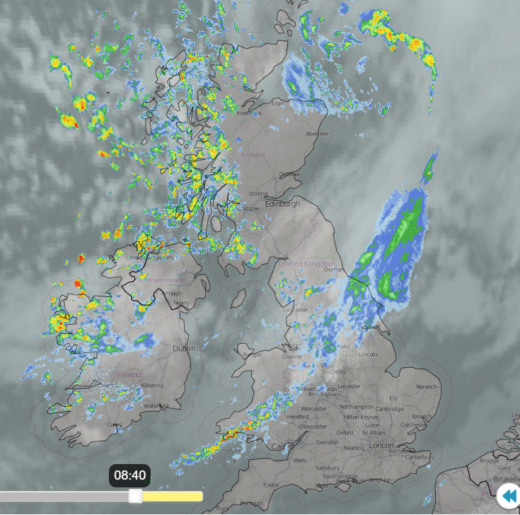
This line does become more patchy as it moves over southern, central and eastern England but still with some heavier burst for SW England by lunchtime. After a fine start for southern and south-eastern England with light winds and mist, the frontal cloud will move in with outbreaks of rain this afternoon. Behind the frontal band, there are brighter skies and showers with a bit more of a westerly breeze. Western Scotland and Northern Ireland already have heavy showers, and these spread to NW England and north Wales by lunchtime. These could include hail, even with wintry over the Scottish mountains. Rain showers then work their way across the Midlands on a NW wind. In-between the showers there will be a lot of bright weather with sunshine, Grampian improves as the low pulls away, but it will feel cooler. Temperatures of 9 to 15C north to south.
For much of Britain, it will be a clear, cool night however lines of showers pack into NW Scotland on fresh NW winds reaching Northern Ireland, more of Scotland, NW England and north Wales later in the night. A touch of frost for inland northern Britain.
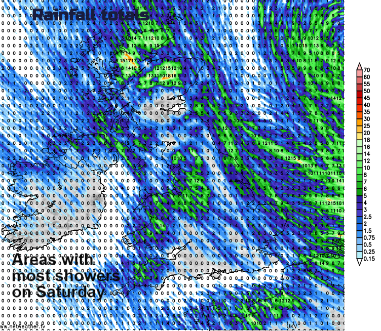
Saturday will feel colder, with a breeze, clear skies, sunshine for many. However, the bands of heavier showers and more cloud will be working their way southwards as the westerly winds veer to a northerly. Watch on the radar if you are popping out to see if a cluster is on the way. Daytime temperatures will be around 11 to 14C. By Saturday teatime there will be a scattering of showers over the UK, bright or sunny spells but a noticeable chill in the air, especially in the wind
Overnight a few showers continue to run in on the north to NW breeze, for northern Scotland, north Wales, clipping Norfolk but overall, it will be dry and clear as pressure builds.
A cold start on Sunday but fine with super autumn sunshine. There is some uncertainty for East Anglia, maybe Lincolnshire and East Yorkshire with a band of cloud and showery rain lurking nearby over the North Sea. It could plague eastern England on Sunday and bring quite a different day. The cloud fills in during Sunday, but it stays fair and bright still with a cool breeze.
Nippy again on Sunday night but an Atlantic low looks to move in for Monday bringing rain from the west, blustery winds but also milder air briefly., The chill will be back by Tuesday as the winds swing round to the north.
Further afield, Typhoon Chan-hom is forecast to move close to the southern side of Japan today bringing heavy rains which will last into the weekend. There will also be high winds and large waves with the risk of flooding.
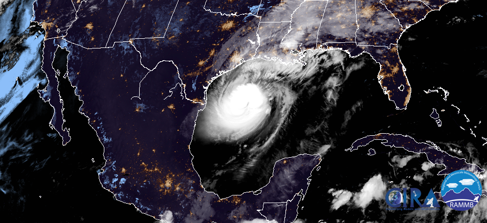
Hurricane Delta is now a major hurricane once more, in the Gulf of Mexico and forecast to make landfall today over Louisiana.
Pumpkins previously from Calke Abbey, National Trust