The very unsettled weather for the start of October continues, with further occasional rain or showers during the next few days.
The very unsettled start to October continues, with further occasional rain or showers in the next few days. There'll be a lull tomorrow, however, before yet another depression moves in later to affect mostly England and Wales, followed by rather cold, blustery but still showery weather for the remainder of the week.
Will the unsettled October continue? Check the month ahead forecast.
We have a depression over Scotland that'll give most parts a showery day today. Some showers will be heavy giving local hail and perhaps a crack of thunder, with embedded troughs currently over Scotland, Northern Ireland and the North of England forming 'streets' of showers. If you're unlucky to end up under one, the showers will be frequent and lengthy, while others mostly in the East see few if any showers and more in the way of sunny spells, but cloud amounts will often be quite large.
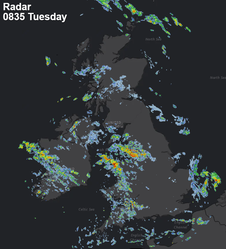 View the live weather radar here.
Winds will be lighter over Scotland particularly the North, but with a fresher and blustery South West or Westerly elsewhere that could give strong or gale-force gusts in exposed areas and during more squally showers. Top temperatures 12 to 14C in the North and 15 to 17C in the South, but it may feel a little chilly in the wind especially when a shower comes along.
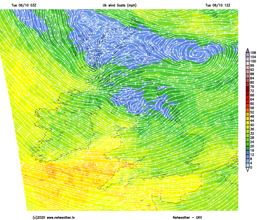
There'll be little change into the evening and after dark, with a further scattering of blustery showers. They'll become fewer in central and eastern areas leaving clear spells, while parts of Scotland and the far North of England continue to see the bulk of the showers some heavy and perhaps lengthy. Although still lighter over the North of Scotland, a mostly moderate or fresh Westerly wind will prevent temperatures on the whole from falling below 7 to 11C.
Tomorrow brings an improvement to England and Wales with fewer showers, and these mostly in the West. As a result, central and eastern parts, in particular, see sunny spells and will be mostly dry in a lighter Westerly breeze. Across South Wales and the South West though there'll be more cloud ahead of the next Atlantic system moving in, which will bring some rain to the Isles of Scilly, Channel Islands and the far South West later. Meanwhile, Northern Ireland and Scotland in particular continue to see showers, mostly in the West and North. Top temperatures 12 to 17C locally 18C in the South.
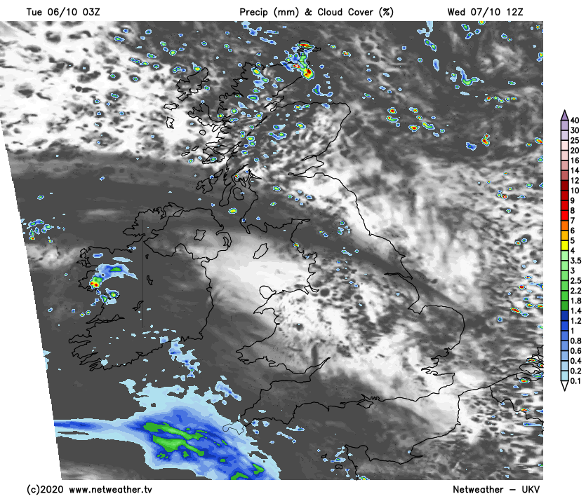
After dark cloud and some rain spread to Wales, the South, and to much of the Midlands, while remaining parts of England stay dry with clear spells especially in the North. Here it could turn quite chilly in some rural 'hollows' in light winds with temperatures down to around 5C but further South, the cloud will prevent temperatures from falling below a much milder 9 to 12C.
Scotland and Northern Ireland also see clear spells after dark, but the North and West of Scotland continue to see a further scattering of showers in a moderate or fresh South Westerly wind. Lowest temperatures here 5 to 7C in some sheltered eastern areas, but more generally 8 to 10C.