


A chilly start for some on Monday but fair weather around before midweek becomes unsettled and we watch developments for Friday into the weekend with a strengthening jet.
We have plenty of autumnal ingredients in the forecast this week. Frost this morning down a swathe of Britain, a bit of mist and fog for Tuesday morning. And by Friday into Saturday signs of a deep area of low pressure developing bringing a spell of very wet and windy weather, even stormy conditions.
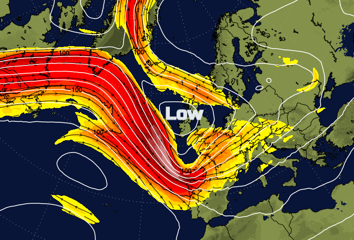
Currently, it is the Mediterranean seeing unsettled September weather with wind warnings over Italy and Sardinia and heavy rain for Greece. Looking at the Jetstream for the start of the week the jet is pootling across the northern Atlantic with a cut of low over the Med. This same low has brought early snow to the Alps along with rain and a lot of cloud.
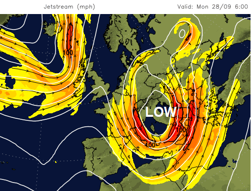
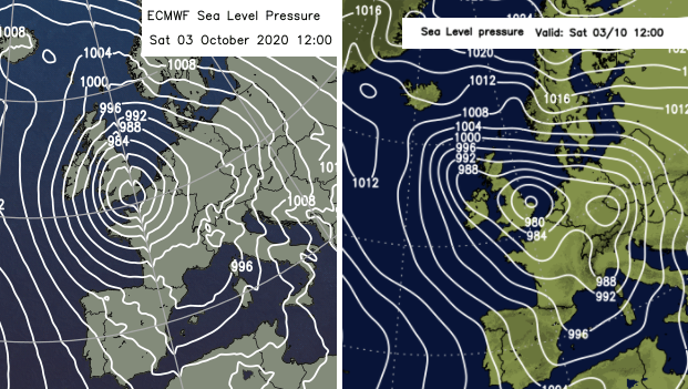
Through this week the jet strengthens out of northern America, its core reaching 200+mph and as a huge meander forms over NW Europe, development of a significant low pressure will be something to keep an eye on for Friday into the weekend. See top image.
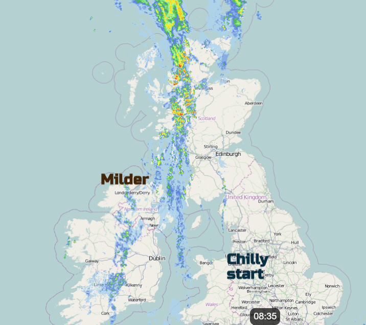
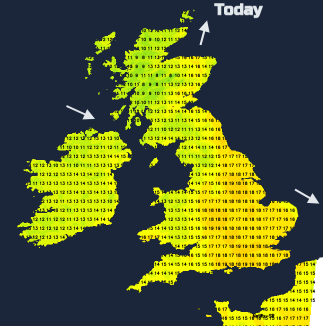
Eastern England will finally be brightening up as the winds ease down. It has been a grim few days with lashing rain, winds and a wild North Sea. The weakening front and its cloud give way to sunshine. The clear skies over inland Britain which brought a chilly start with a touch of frost are already being overrun by high cloud from the west. An upper front and then surface cold front which will bring more rain in from the northwest. This too is fading so won’t amount to much over Wales or NW England this afternoon but brings a wet start for western Scotland and Northern Ireland and patchy rain to SW England at lunchtime. The frontal cloud with a little dampness will reach eastern Scotland this afternoon as much of England sees fine and bright conditions with temperatures in the mid to high teens. London should reach 19 or 20C and feel pleasantly warm with light winds.
Tonight and Tuesday
As the cold front fades to just cloud, this will keep the temperatures up over SE Britain tonight but behind in clear skies again there will be single figures. With very light winds there will be pockets of mist and fog ready for a fine day on Tuesday. Northern Ireland will see the odd shower by the afternoon and feel cooler as a southerly breeze begins to pick up.
A midweek low spins in off the Atlantic, centring towards Iceland which brings a spell of rain and blustery winds over Ireland on Wednesday morning and moving over Britain through the day. The west coast of Scotland will see the most rain, there will be strong southerly winds through the Irish Sea. Eastern England won’t see the rain until later in the day but everywhere becomes breezy as the southerly winds then veer to a cooler north-westerly after the frontal rain.
Thursday looks brighter but fresher will a few sharp showers in the west. Friday will see the limbering up for whatever this deep European low is going to throw at the UK for the end of the week thanks to that strengthening and buckling jet. Stay tuned.


