


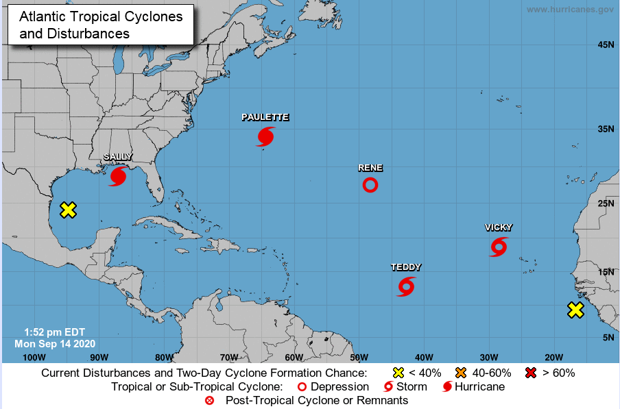
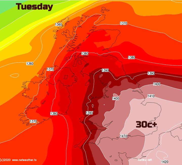
With lingering heat for the south, after a very warm start throughout the UK, mid-September is peaking around 30C. The Atlantic hurricane season is in full swing with five cyclones currently on the go.
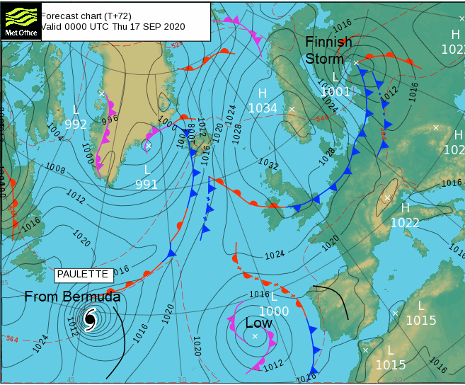
There is a lot of unusual weather going on for NW Europe and over the Atlantic this week. The British Isles has temperatures in the high 20sC even 30C to start the week and as that heat continues for southern Britain, some areas could see heatwave conditions. These usually only occur in the summer months. Finland is already on a red wind warning for potentially very dangerous winds from a midweek low pressure and the Atlantic hurricane season has gone bananas with five tropical cyclones on the go at the moment.
Atlantic
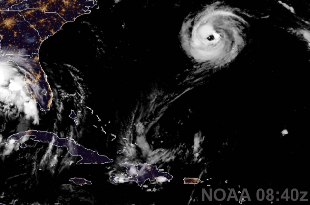
This has happened before in 1971 (when there were actually six at once) but Hurricane Paulette has just moved over Bermuda on Monday, right overhead. The Bermuda Weather Service had to continually warn people that the storm wasn’t over yet. The eye was 40 miles wide and the island stayed in relative calm for quite a while overnight. Now Hurricane Sally is forecast to hit the North Gulf coast on Tuesday 15th. Preparations are underway in the US. As this storm affects the coast of Louisiana, Mississippi and Alabama even Florida there are concerns about a large swell and extremely dangerous storm surge, heavy rain as the storm slows and turns NE leading to significant widespread flooding and life-threatening flash flooding along with the wind hazards from a hurricane-strength cyclone.
It seems likely that Wilfred will be used as a name then we move to the Greek Alphabet for names, which has happened before in 2005.
UK
So far Heathrow and Northolt, Gt. London have reached 29C and Jersey Airport 31C. Other parts of southern England well into the 20sC. The heatwave thresholds for England range from 25 to 28C. Wales is 25 or 26C and it is for 3 or more consecutive days. Temperatures are reaching the thresholds, but Sunday wasn’t hot enough and Wednesday might not be either, so we’ll have to see about an actual “heatwave”. However, this is a run of very warm even hot weather with Tuesday perhaps tipping into the low 30sC for SE England. Further NW it won’t be as warm with more cloud and outbreaks of rain, even the odd thundery burst later on Tuesday for western Britain.
Finland
The Jetstream high up in the atmosphere sees its large meander become a cut off low. The surface low which adds an unsettled tinge to our otherwise fine UK weather continues to deepen and move southwards. The strong portion of the jet over Scandinavia interacts with the surface low which is going to strike Finland and then NW Russia. It is unusual to have a red warning for Finland, let alone issued 3 days in advance of severe weather but as we’ve seen here in the UK, summer storms cause plenty of damage to trees in full leaf and so pull down power lines.
Our UK weather will be mostly settled as the week goes on and high pressure builds. All those tropical cyclones will stir up the forecast models by next weekend. For now. light winds, cooler in the north but the warmth continues further south.


