The intense heat of last week is behind us, but humid airmass across the south will bringing a risk of heavy thundery downpours this weekend. Turning unsettled across all parts next week.
The intense heat parts of England experienced during the week is behind us now, with no sign of temperatures returning into the thirties, temperatures returning to more comfortable average values for August for most. However, there is still warmth and humidity lingering across southern Britain and with lower pressure and areas of breeze convergence here, there will be a continued risk of heavy showers and thunderstorms breaking out today, this risk extending further north across England, Wales and Northern Ireland on Sunday. Scotland seeing a mostly dry and bright or sunny weekend, best of the sunshine in the west, mist and low cloud perhaps plaguing eastern coasts. Next week is unsettled and feeling more autumnal. Low pressure settles over Britain early in the week, bringing spells of rain or showers across many parts, perhaps thundery in places. This low moves away mid-week, but a deep Atlantic low moving into the west could bring wet and windy conditions spreading east later in the week.
For now, extensive low cloud and mist covering south Wales, southern and eastern England will persist through much of the morning, with patchy outbreaks of rain in places too. North Sea haar plaguing eastern areas of Scotland and NE England will be slow to clear as well. Brighter skies with sunshine this morning across north Wales, NW England, N. Ireland and western Scotland.
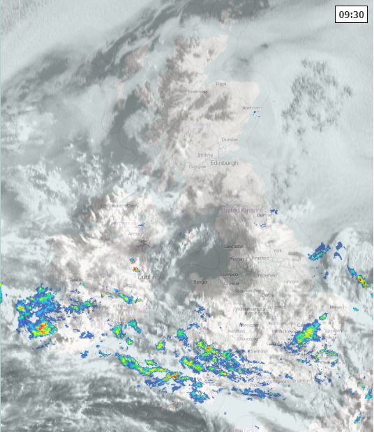
Into the afternoon, cloudy skies perhaps persisting across south Wales and southern England, with further outbreaks of showery rain spreading west. Some cloud breaks may develop across SE England and southern East Anglia, allowing warm sunny spells to develop, but this may trigger heavy showers and thunderstorms, some of which could bring torrential downpours leading to flash-flooding. Further north, North Wales, north Midlands northwards across northern England, Scotland and N. Ireland it will be a mostly, dry bright or sunny afternoon, away from North Sea coastal areas where mist and low cloud may persist all day. Best of the sunshine always in the northwest.
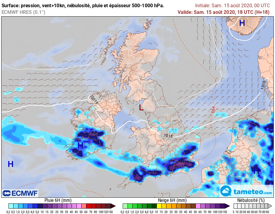
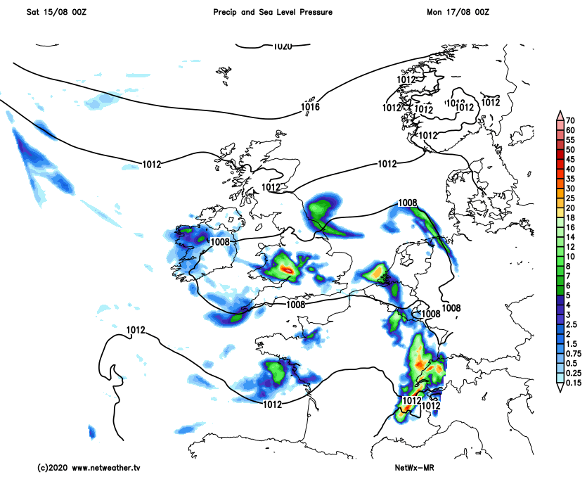
ECMWF rainfall forecast for 6pm this evening:
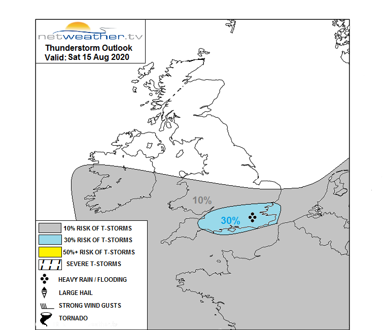
Saturday's Thunderstorm Outlook
Temperatures this afternoon reaching 21C in Belfast, 22C in Glasgow and Cardiff, 23C in Manchester, perhaps 25C in London if the sun come out. Winds generally light and from the east or northeast.
Generally cloudy, mild and turning misty in places across southern Britain tonight, with scattered showers and the odd thunderstorm continuing in places. Northern areas will be largely dry, but with a low cloud becoming extensive across more eastern areas.
On Sunday, high pressure that was close to the northeast will tend to drift north, allowing low pressure to move in from the southwest towards southern England during the day. This will bring a more widespread risk of showers breaking out and spreading north across England and Wales, a risk of heavy showers and thunderstorms across southern and eastern England into the afternoon. Some sunny spells possible, but overall rather cloudy. Scotland and N. Ireland look to stay mostly dry and bright, sunniest in the west, low cloud and mist may persist across eastern Scotland and risk of an isolated shower in the afternoon across southern Scotland too. Temperatures highest towards the southeast, where 24-25C is possible with any sunshine, elsewhere low twenties or high teens.
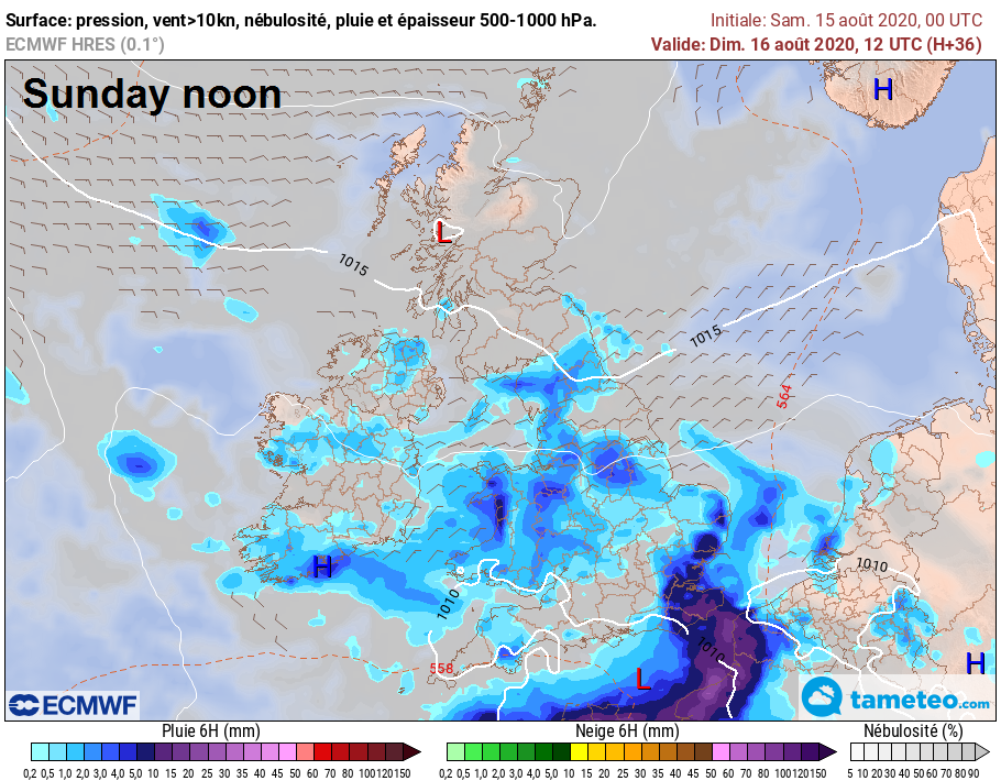
A weak area of low pressure sat on top of England and Wales on Monday, with sunny spells and slow-moving showers, locally heavy, or thunderstorms spiralling around the low across here and also in across southern and central Scotland and N. Ireland. The far north of Scotland perhaps staying dry and sunny. Temperatures reaching the high teens across Scotland and N. Ireland, low twenties for much of England and Wales.
Further showers look likely on Tuesday, with shallow low pressure still centred over the UK, showers turning heavy and locally thundery quite widely, some sunny spells between the showers. Perhaps drier and sunnier with fewer showers on Wednesday, as a brief ridge of high pressure builds in, before potentially a spell of wet and windy sweeps northeast Wednesday night ahead of a deep low moving in the west. After overnight rain clears, Thursday cool and blustery with sunny spells and showers, locally heavy and thundery in the west and possibly merging into longer spells of rain, gales possible in the west too. Perhaps similar on Friday.