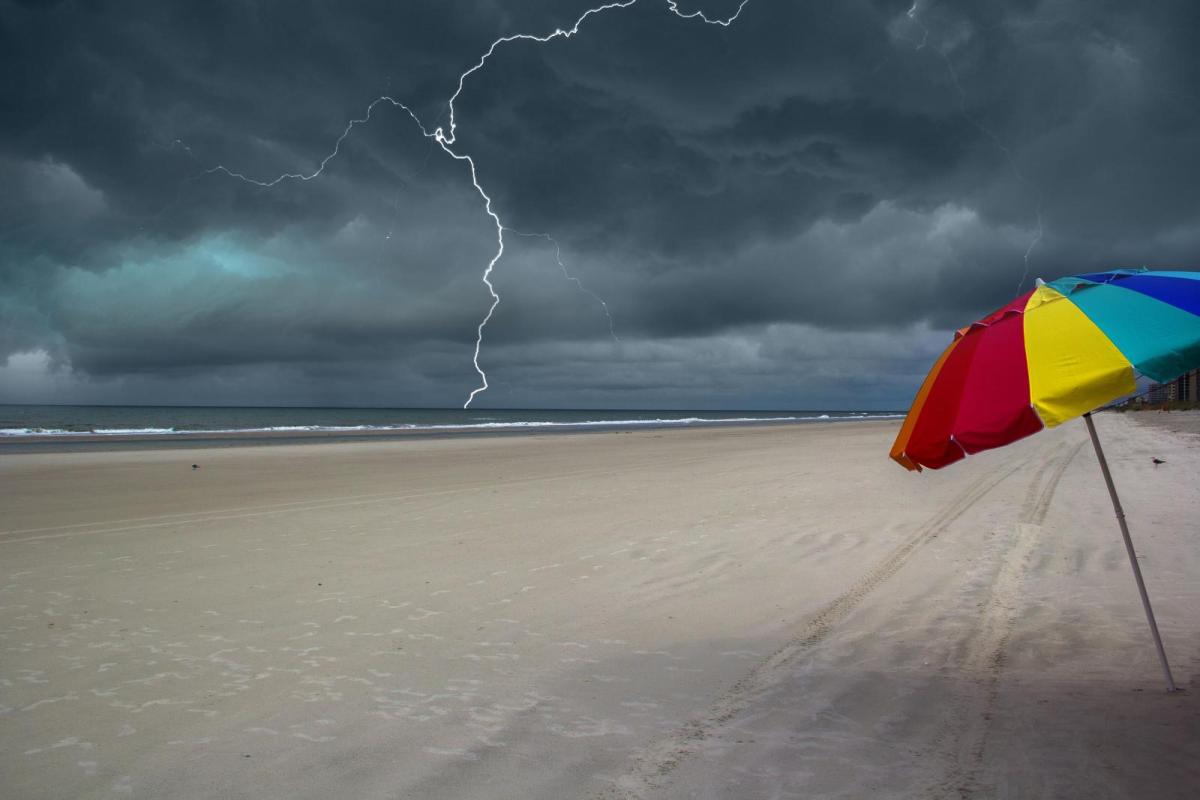
As the heatwave conditions continue and over 37C is forecast once more, the UK has a risk of severe thunderstorms over the next few days. Quite a week coming up.
More heat and the risk of thunderstorms. This week brings more heat for southern Britain with temperatures peaking around 37C maybe 38C on Tuesday or Wednesday. The heat will spill northwards as Scottish schools return after five months. The whole of the UK is covered in yellow Thunderstorm warnings from the Met Office, showing a risk of heavy, thundery downpours with hail and lightning but not yet more honed locations. There is a risk, but you may not see a thunderstorm. However, if you do you could get very wet as these thunderstorms could be severe.
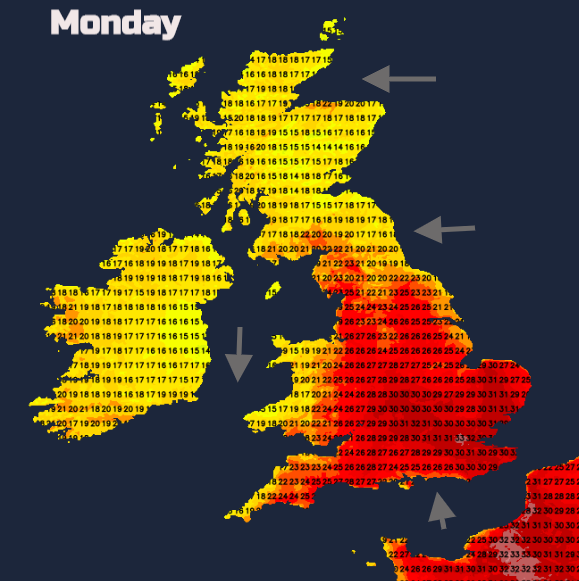
Over the next few days, there will be temperatures in the 20s to 30s Celsius. In the sunny spells, the temperatures leap up, particularly in southern Britain. With an easterly breeze off the North Sea, the coasts of NE Britain will stay in high teens and eastern Scotland. The extra cloud from the storms could keep temperatures down for Wales and Northern Ireland with a northerly breeze. Much of England and eastern Wales should see temperatures well into the 20sC and again the 30sC for SE Britain. 35C+ possible today in Greater London.
There have now been four consecutive days with temperatures over 30C in the UK. The highest in this spell, 36.4C for London Heathrow on Friday 7th and East Sussex saw 34.5C and 34C at the weekend. This trend continues, with the only signs of slight easing at the end of this week.
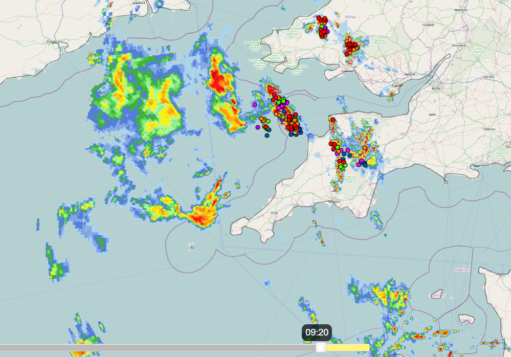
For many areas, there will not be any storms, you might not see any all week. However, with people still on summer holiday, planning days out or trips the risk of severe weather has been identified with the four-day “Heads-Up” type thunderstorm warnings. If your weather app is covered in thunderstorm symbols or has a cluster on a particular day don’t focus on the timings too much. They could come later in the day, be further west or east. This will be a case of watching developments and progress of storms on the radar and satellite imagery. See how some areas have rain and lightning on the Netweather Radar image below but a few miles away it is dry.
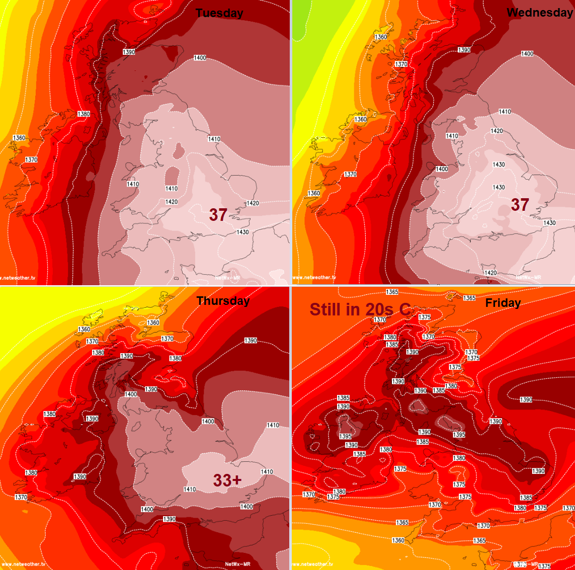
As temperatures return to the heights of 37C (seen on the last day of July) on Tuesday or Wednesday that is thanks to drier, hot air lingering over SE and eastern England. A plume of very warm and humid air moves up over southern UK giving a close, muggy feel to the air but enabling the thunderstorm process.
Convective forecast- “Isolated to scattered elevated thunderstorms, generated by subtle uplift and cooling on the western edge of mid-level warm moist plume, will continue to track N across SW England, Wales, Irish Sea coasts this morning, before reaching NW England and SW Scotland through the afternoon and evening.”
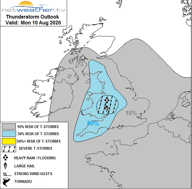
The plume continues north/NW through more of Britain, reaching southern Scotland. The forecast graphic shows a particular area over Wales and the Midlands which could see a significant release of instability. Surface-based convection could kick off with severe thunderstorms being possible. This would mean large hail, frequent lightning, gusty winds and torrential rain with the risk of flash flooding. This heightened risk extends to NW England by this evening.
Other areas could see the odd heavy shower or elevated thunderstorm (where less rain reaches the ground, there can be lightning seen) but this is not expected to be the focus of today’s action. You may have seen the distinctive castle turrets of Altocumulus Castellanus showing the mid-level instability already.
The cluster of storms forecast for NW England this evening, creep northwards during Monday night into southern Scotland and could still be over eastern and northern mainland Scotland on Tuesday. The heat will be fierce for SE England on Tuesday and Wednesday as the risk of thunderstorms continues.
The continuation of the very hot conditions in the south is becoming notable. We don’t often see a run of temperatures reaching 33C+ yet here we are looking at a week. This heatwave including the overnight high temperatures is quite something.