Warm sunshine in the south today as rain spreads over northern areas. More rain for central Britain tomorrow and Saturday looks wet everywhere with some hefty downpours.
The next week stays unsettled with more chance of warm sunshine in the south but rain from the Atlantic keeping us all on our toes. Saturday could bring some heavy downpours, so do bear that in mind if you have weekend or holiday plans.
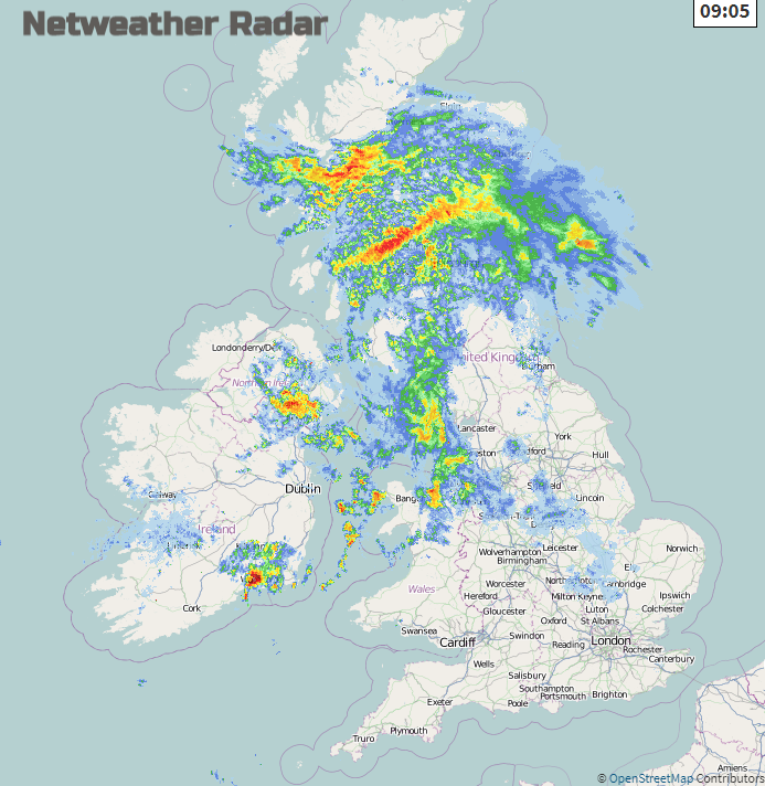
As a frontal system approached the UK on Tuesday evening, Altostratus filled the sky (see photo above). This mid-level, featureless cloud makes the sun appear like it is being viewed through ground glass. The cloud then thickens and lowers and, in the end, can bring rain, as it did overnight, from Nimbostratus. That rain is now across Scotland, Northern Ireland and has crossed the Irish Sea into Gwynedd, Cheshire and Manchester. There is thicker cloud over northern England, the Midlands and more of north Wales with outbreaks of rain but to the south and east, there are still brighter skies and even sunshine for southern Britain.
One low centre moves near to NW Scotland during today but waves along the trailing front will bring further pulses of rain during Thursday before finally clearing south-eastwards away from the UK on Friday. Behind that, another Atlantic low then heads for the UK at the weekend bringing a spell of wet and blustery weather on Saturday.
Temperatures
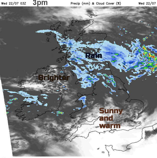
The warmest air remains to the south of the frontal band and in any sheltered sunshine it will feel very warm, the UV levels are high. However, air temperatures remain in the 20sC throughout the week, no sign of tipping into the 30sC for the end of July. Southeast England should see mid 20sC today, on Thursday and Friday with 27C possible. Northern Ireland and Scotland stay in the high teens. Wales and northern England in the high teens and low twenties Celsius.
Winds
The winds veer from a south-easterly to brisk southwesterlies today as the rain edges eastwards. The winds stay light for southern England and East Anglia adding to the pleasant feel to today in the sunshine. Winds will also be light for the far north of Scotland which avoids the rain, which becomes more patchy through the day over central and southern Scotland and northern England. It will be the northern Pennies and Cumbria, also Snowdonia seeing more rain with little reaching eastern parts of Yorkshire. The Northern Isles keep an easterly wind and the coast of Essex and Suffolk will have a light southerly onshore breeze, English Channel coasts, a SW breeze if you are off to the seaside today. 17C for Bournemouth and 20C for Southend-on-Sea.
Northern Ireland will improve this afternoon with bright spells as the rain clears. Belfast up to 19C today. Southern Britain and East Anglia continue with fine weather and warm sunshine. NW Wales keeps more cloud and outbreaks of rain but much of Wales will be dry this afternoon with sunshine in the south and a mixture of bright spells and more cloud elsewhere. Western coasts and hill tops keep more cloud and dampness through the evening before the next main ripple on this frontal divide heads into Ireland. Northern Scotland will be showery, caught up in the occlusion of the first low centre. One band of rain extends over the Irish Sea and northern England as another band heads across Wales on Thursday morning. NW England looks wet as does the East Riding of Yorkshire. Gradually through the day, showery outbreaks move over Wales and SW England into central England. The warmest air will be over SE England and to the north of the rain, brighter skies appear for Scotland with a scattering of showers. In any sunshine, temperatures could lift to 19 or 20C so feeling much warmer than today for the Central Belt.
For many, Friday will be a fine day with warm sunshine and just a few lingering showers for the southeast. There will be light winds and temperatures into the 20sC. Later in the day, the winds pick up from the south over Ireland as the next area of frontal rain heads in, becoming heavy for Northern Ireland and western Scotland on Friday evening.
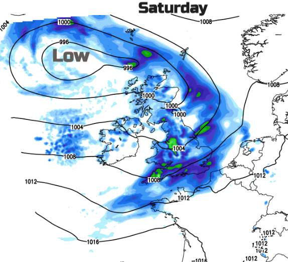
Saturday’s forecast includes a spell of heavy rain across the UK with a risk of heavy even thundery showers to follow. Something to keep an eye on. If you are heading further afield for your holidays, here's a look at the forecast for some of the travel corridor locations including Spain and Greece.