There have been some torrential downpours to start the week from heavy thundery showers for the UK and Ireland. The thunderstorm risk continues this week. More funnels to spot?
The theme for this week is of warm humid air, light winds with the threat of heavy, thundery showers. Low cloud off the North Sea continues to smother eastern Britain, particularly the northeast.
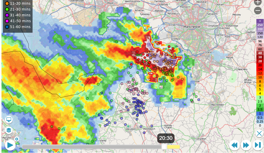
The heaviest showers were for NW England, north Wales, SW Scotland and Northern Ireland on Monday, with a supercell west of Greater Manchester by the evening. This western and southern preference persists into Tuesday although other homegrown showers will appear for central Britain by the afternoon. The UK Met Office highlighted northern England and north Wales in their yellow warning for thunderstorms and also Northern Ireland, particularly Co.Fermanagh. Unusually Met Eireann included the yellow warning on their graphic as an extension of the information shown on their warnings. There were yellow and orange warnings for Thunderstorms on Monday. "Intense thundery downpours today, in excess of 50mm, will lead to surface flooding. Met Eireann"
A funnel cloud was seen over North Yorkshire showing severe convection with tornado reports from Ingleborough Common.
Tornado or funnel cloud, West Yorkshire too.
Thorugh Monday evening clusters of storms continued to drift northeastward, bringing heavy rain, lightning strikes and large puddles. There were dramatic skies and hail as the huge thunderstorm moved over Irlam.
The risk of surface water flooding remains from these downpours today. The severe convective forecast is out for Tuesday, highlighting a higher risk for NW England, north Wales, the north Midlands and also for southern Ireland.
This week will bring more heavy thundery downpours although it will be southern Britain more at risk by Thursday as the low pressure away to the SW shifts along the English Channel.