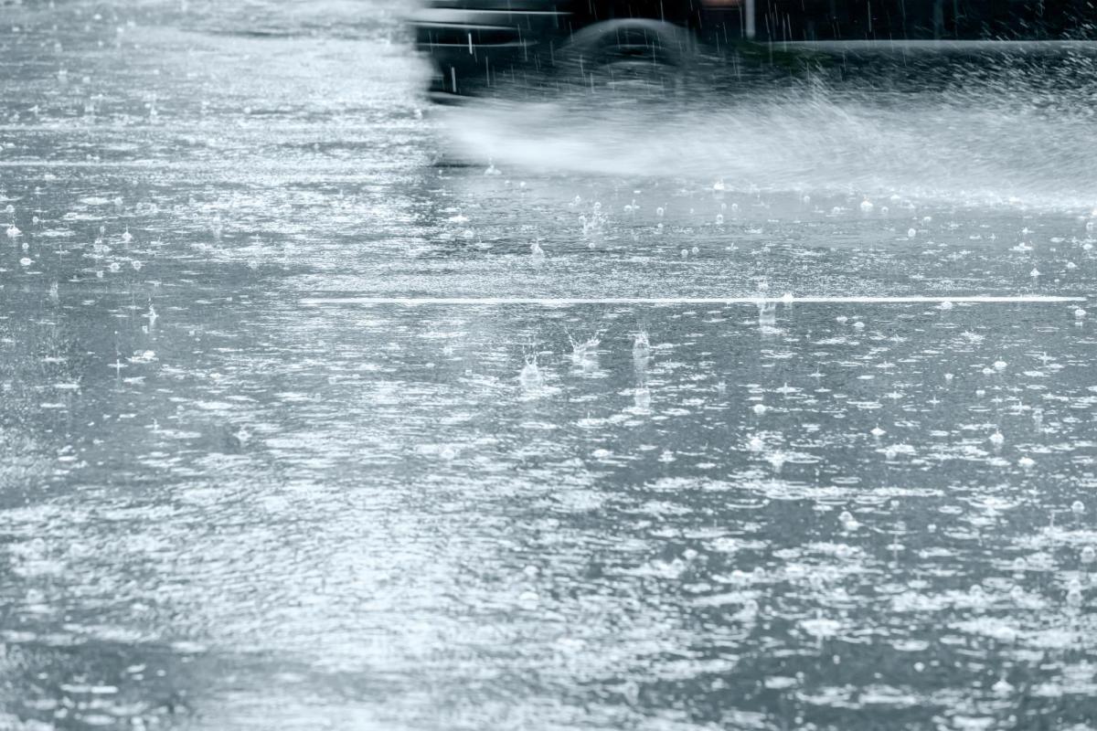
Midweek video with Jo Farrow as the UK's weather turns unsettled. Heavy downpours even thunderstorms bring a risk of surface water flooding, mainly in the south.
Quite a shift from the endless fine weather of spring, it's dry, warm and very sunny conditions. June has brought some rain and a cooler feel and now with low pressure lurking nearby for several days, there is the risk of heavy showers, thunderstorms and flooding.
The Netweather convective forecast shows the area most at risk from a thunderstorm this evening and overnight. Your weather app maybe showing lots of heavy showers symbols, even a thunderstorm but this is just a risk. The shower may move two miles down the road from you and so you stay dry, the nearby town gets drenched.
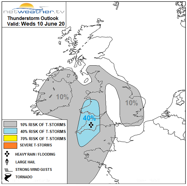
"An increase in convective rainfall across Wales and SW England from late afternoon, through the evening and overnight. Some of the convection embedded in developing area of heavy rain here could be strong enough to produce thunderstorms, which will be capable of producing localised flooding." Nick Finnis
The ground is very dry. These convective showers will bring hefty downpours with 50 to 80mm of rain forecast in places, that is 2 or 3" Wednesday into early Thursday. As the flow continues from the NE or east wet weather will also set in for NE England later on Thursday with the risk of heavy, sometimes thundery showers continuing for southern Britain into Friday. This risk then extends northwards through Britain on Saturday.
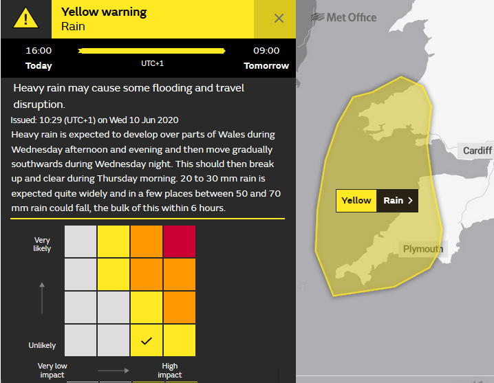
The UK Met Office have issued a petite yellow warning for rain over Cornwall and Devon and SW Wales for the end of Wednesday and overnight. The warning matrix shows that for one particular location within the yellow area you aren't that likely to see a very heavy downpour but if you do, its impacts will be high. Further warnings could appear, perhaps for the rain over NE England later on Thursday and the heavy thundery showers in the south on Friday could again bring surface water problems.
The Environment Agency 5-day forecast. 'Local flooding is possible but not expected from surface water and rivers across parts of SW Wales and SW England this afternoon (Weds) and overnight into Thursday. Further surface water and river flooding is possible across parts of NE England on Thursday evening and overnight into Friday. Local flooding from surface water is also possible more widely on Friday into Saturday for parts of England and Wales.'