That wind is cold for Monday morning, an Arctic chill for the start of the week. High pressure brings a lot of dry weather but a few wintry showers too from the north. Frost risk continues.
We have a cold May week, with frost and a real nip in the air especially in the brisk winds today. Saturday saw a top temperature of 24.9C for London with top a maximum of only 14C. The cold Arctic flow and brisk winds will ease off slowly this week with higher temperatures by next weekend, high teens and low 20sC. High pressure will bring a lot of dry, settled weather in the next few days. There will be little rain overall.
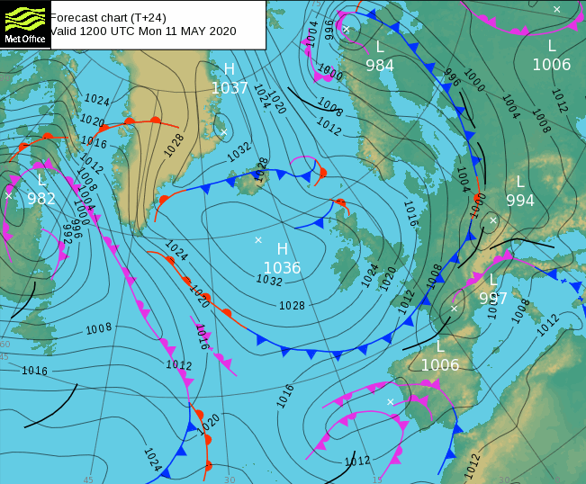
The cold air has reached right down to the English Channel now and with fresh NE winds around the high over southern Britain, it is feeling chilly out there this morning. Take a coat if you are queueing for the supermarket today. There still is a lot of fine sunshine but also some low cloud off the North Sea caught in that flow.
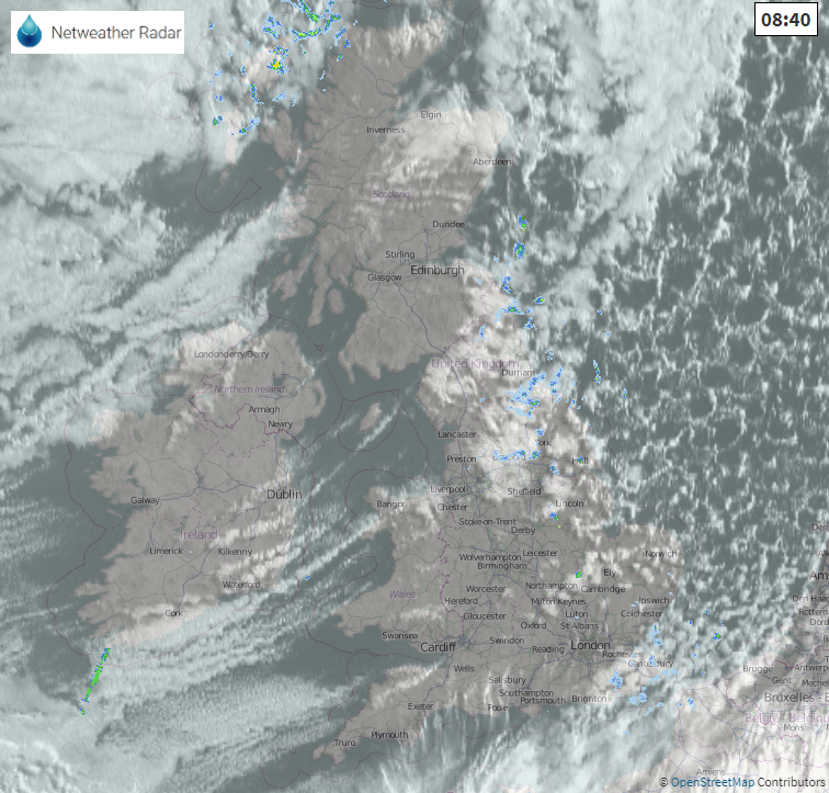
There will still be a few showers coming down in the flow, grazing eastern Britain and northern Scotland (where the wind will be from the NW). At the weekend there was snow in the far north and Northern Isles with wintry precipitation seen at a few other parts of NE Britain. I saw snow pellets or graupel, the opaque white spheres which might sound a little like hail initially.
Again, over the next few days, there will be wintry bits in some of the showers with snow over the highest hills.
The fresh NE wind will continue for East Anglia, SE England and southern England into the afternoon, strong for Kent coasts. Temperatures today across the UK will be 9 to 14C and nippy tonight with a touch of frost inland. So again, gardeners take note. Bands of showers will appear in the flow, coming down from the north. There will be a scattering of rain, sleet and mountain snow showers overnight into Tuesday morning, for Northern Ireland, northern and western Scotland and over Grampian in north to NW winds.
A more distinct band of rain and wintry precipitation will move down through Scotland on Tuesday. Elsewhere still a lot of fair weather with warm sunshine but still a coolness to the air even though the winds will be easing down.
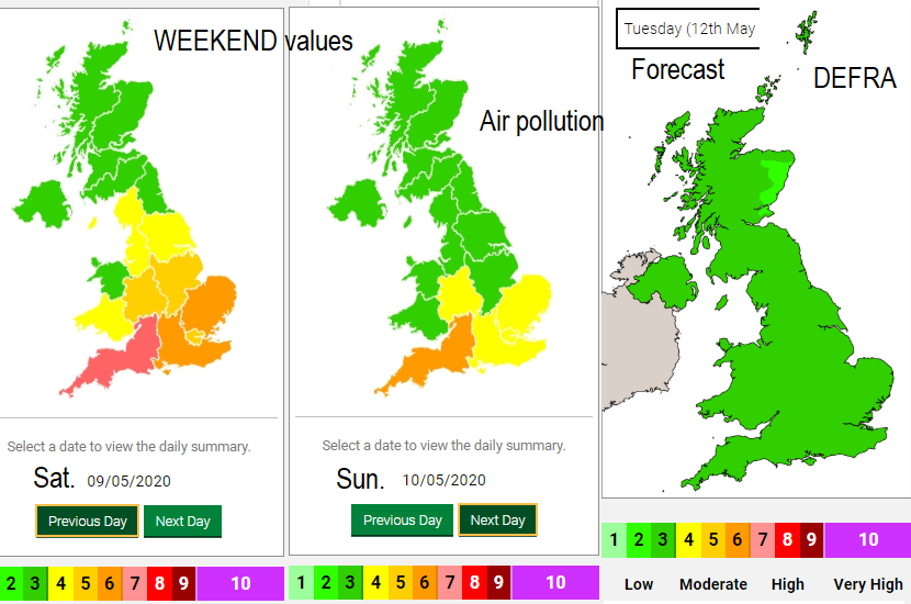
Today : Strong north to northeast winds have brought cold, clean air across the whole UK. Pollution levels will be Low in all areas. DEFRA
Northern France and Paris have had air quality issues this weekend as did southern England in the still, warm air, even in this time of lockdown. Thank goodness the Arctic is cold and “clean”.
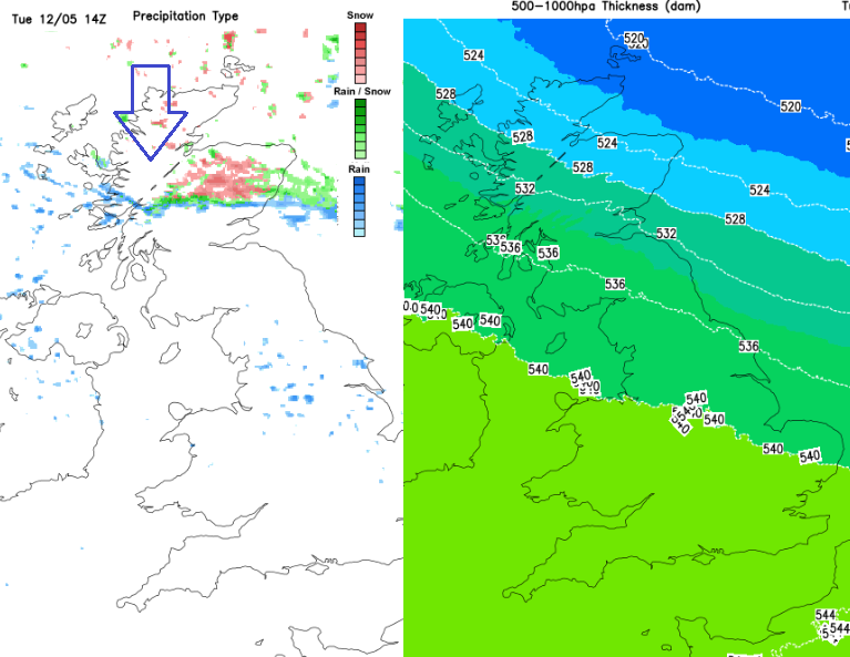
The cold front continues down over England with more cloud and a little rain, even snow for tops of the Pennines. Colder air pulls into northern Scotland on Tuesday night with a widespread frost and a few snow showers for the far north of Scotland and Aberdeenshire. Early on Wednesday, there could be ice to watch out for in parts of northern Britain. The winds will be very light by Wednesday. So, temperatures of 10 to 15C won’t feel as chilly as today.
Slowly the high shifts southwards and the colder airflow is cut off. For northern areas more cloud but for central and southern UK, there will still be patchy frost but plenty of sunshine and dry, fine weather by day. By the weekend the temperatures will lift.