A warm VE Day with scattered showers and that warmth lingers in the south as a dramatic change from the north takes place this weekend. Much colder air with frost for the new week.
It’s Friday, it’s also May Day Bank Holiday on the 8th, on a Friday. Today sees the 75th anniversary of VE Day, which is why the Bank holiday was moved, and in normal times the forecast would have been for outdoor events and long weekend plans. However, it’s still #StayatHome, so onwards with the weather out of your window, in the garden or just for timing your daily exercise.
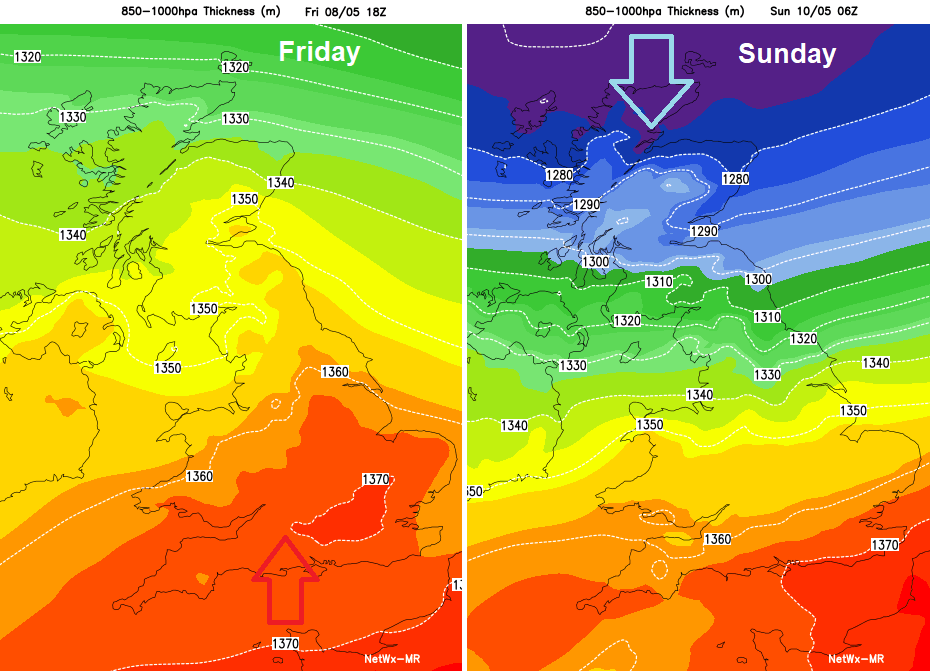
This week has seen some warm sunshine and temperatures continue to rise today into the 20sC but there will be a dramatic change this weekend into Monday, so it’s as well that you aren’t going away because packing the right clothes would have been a nightmare. By the start of the new week, there will be frost, ice and even snow showers in the forecast for parts of the UK as the southerly winds change around to the north.
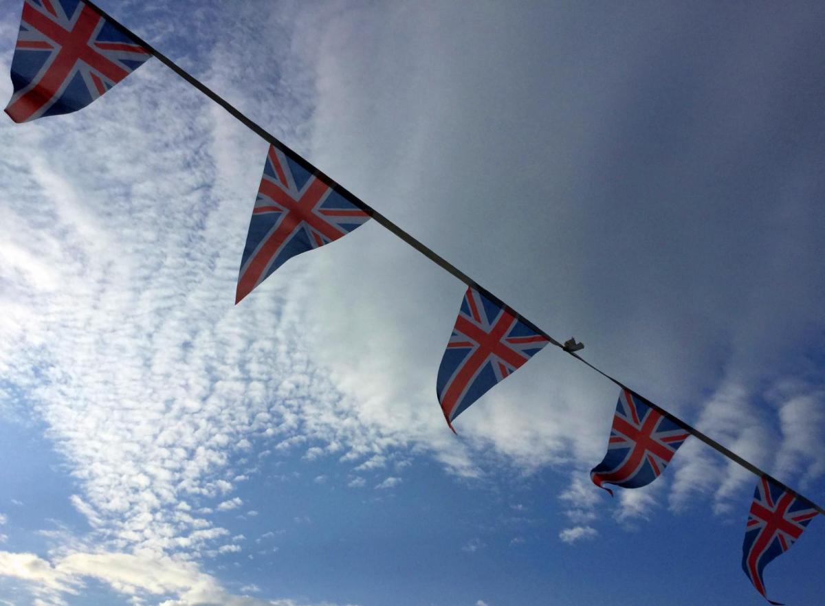
Victory in Europe Day 75
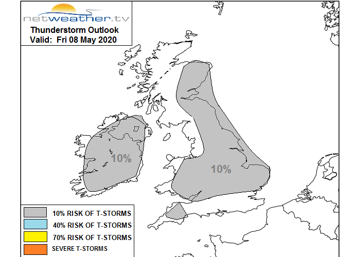
For many today will be fine and warm but there will be scattered showers which could soak the bunting before the drier conditions return. The air is feeling more humid and there is a small risk of thunderstorms today.
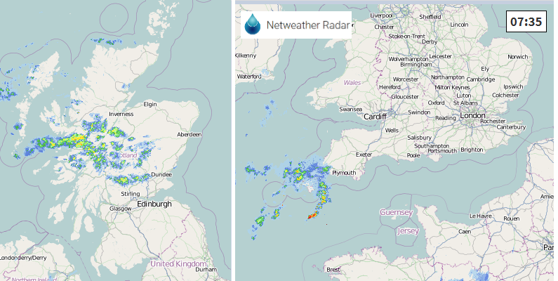
To start the day there will be patchy rain over Cornwall edging into Devon and there are the remains of a frontal band across northern Scotland bringing rain this morning. That lingers into the afternoon with more cloud and showery outbreaks, particularly for Grampian.
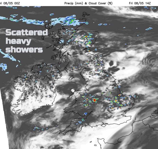
A scattering of showers will appear for Wales, the Midlands and inland East Anglia with some sharp downpours and the small risk of lightning. There will also be scattered showers for Northern Ireland, southern Scotland and eastern Britain, not many but it’s not a completely dry forecast. In between and for most there will be fine, bright weather and warmth.
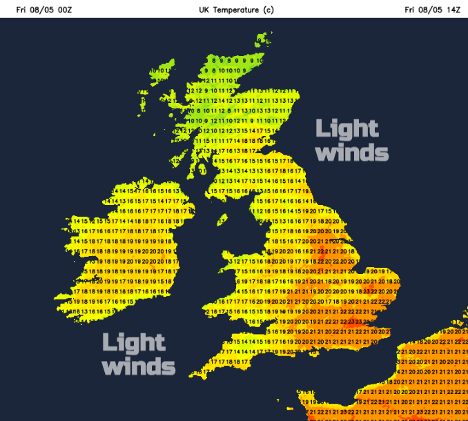
18 or 19 for Northern Ireland, Wales and the Central Belt of Scotland. Northern England, high teens up to 21C (70F). For the rest of England, inland should see high teens, low 20sC and for London up to 25C today. Mild tonight for all but Shetland and tomorrow London could see a degree or so higher.
The frontal band over northern Scotland gathers itself by Saturday morning with wet weather for the NW Highlands across to the Moray coast. Under this, it will feel much cooler. For much of the UK, Saturday will be another fine, warm day with more sunshine, light winds and a scattering of showers. Much of southern Britain looks dry and fine but from the Bristol Channel across to The Wash northwards could see a shower, north Norfolk too. Again, the risk of a heavy downpour as the showers will be slow-moving and chance of thunder.
By Saturday evening, the frontal band will be moving south over Scotland, colder air tucking in behind with a frost. There will be a cold NE wind developing too and the risk of ice overnight for Scotland. Through the English Channel, the risk of heavy showers remains linked to a low in the Bay of Biscay. There has been uncertainty around the bands of heavy showers, even thunderstorms over northern France and their positioning for southern England on Sunday, something to keep an eye on.
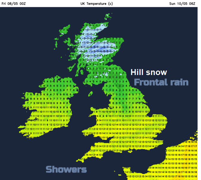
Southern Britain could see in the high teens around lunchtime before the cooler air arrives, so still some fine weather but with a freshening cold NE wind, reaching right down through the UK on Sunday. For many a distinct change with temperatures in single figure or low teens. The risk of snow showers is focused over the Northern Isles with a few for NE Scotland and the far north of the mainland. The flow around the building high is drier and the high will move in from the NW.
The winds ease for NW UK and a widespread frost is forecast as the chilly wind continues elsewhere. That will only strengthen by Monday so really feeling cold in the wind then with temperatures of 7 to 12C. Next week stays cool but fairly settled.