High pressure over Scandinavia is bringing settled weather to the UK with clear skies giving sunshine by day but a chill and frost by night. Often feeling cold in the wind out of the sun.
The days are lengthening, the sun is getting higher and we have a mainly dry, fine weekend to look forward to for a change, so it's not all doom and gloom in these, to say the least, very challenging times.
The Atlantic westerlies so dominant during the winter have left us, with the weather now coming off the nearby continent in a complete change that often occurs around this time in March.
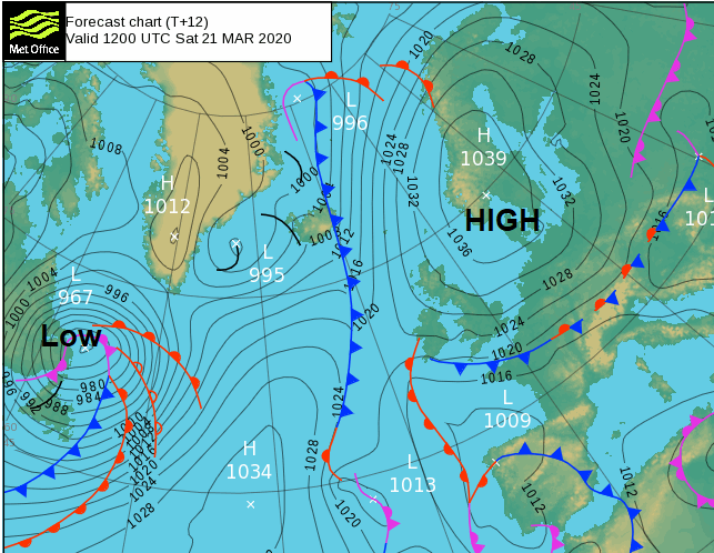
A large anticyclone over Scandinavia is 'feeding' chilly North Easterly winds across most parts, with much of Scotland and some sheltered central and western areas waking to a frost this morning. For most though it'll be a fine day with plenty of sunshine, but a chilly East or North Easterly wind will prevent temperatures from getting much above 10 to 12C.
As ever there'll be a few exceptions, with patchy cloud over East Scotland currently giving a few light showers, but these will clear. More western areas will also see the sun made watery or hazy at times by thin high cloud, with patchy cloud along some North Sea coasts keeping temperatures down here to no more than 8 or 9C.
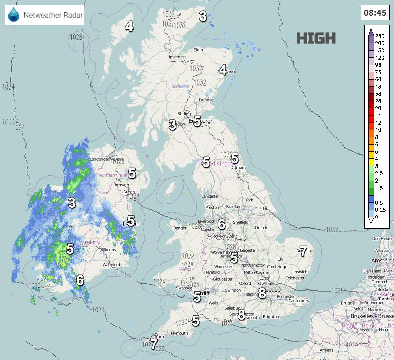
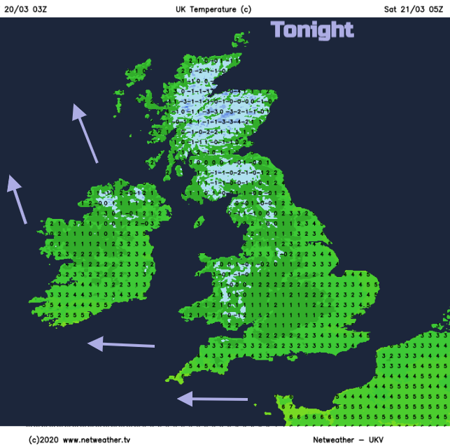
The Western Isles and the far North West of Scotland may see a little rain from an old decaying front after dark, but for most, it'll remain dry with clear spells. Another frost is expected mostly in central and western areas and over Scotland, where some sheltered glens could see temperatures fall as low as -5 or -6C but -2 to +2C will be a more general minimum. In the East and across North East England, in particular, an East or North Easterly breeze coupled with patches of low cloud drifting off the North Sea will help prevent a frost.
High pressure remains the dominant feature on Sunday, so it'll continue mostly dry and fine. After a frosty start particularly over Scotland and in the West, there'll be lots of sunshine again, although some eastern areas may start grey or see patchy cloud occasionally. A chilly East or North East wind will prevent temperatures from getting above 8 or 9C along some North Sea coasts again with 10 to 12C likely in most other parts. Towards the Moray Firth however, where a South East wind will be lighter temperatures could briefly reach 13 or 14C into the afternoon.
Another fine but chilly evening is followed in most parts by a dry largely clear night. A frost is likely again especially over Scotland, Wales and in the West, while some eastern parts may see patches of very low cloud later in the night drifting in off the North Sea once more on a cold Easterly wind. Towards morning, lighter South Easterly breezes across Scotland and Northern Ireland could allow a few mist patches to form towards dawn. Lowest temperatures should mostly be in the range -2 to 0C in the West and zero to +2C in the East.
It continues mainly dry well into next week, which will be good news for the farmers and gardeners in particular. There'll be further spells of sunshine to add some cheer at this awful time, but with further night frosts and a few mist or fog patches to clear first thing from some rural areas.