Met Office have named Storm Ciara which will bring widespread gales on Sunday. Staying very unsettled and turning colder early next week, with gales and risk of snow, perhaps another deep low mid-week.
The Arctic Oscillation is set to go exceptionally high by early next week, perhaps exceeding the AO index record of +5.9 set back in February 1990. The strong AO will keep the jet stream very strong and zonal across the Atlantic from this weekend and into next week. The steep temperature contrast either side of the jet stream and baroclinic zone at the surface and strong winds aloft will be the catalyst for a few deepening depressions crossing over the North Atlantic and crossing close to or over the UK from Sunday and through next week.

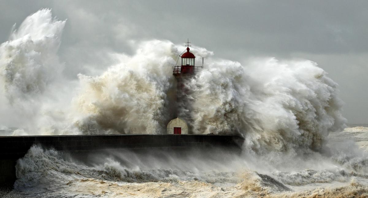
The first of these deep lows, named Storm Ciara by the Met Office this morning, looks to sweep northeast close to Scotland on Sunday, bringing widespread gales and heavy rain across the UK and Ireland from Saturday night and through Sunday.
This low forming Storm Ciara has already started its long journey to the UK and can be traced all the way back to the southern Plains of the U.S.A – where a fairly innocuous looking low has brought a swathe of several inches of snow from Texas through Oklahoma to Missouri overnight. This low will continue to travel northeast towards New England over the next few days along the boundary marking a stark contrast of bitter cold air coming down from Canada to the northwest and warmer tropical air to the southeast. The system will bring snow to the Mid-West, Great Lakes then New England over the next few days, before the low then moves out over New Foundland and NW Atlantic Saturday morning, a deepening low by then.
Storm Ciara continuing to deepen across the far North Atlantic, as it moves onto the cold side of the jet stream and under the developmental left exit region of a 250mph+ jet streak racing across the Atlantic towards Britain. Still some uncertainty over the exact track of this low, from the 00z runs GFS takes it a few 100 miles to the north of Scotland, near the Faeroe Isles, while EC and UKMO close to the north of Scotland while GEM takes the low right across Scotland.
Either way, the field of very strong winds reaching gale force, or locally severe gale force around coasts and over hills, will cover much of the UK. Hence the Met Office yesterday issued a yellow wind warning for all of the UK.
Following Storm Ciara, a very strong WNW flow all the way from the Canadian arctic will usher in an increasingly cold Polar maritime flow on Monday. The showery flow will see blustery showers of rain, hail and thunder spread through many areas for a time, turning increasingly to sleet and snow by evening in the north and west as colder air moves in – some significant falls of snow are possible across higher ground of western Scotland, NW England, Wales, Ireland and Northern Ireland by early Tuesday. Sleet and snow showers perhaps becoming confined to Ireland and western coastal areas of mainland Britain on Tuesday, but still very windy, with drifting of snow where it settles. Brighter, drier but chilly conditions in the east.

Increasing uncertainty by Wednesday next week, given seven days away is a long time in weather forecasting with a large margin for error at that range from weather models. A few recent GFS runs have brought a very deep low east across Britain, akin to the Burns’ Day storm of January 1990 which brought widespread damaging winds across England and Wales. 00z/06z GFS and 00z ECM still have this deepening low over the Atlantic heading towards the UK, but further north in track over and winds not as strong and on Thursday morning. So, a risk there for gales or severe gales across parts of Britain Wednesday or Thursday next week, though where the strongest winds will be uncertain. Potential for snow too on the northern and western flank of this low as it moves through, perhaps bringing blizzard conditions over hills. This may be another storm named by the Met Office or Met Eireann.

Thereafter, the weather models have been fairly consistent in the outlook over the last several days beyond early next week colder and very unsettled spell.
The stratosphere and troposphere are strongly coupled over this side of the northern hemisphere, so the troposphere pattern (where our weather happens) at the start of next week mirrors the elongated stratospheric polar vortex, The SPV displaced from its usual home over the north pole, by stratospheric warming over North America, with one side of the elongated SPV across the NE Atlantic and other side over Siberia, with a similar pattern in the troposphere looking at 500mb level, with strong W/NW flow deep through the atmosphere over the far north Atlantic.

By day 10 (Saturday 15th Feb) the SPV tightens its circulation and becomes more rounded as the core drifts back towards Greenland, probably because the stratospheric warming over North America subsides. This eventually mirrored in the troposphere, with a more rounded tropospheric polar vortex gradually returning back over Greenland, strengthening ridging over Europe and allowing a milder southwesterly flow to return across the UK as we head into the second half of February. This has been a fairly consistent signal from the extended ECMWF ensembles.