A strong polar vortex over the arctic over the next few weeks and strong jet stream close to northern Britain will mean snow is unlikely for most until at least mid-month
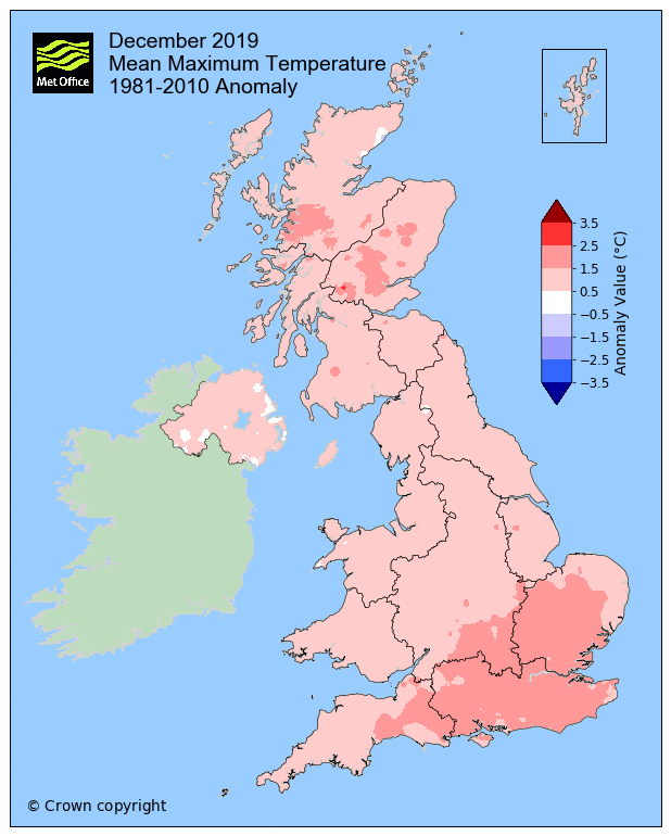
Most have yet to see a single flake of snow since the start of meteorological winter, so mild it's been since the begining of December. Since the start of winter, the flow has generally been coming in from the west off the Atlantic. Before Christmas, the UK experienced several weeks of unsettled and rather wet weather, thanks to a strong jet stream directed at NW Europe, often running close to southern Britain and bringing a succession of weather systems off the Atlantic accompanied by frequent spells of rain. There were large rainfall totals across parts of England and Wales as a result- leading to some flooding across central and southern parts before Christmas.
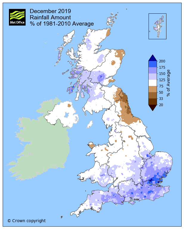
There was a change in the track of the jet stream just before Christmas, with a shift in the jet closer to the north of Britain, a change that has stuck ever since. This means most of the wind and rain since the change has been directed at northern and western areas, while southern, central and eastern areas that saw so much rain before Christmas have seen much less rain thanks to higher pressure.
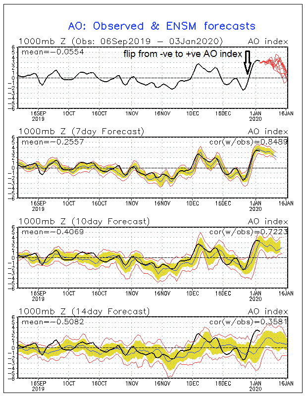
The shift to a more northerly track in the jet stream can be attributed to a suddenly flip in the Arctic Oscilation (AO) in late December.
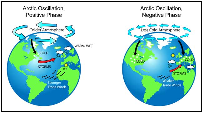
The AO's positive phase is characterised by lower-than-average pressure over the Arctic paired with higher than average pressure over the north Pacific and north Atlantic oceans, this leads to a jet stream that is further north than average, leading a more northerly storm track over both oceans. While the negative phase is the reverse of the positive phase, with higher-than-average pressure over the Arctic and lower-than-average over the northern parts of Pacific and Atlantic oceans.
Through much of November and mid-to-late December, the AO was in neutral to negative phase, then just before the New Year the AO flipped from negative to positive in the space of a few days, the AO indices going from -2.5 to +3.5C around New Year's Day.
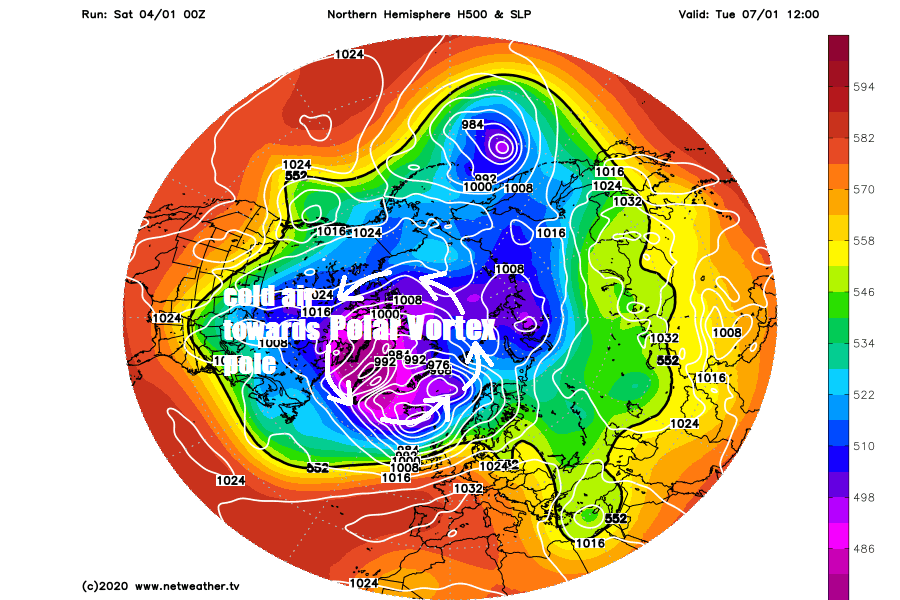
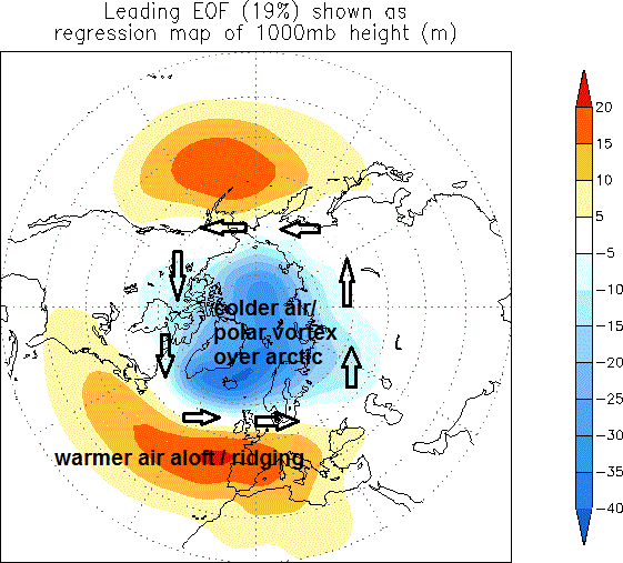
The change can be attribued to a strong Polar Vortex sat over arctic vertically stacked through the troposphere (where our weather is) and up through the stratosphere. The Polar Vortex is a column of very cold air that forms one big low pressure circulation in the atmosphere and keeps cold air bottled up in the high latitudes of the arctic while lower latidudes of United States (Canada mostly cold) and Europe stay mild. The Polar Vortex was already strong at the start of winter in the stratopshere, but started to couple with the troposphere lower down, where our weather takes place, as December progressed.
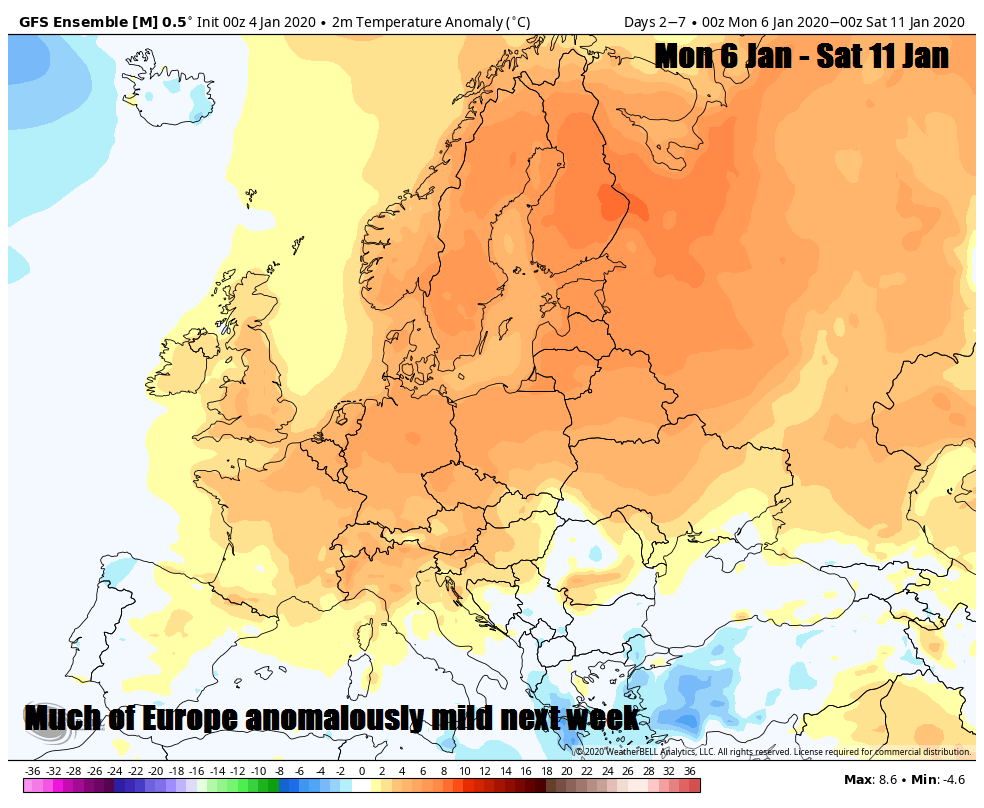
The current pattern of a positive AO with a northerly tracking jet stream, tracking just north or over northern Britain, resulting in low pressure close to north and high pressure over continental Europe, looks to continue until at least mid January. So the flow will be from the southwest or west, a mild direction this time of year. High pressure close to the south will keep most dry this weekend and into the start of next week, with most rain limited to northern Scotland. However, as next week progresses, the strengthening jet stream will shift south across northern Britain and high pressure will retreat, so it will turn increasingly windy and there will be spells of rain crossing the UK, though the heaviest and most persistent rain will be across the north and west. It will be mild for the time of year, particularly earlier in the week, Tuesday could see maximum temperatures reach the low teens widely, perhaps mid-teens in a few spots, though temperature tending to drop through the week as the jet sinks south, particularly in the far north.
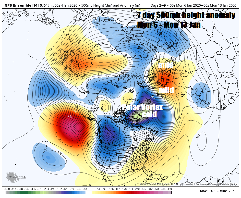
The UK can still get brief cold snaps with a positive AO, which often pairs with a positive NAO (North Atlantic Oscillation), this tend to occur when ripples in the jet stream amplify or buckle enough to allow cold air over the arctic to escape southwards into Europe. However, the jet stream recently and over coming days looks to remain rather flat or zonal (west to east) - this means cold air at higher latitudes is not allowed to escape south. This strong westerly flow not just across the Atlantic but also across North America and back across the north Pacific, this is perhaps attributable to the recently strong positive phase of the Indian Ocean Dipole (IOD) where there are warm waters over the western Indian Ocean. This paired with warm tropical Pacific waters and strong high pressure over NE Pacific - driving stronger than normal jet stream around the northern hemisphere.
The IOD is now easing to neutral values, which may allow westerlies to ease and the jet stream to become more wavy downstream over N America and eventually the Atlantic later this month. This could be reflected by the tentative signs from the model ensemble guidance over recent runs for pressure/heights to build to the east and eventually northeast over Scandiavia by mid-month. This could increasingly block the mild and unsettled Atlantic onslaught and allow a colder and drier continental flow from the east. But this potential is rather uncertain for now and just consigned to some support in the ensembles. Certainly no signs of any snow for lowland Britain away from the north of Scotland for a while.