Latest Synoptic Analysis - 2nd week of the school Easter Break stays mostly warm and sunny. Turning cooler and more unsettled over the weekend, but high pressure back next week?
Many areas enjoyed some pleasantly warm spring sunshine over the Easter Holiday Weekend, with the mercury rising to 20.7C at Aboyne in Aberdeenshire on Easter Sunday, which made it the UK's warmest Easter Sunday for 4 years. Then yesterday the temperature rose to 19.9C in Usk in Monmouthshire, south Wales.
High pressure firmly across the UK today:
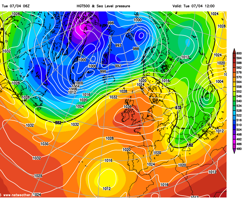
High pressure is centred across the UK for Tuesday and, although it will drift east toward the end of the week, most of the UK will stay dry for the rest of the week. The exception will be across northern Scotland where we will see thicker cloud with some rain at times. Indeed today, a weather front will push in across the far north, which will bring cloud and outbreaks of rain across northern Scotland through today with some patchy cloudy spilling further south across Scotland. And again on Friday, we will see weather fronts arrive from the west which could see cloudier skies across the north and northwest and rain return across northern and western Scotland along with Northern Ireland.
So away from the cloudy far north and northwest, many areas can look forward to some pleasant sunshine for the rest of the week, though it won't be wall-to-wall sunshine for everyone all the time, with some patchy cloud, particularly in the mornings, and a risk of some sea fog lapping in across western coastal areas overnight before burning back to the coasts during the day. Temperatures will not be as high today and tomorrow as the last few days, but still reaching the mid to high teens where we see sunshine. And remember, nights will turn chilly under the clear skies, with a risk of localised frost patches developing in places.
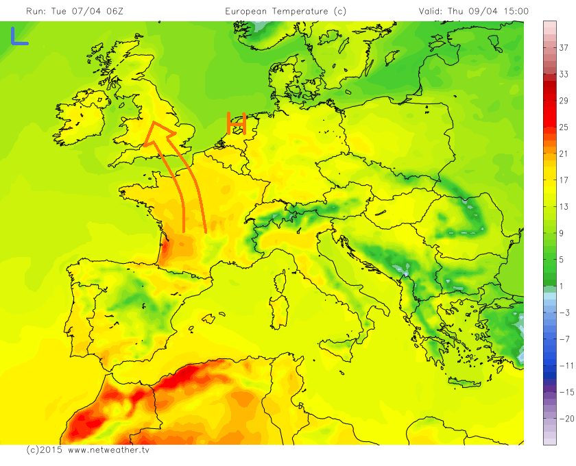
As the high pressure system over the UK drifts east into the near continent by Thursday, a southerly flow will develop which will drag in warmer air from southern Europe, so we are likely to see temperatures hit 20C or more on Thursday and Friday across central, southern and eastern areas of the UK, perhaps somewhere beating the 20.7C we saw on Easter Sunday.
Warmth spreading north on Thursday:
But by the weekend, we are likely to see a change to cooler conditions, as a cold front arriving across the west later on Friday moves east across all parts on Saturday. By the time the front reaches the SE of England Saturday afternoon, it looks to be a weak affair bringing nothing more than a band of cloud and the odd spot of rain, followed by brighter but cooler conditions with showers across Scotland, which maybe wintry over higher ground.
Turning colder behind weakening cold front moving east Saturday:
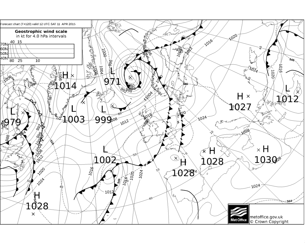
Temperatures will back into the low to mid-teens across the south and perhaps only into high single figures across the north over the weekend. A cool and unsettled day is indicated for Sunday, some uncertainties over detail. GFS suggests showery for many, with perhaps some more organised rain for the south. ECMWF shows a small depression moving east across Ireland and then northern England, bringing wet and windy conditions across central areas through the day, perhaps even some snow for higher ground on the low's northern flank.
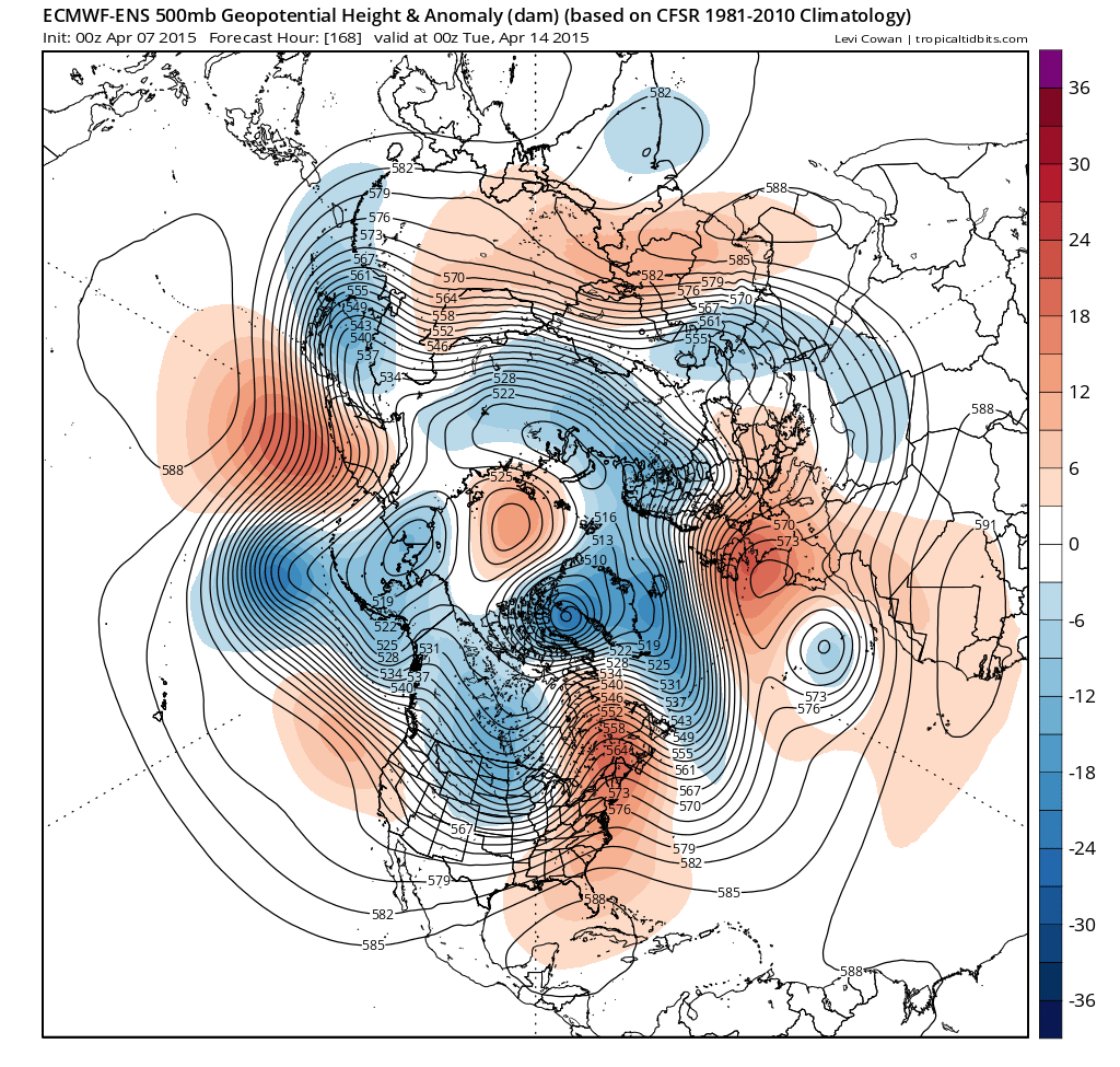
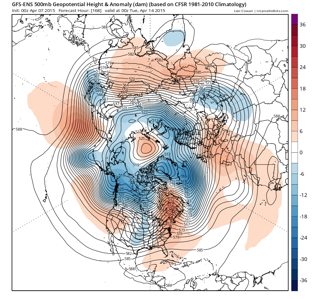
Both GFS and ECMWF show high pressure returning early next week though and with temperatures rising back into the mid-teens, even high teens or low 20s by Thursday as per GFS. But too far off to have confidence in these temperature predictions and high pressure maybe more dominant across the south with a risk of more unsettled conditions possible still in the far north. But, it does look like the cool down and return to unsettled conditions this coming week will be a temporary blip across the south at least, before anticyclonic conditions return next week. Hints of possible break down of the high from the west or SW toward the end of next week.
00z GFS and ECMWF ensemble mean suggest high pressure returning across southern areas at least early next week: