We have further temperature fluctuations this week after a mild start on Monday. Frontal bands will sweep across the UK, linked to low pressures which often stay away to the northwest. It is October break for many Scottish schools this week, with some wild weather by Wednesday for the Highlands and Islands. There will be the risk of gales, even severe gales in the far northwest of the UK. Anyone planning ferry travel midweek should monitor the forecast and Scottish or Irish Sea operator updates. It will be windy into Wednesday night as well. High pressure will build over the UK later this week, bringing settled, drier and cooler conditions, with frost more likely by the weekend.
The main excitement last weekend was for those who saw the Aurora, particularly on Saturday night when the Northern Lights were visible even in southern Britain.
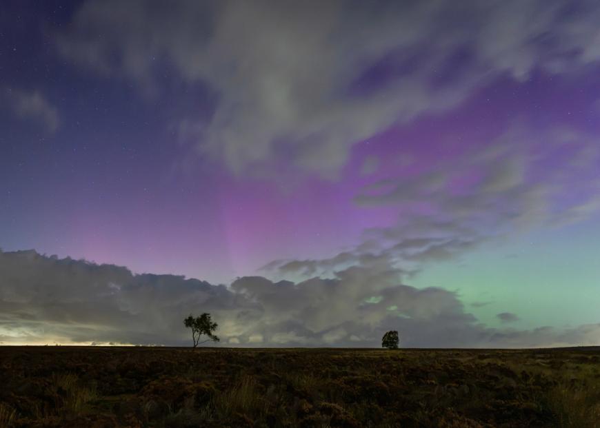
Peak District purple (Community member GreyCrag)
The US Space Weather Prediction Centre, part of NOAA, issued a G3 (Strong) or greater geomagnetic storm warning at the weekend. As “the solar wind environment became strongly enhanced following the arrival of a CME (Coronal Mass Ejection) from 08 Oct at around 10th/1434 UTC” and the geomagnetic field reached G3 levels during Saturday evening UK time.
There may be other opportunities to see the Aurora tonight for Scotland, possibly northern England. Also on Tuesday night but probably only northern Scotland by then, perhaps just confined to Shetland.
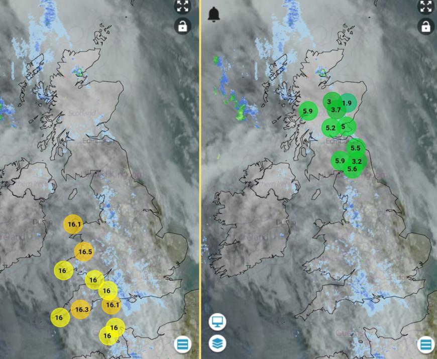
Netweather Radar on Monday morning 0845, top ten temperatures and lowest ten
On Monday, we have a band of frontal cloud with patchy rain working its way across the UK. Ahead of this there was cooler air and some clear skies. Behind there is a lot of cloud and some damp weather but also milder air. Northern Ireland could see 17 or 18C in the afternoon and for England and Wales, 16 to 19C later today, even 21C is possible for inland SW Britain if any sunny spells appear.
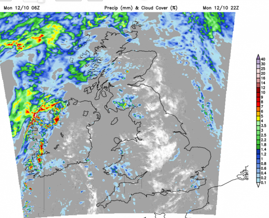
In this southerly flow, it will be very mild tonight but still with a lot of cloud about. There will be a clearer section but outbreaks of rain will gather for western areas through the night as the southerly wind freshens.
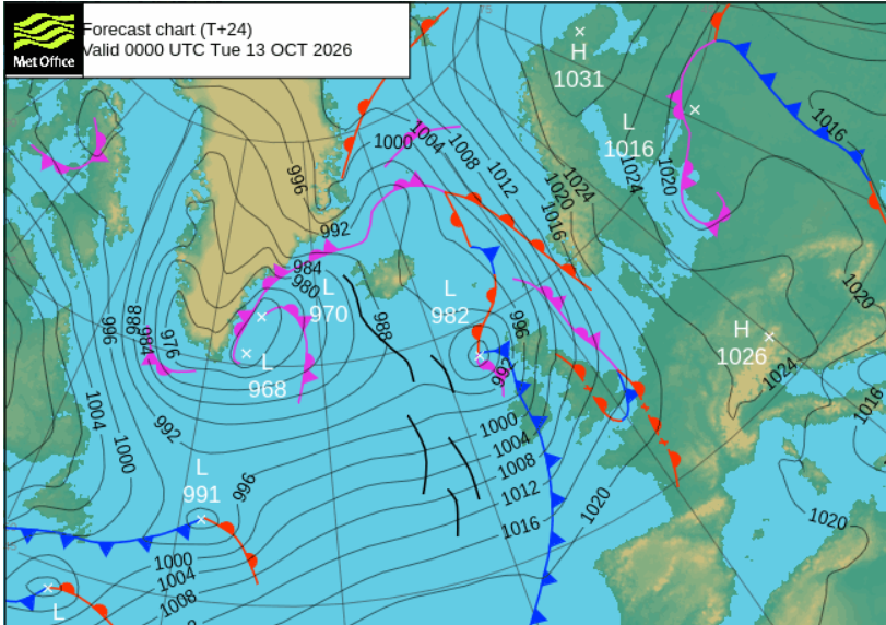
The next change will be along a cold front which will bring bursts of heavy rain over Northern Ireland and western Scotland in the small hours of Tuesday. The low centre will head up to the Norwegian Sea as the frontal rain marches across Britain in the morning, clearing Kent at lunchtime. It will be a very mild start for England, but cooler and fresher conditions will take hold. Behind the front there will be plenty of sunshine, but with a host of sharp showers from the west over Northern Ireland and northern Britain.
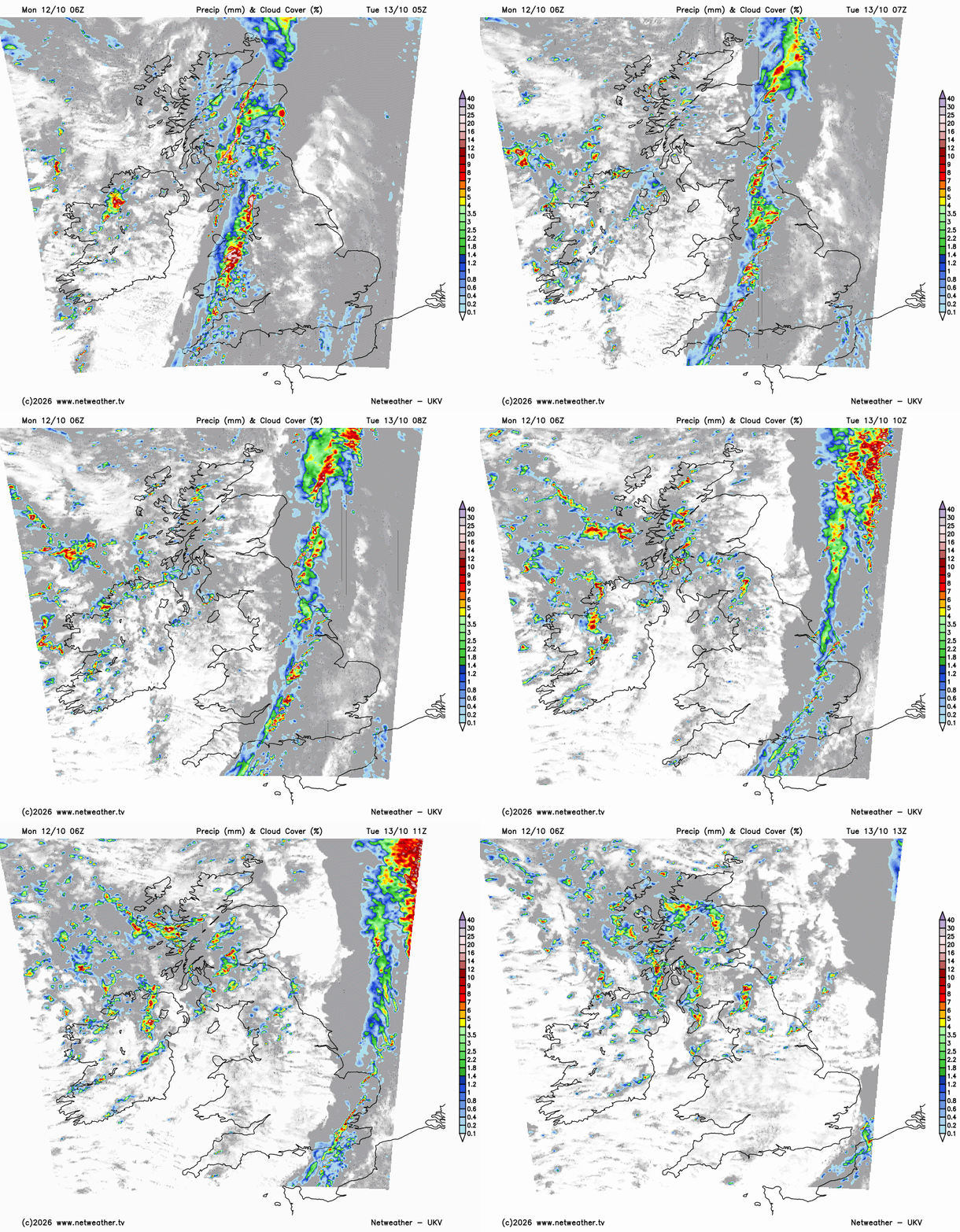
It will be a blustery afternoon with temperatures of 16C for Manchester but London and the Home Counties should manage the low 20s Celsius.
Most of the showers will fade into the evening, just lingering in the far north of Scotland. It will turn cooler overnight, noticeably colder for rural Scotland by early on Wednesday. There might be patchy fog for counties along the M4 and in central southern England.
Soon enough, milder air will reach over the UK as a warm front brushes the far north of Scotland with some early rain and more cloud. The wide warm sector will bring a mild Wednesday across the UK with temperatures from 14 to 20C.
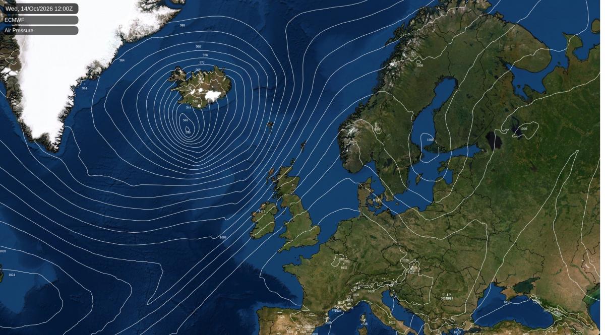
The low centre linked to that warm front will be quite a feature and will head for Iceland.
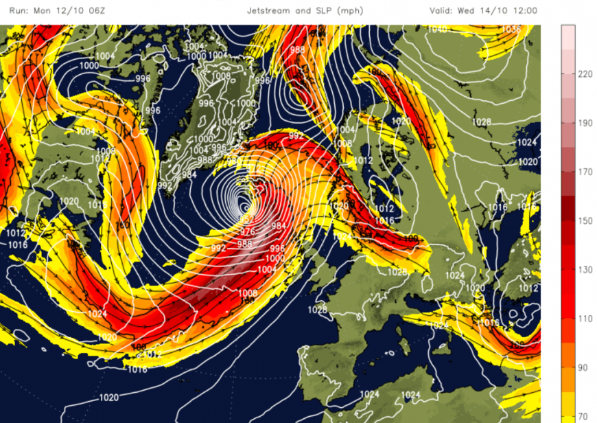
This rapidly deepening low pressure contains the remnants of Hurricane Isaias. This slammed into the Gulf Coast of the southern USA on Friday night, leaving four people dead and thousands without power. It also brought heavy rain to other states as it moved across the Southeast and out of the Eastern Seaboard.
There will be tropical energy entwined in the system as a strong jet will help develop a new extratropical low pressure (a usual autumn low). This low pressure will undergo significant deepening before reaching Iceland as a storm midweek.
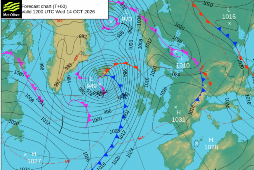
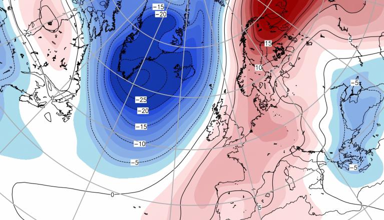
For the UK, there will be high pressure to the southeast and this storm away to the northwest. Northwestern parts of the UK will turn wet and very windy later on Wednesday.
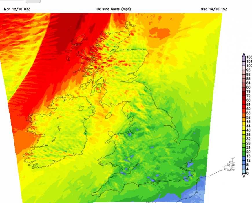
The warm air and sunshine will hold on for much of England and Wales until the cold front from this Icelandic low arrives Thursday night into Friday.
Loading recent activity...