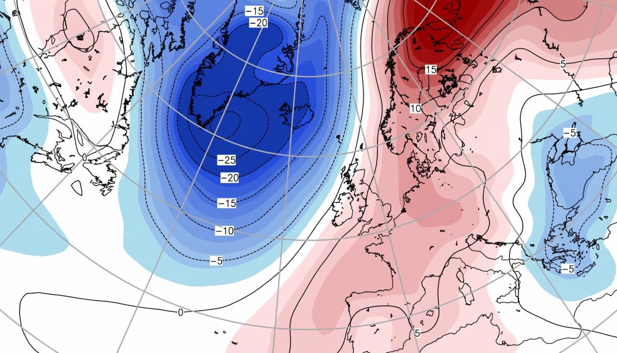
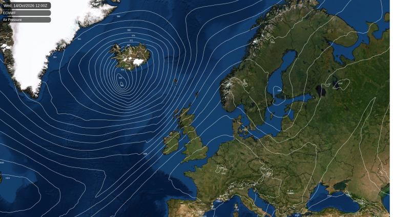
After a cool weekend, with temperatures a little below average, next week will see temperatures return to above average across many parts, as deepening low pressure out over the Atlantic draws in warm southwesterly winds from a long way south. Tuesday and Thursday are forecast to be the warmest days when temperatures could reach 21C in eastern England both days. Nights will be very mild too, particularly Monday night, with temperatures falling no lower than 16-17C in the south. However, it does look to turn cooler on Friday, as winds turn northwesterly.
Temperatures returning above average in the coming week after a cool weekend
There will be brief spells of rain moving through at times through the week, as Atlantic frontal systems tied in with a couple of deepening areas of low pressure to the northwest over the Atlantic move across the UK. Though rainfall from these fronts will generally be greatest across the north and west, with not much falling across the south and east, as the fronts move into higher pressure here.
It will be windy at times too, especially in the north and west, as deepening areas of low pressure move northeast to the northwest of the UK and Ireland and a few squally cold fronts move across the UK.
For now, after a chilly night, with a grass frost in rural areas in the north, it will be a drier day for Scotland, N. Ireland, north Wales and northern England, after a showery day on Saturday, these areas along with eastern England will have a mostly dry day with sunny spells. Cloud will thicken across SW England and south Wales, with mainly light rain moving in through the day. Temperatures reaching highs of 12-15C in the north, 15-17C in the south.
Monday will see a transition to milder and moister air moving in from the southwest, which along with weather fronts moving through, will bring a cloudier day with patchy outbreaks of rain or drizzle spreading east across many areas. Heavier rain spreading across northern Scotland during the evening. Despite the cloud, a warmer day, temperatures reaching 14-17C in the north, 18-19C in the south. A breezier day, especially in the west, very windy in the northwest into the evening, with gales developing across the Western Isles.
A windier day for all on Tuesday, especially in the north and west, with a band of squally rain moving east during the morning, clearing SE England and East Anglia around lunchtime. Brighter conditions follow, but with squally showers spreading east across Scotland. A warm day for mid-October across England, temperatures could reach 20C across eastern England.
Wednesday is looking largely dry and bright, away from western and northwestern coastal areas - which will be cloudier, with some patchy light rain or drizzle. A band of heavy rain and stronger winds moving in from the west across Scotland and Northern Ireland during the evening. Still warm across England, Wales and N. Ireland, with temperatures reaching 15-19C in the afternoon.
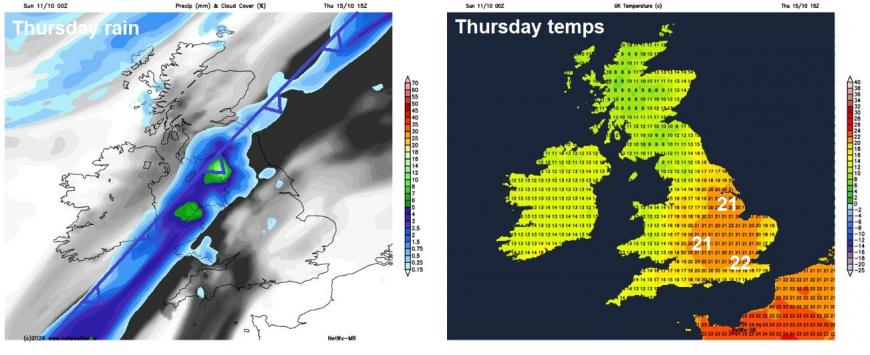
A windier day on Thursday. A band of heavy rain along a cold front across southern Scotland and Northern Ireland first thing will continue to slide southeast across England and Wales, though not reaching SE England and East Anglia until overnight, so here could be some sunny spells and temperatures perhaps reaching 20-21C in the mild southwesterly flow. Cooler and brighter conditions moving in across the north following the front, but with blustery showers in the northwest.
 Friday
Rain clearing the far southeast first thing in the morning on Friday, then all parts under a cooler northwesterly flow with sunny spells, most staying dry, but showers are possible around coasts.
An area of high pressure looks to build in from the southwest across the UK next weekend, bringing drier and more settled weather for most, on the cool side though by day thanks to a northeasterly flow around the high, while nights will turn cold where skies clear. There could be more in the way of cloud with some showers across southern and eastern England though, particularly later in the weekend, but uncertainty over this, depending on how the high orientates.
Loading recent activity...