Fog and Ice warnings for Wednesday morning before wet and windy weather moves in from the SW. Concerns for high rainfall amounts over Wales and southern England for next few days.
This morning has brought issues with ice and frost, fog, even freezing fog in places. All thanks to clear skies and light winds. A real change is on the way from the SW today as low pressure brushes by, bringing strong, gusty winds to western parts of the UK and rain to everyone by Thursday.
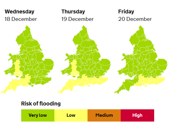
There is a whole host of warnings out and the risk of flooding will increase.
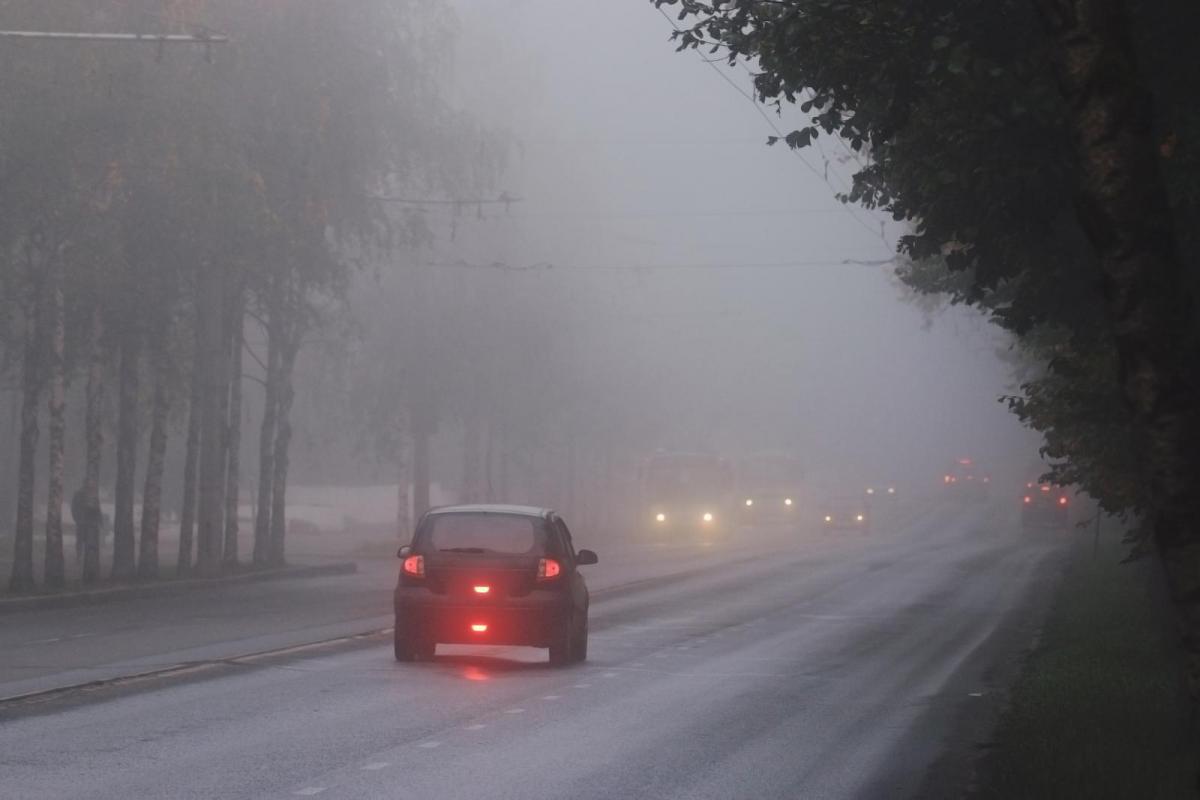
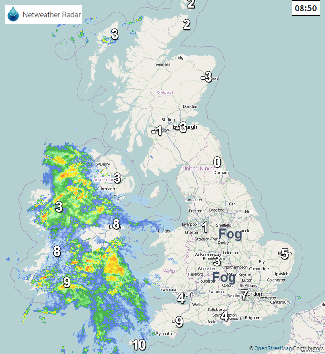
FOG: warning for England and inland Wales until lunchtime, also reports from Northern Ireland of freezing fog this morning but the breeze is picking up.
ICE: Central part of Britain, mainly the Midlands. Warning until 10am Wednesday but risk of icy patches elsewhere after showers and low overnight temperatures.
8am Weds 11 Flood warnings England, many appearing near the River Severn. There are ongoing groundwater warnings in this list too.
Flooding outlook England – “Local river and surface water flooding is probable on Wednesday, Thursday, Friday and Saturday in parts of the south of England and the south of Wales and possible more widely at times during this period.” Minor coastal impacts are also possible along parts of the south coast of England.
There are several bands of rain arriving today, one already over SW England this morning and Northern Ireland, slightly ahead of model timings. Northern Ireland will turn wet and cloudy with more of a breeze. The rain will be patchy over Cornwall, Pembrokeshire and Anglesey this morning. By lunchtime, the first band will reach SW Scotland and then Glasgow as a second heavier line of rain sets in for SW Britain. This second band will bring a spell of heavy rain to SW England and Wales late afternoon, early evening as people are on the move after work. Traffic is building before the holidays along with Christmas shoppers.
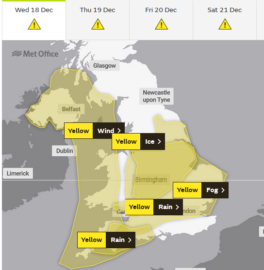
RAIN: “Heavy rain is likely to cause some problems for travel, as well as flooding in a few places.” From 4pm til midnight on Wednesday for south Wales and SW England. “…perhaps as much as 60 mm over Dartmoor and the high ground of south Wales. Falling on saturated ground, this will probably cause a few problems.” Met Office
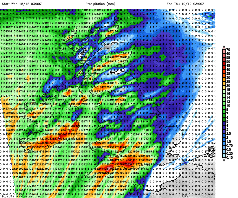
There are high totals showing Wednesday into Thursday for southwest England across to Hampshire and W.Sussex and also south Wales, the Severn catchments remain sensitive and pulses of heavy rain will affect SE England later on Thursday onwards.
WIND: “Strong winds likely to bring some disruption during Wednesday afternoon and overnight.” The warning runs from this afternoon until the small hours of Thursday. Through the Irish Sea, for Northern Ireland, Isle of Man and the North Channel become windy this evening. Then a curl of higher gusts is forecast to move from western Ireland up to the Western Isles early on Thursday. 60-70mph with gales for exposed coasts and hills.
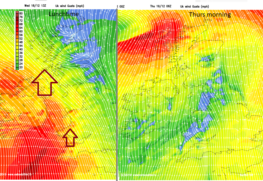
For many, it will be mild overnight, temperatures in the south in double figures. For Scotland, there will be an early frost on Wednesday evening but turning milder later. The frontal rain pushes across most of the UK tonight, missing East Anglia and the far SE until Thursday morning when the fading, lingering front could still be over southeastern half of Britain with more cloud. Elsewhere it will be brighter with sunshine. The strongest winds clear away to the north, there will be a milder flow of air from the south and further bands of heavy rain moving up from France.
More RAIN: There is a rain warning for SE England which runs from Thursday until Saturday. The Met Office works with the Environment Agencies to issue warnings for rain and flood risk. This area will be sensitive to any extra rain and there are coastal concerns too. “Spells of heavy rain are likely to lead to travel disruption at times throughout the period.”
“With the ground already saturated there is the potential for problems due to flooding. At present there is significant uncertainty regarding the timing and detail of individual rainfall events.” Met Office.
Pulses of heavy rain head up from the south, so don’t take weather app timings at face value but view the overall picture that there will be times of heavy rain, poor visibility and surface water on roads and on what will be a very busy traffic day, Friday could see significant impacts to travel.