After a mostly dry start to Wednesday, more trouble is brewing to our southwest as another spell of heavy rain approaches.
After a mostly dry start to Wednesday, more trouble is brewing to our southwest as another spell of heavy rain approaches. This time it's southern England and South Wales in the firing line, to start with at least. With parts of central and eastern England getting in on the act into tomorrow.
Elsewhere, it's a quieter picture with some showers near to coasts - especially western ones, but plenty of dry, bright or sunny weather during today. It's not going to be a warm day though, with highs reaching 6-9c in England and Wales, with maybe a 10c near to the south coast. For Scotland and Northern Ireland, it's a touch colder, peaking at 4-7c typically.
It's around lunchtime today that the rain is going to start to show itself, turning up first into the southwest with showers tending to develop into Wales and along the south coast ahead of it. The winds will become increasingly strong in the southwest as well - with gales in exposed spots and some choppy seas. The rain and hill snow will then push a little further north into Wales, but its main movement will be east across southern England - with around the M4 the northernmost extent, approximately. It'll clear the southwest corner of England during the first part of the night, but there'll still be some sharp showers leftover.
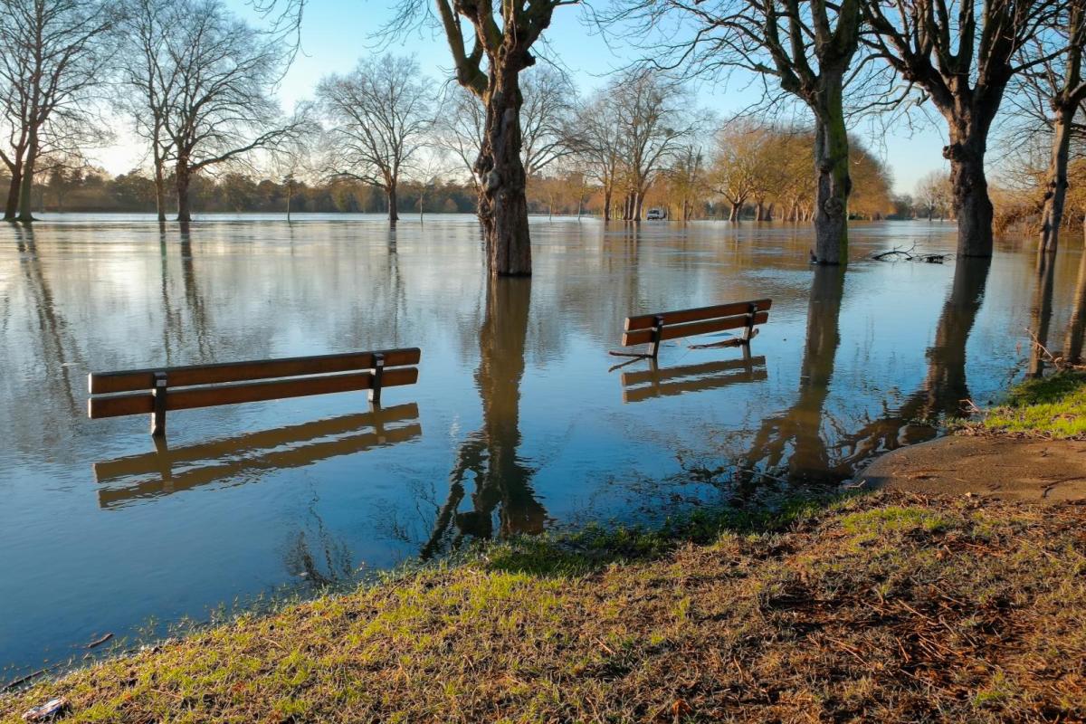
These are the forecast rainfall totals up to 3am Thursday morning - with some parts seeing 25mm or more, flooding is possible and Met Office warnings have been issued. 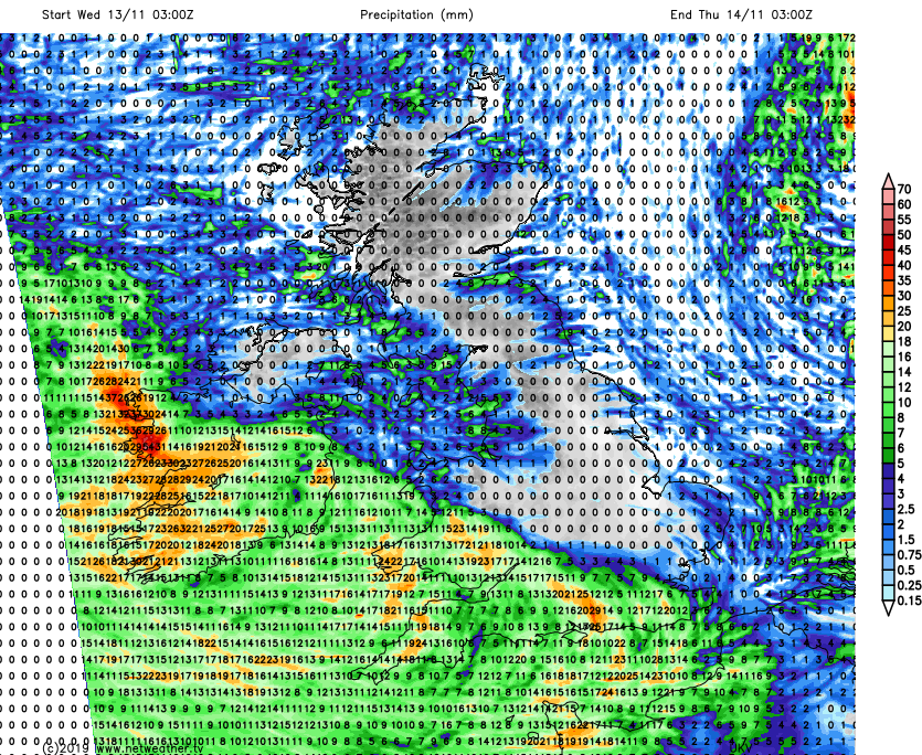
For other parts of the country, aside from a scattering of at times wintry showers near to east coasts, it'll be a dry, quite cold night with a widespread frost for Scotland and a patchy one in northern England.
Later in the night and into Thursday, the wet weather with snow on the hills in the south will push further north into central England and potentially back into south Wales. More rain will also feed into eastern England, affecting east Anglia, parts of Yorkshire and through into the East Midlands as a front wraps around low pressure close to the south coast of England. Later on, that front will start to push northward, running up through the rest of Eastern England, still bringing snow to higher levels, before fading to a few showers as it reaches Scotland during Friday.
More high rainfall totals are likely on Thursday. 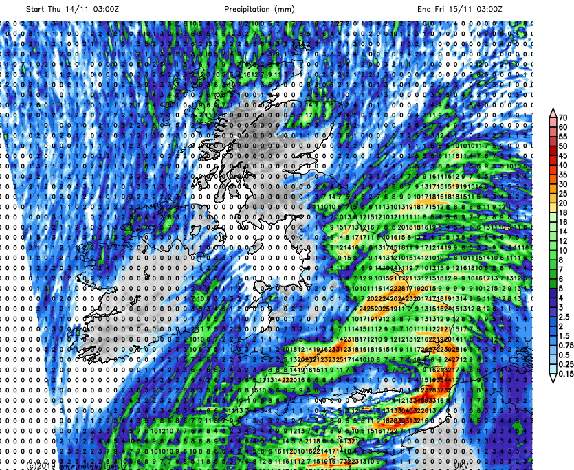
For the remainder of the country, Thursday and Friday will keep the chilly theme going, with frosts overnight - especially in the north. There'll be some showers around that'll mainly stay near to eastern and northern coasts, and will be wintry over the hills but away from those, there'll be plenty of dry weather around. Later on Friday, a more organised set of showers will move into eastern England, and they'll continue to be a feature at the start of the weekend.
Through the rest of the weekend, we look set to see a bit of an east-west stand-off with rain trying to move into the west, but having its progress blocked. There's some uncertainty over how far inland that rain will make it, but we're likely to be left with a three-zone spell of weather. That'll mean some rain and potentially gusty winds in the western zone, a decent scatting of showers in eastern coastal counties and in between, dry with varying amounts of cloud with some frost and perhaps fog overnight.