


Low pressure moving slowly in from the west will bring showers for many over the next few days, windy and cooler too, but high pressure builds early next week to bring drier and settled conditions.
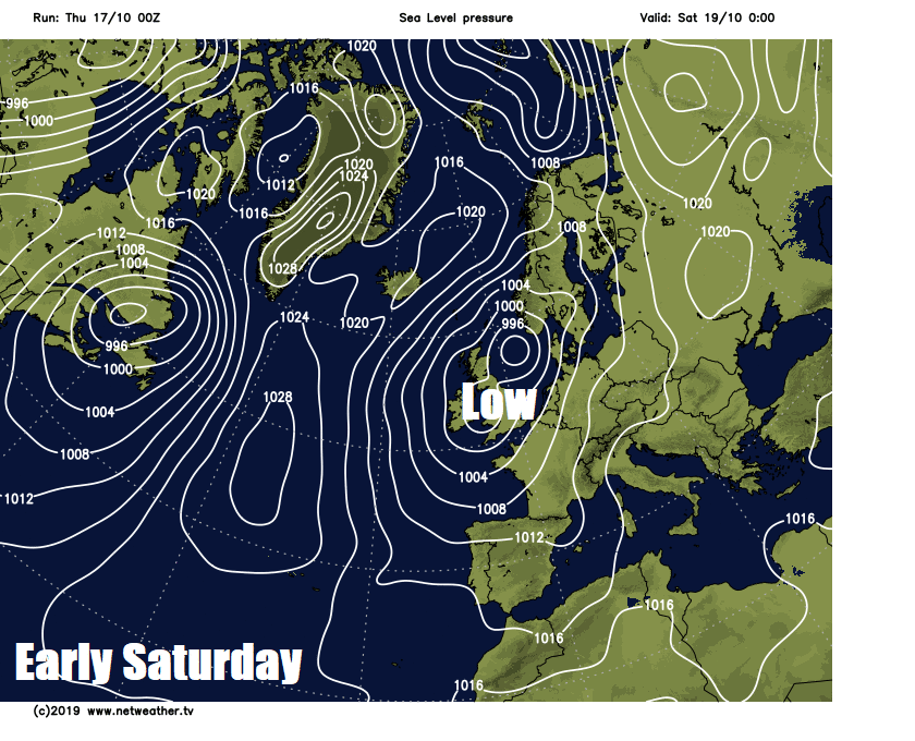
An area of low pressure moving in off the Atlantic across Ireland tomorrow and mainland Britain over the weekend will dominate our weather over the next 4 days, bringing increasing showers or longer spells of rain for some and becoming windy and cooler too. However, it looks to turn drier early next week – as high pressure builds in from the west, though it could turn unsettled again towards the end of the week.
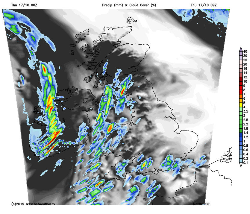
For now, it’s a dry and bright morning commute for many. Cold start earlier away from the far south and far west, with temperatures widely in mid to low single figures at dawn – low enough to allow a ground frost overnight in places, but around or below freezing in the north of Scotland – allowing for an air frost. Temperature at Altnaharra falling to -3C. The exception to the generally dry start is heavy showers pushing up the Irish Sea across parts of SW Scotland, Cumbria, Isle of Man, west Wales and also well-scattered showers affecting SW England and southern coastal counties.
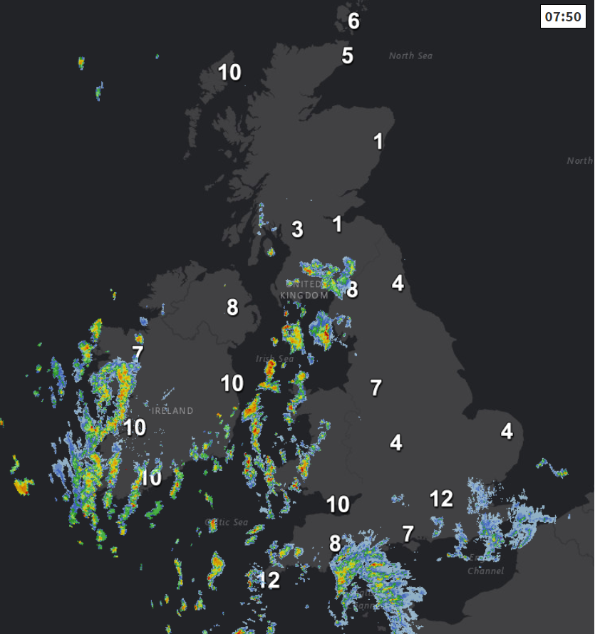
Showers will become more widespread and heavy across southern and western areas through the morning and into the afternoon, pushing up through the Irish Sea to affect the western side of Scotland, parts of NW England, Wales, SW England and moving northeast into the Midlands and SE England – perhaps into East Anglia too. The odd rumble of thunder and hail possible with heavier showers. Otherwise, the rest of eastern England and much of eastern Scotland will stay generally dry with plenty of sunshine. Cooler than recent days, temperatures reaching 13-15C generally, though temperatures dropping under any heavy showers.
Showers continuing overnight, blowing in from the southwest on a brisk wind and, if anything, becoming more widespread further east for a time. Showers locally heavy and becoming prolonged in places – with some torrential downpours in the south and west. There will be some dry and clear spells, the best of these towards the far north and northeast of Scotland. As a result of the blustery wind, it will be a milder night for all, temperatures typically falling to 6-8C in the north, 9-10C in the south.
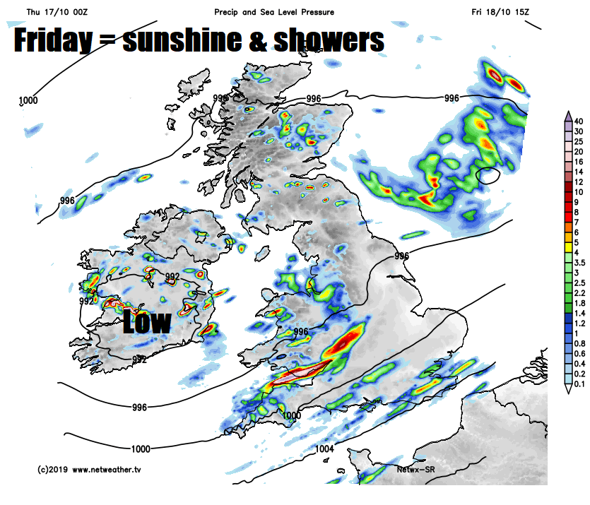
Another day of sunshine and showers on Friday as low pressure continues to move in from the west, frequent showers from the word go across southern and western areas in the morning, then becoming more widespread through the day, showers most frequent in the west, with a risk of hail and thunder. Some sunny spells between the showers. It will be windy in the south too. Temperatures reaching 12-15C.
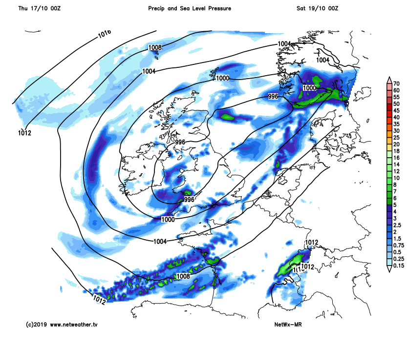
As we go into the weekend, low pressure over Ireland on Friday will drift east across central Britain on Saturday – weakening as it does so, before moving out over the North Sea on Sunday. So Saturday will feature sunny spells and showers circulating around the low, showers locally heavy and thundery. Sunday again seeing some showers around, though perhaps fewer than Saturday – especially for the west, some longer spells of rain possible across eastern Scotland and NE England – with a strong northeasterly wind developing here.
As we enter early next week, showers of recent days will become confined to southern parts on Monday – where they will fade here too into the afternoon, with most places becoming drier and sunnier from the north through the day, as high pressure builds. Tuesday looking generally dry and bright or sunny UK wide, though strengthening winds, cloud and rain could affect the far north of Scotland. Wednesday could turn unsettled across Scotland and N. Ireland, the rest of the UK staying settled. Some uncertainty after mid-week, but for now it looks like low pressure will return close to the northwest, so turning unsettled across most parts.


