Plenty of fine weather today and for many on Saturday with warm sunshine. Fronts from the NW keep a more unsettled them for parts of Scotland with blustery winds. Nippy by night.
Plenty of fine weather for the UK today and at the weekend over England and Wales. Temperatures in the south should rise into the mid 20sC but with cold nights, the autumnal chill is taking hold after dark.
We’ve seen quite a change overnight, from the warm air thanks to ex-Gabrielle on Thursday, a maximum temperature of 26.8C in Suffolk, then 0.7C for Co. Down before dawn. The cold front is just dragging the last of its cloud from Kent now and this fresher, nippier air means a bright sunny start for much of the UK.
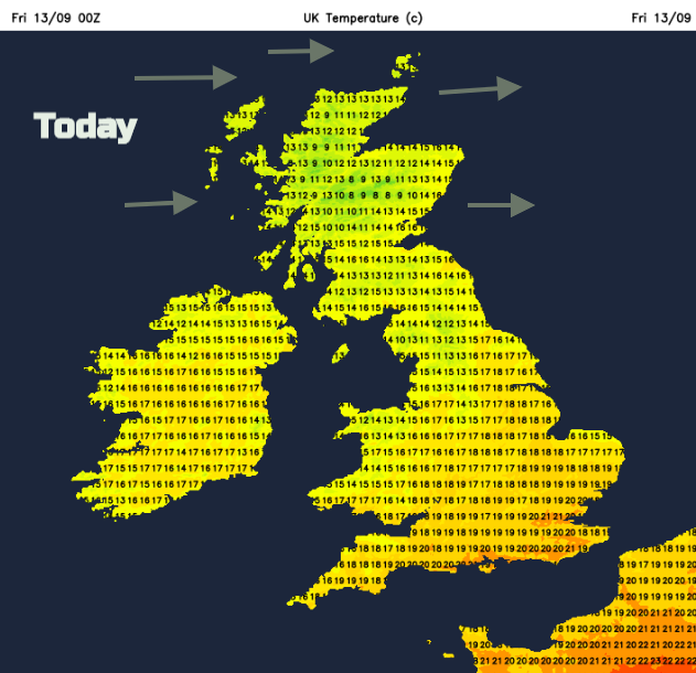
There will be a few more showers over the NW Highlands but essentially it is a dry day, blustery for Scotland with a moderate to fresh west wind. Temperatures will be in the mid-teens to low 20sC in the SE.
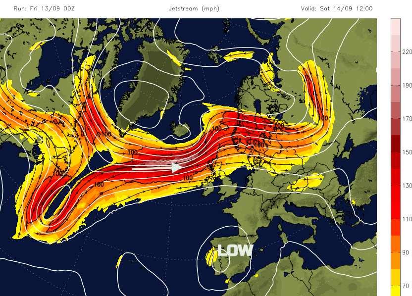
High pressure has built in over the UK but has a bit of a job holding on. Way up in the atmosphere a strong jet is powering across the Atlantic and will manage to force weather fronts over Scotland, sometimes a bit further south and bring more unsettled weather and strong winds to the far north.
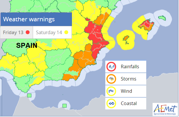
Disruption to the Jetstream early this week led to a cut off low over Iberia and there has been devastating flooding in the east for Alicante, Valencia and awful weather for holidaymakers in the Costa Blanca or Balearics. With the warm waters of the Med, this cut-off vortex of cooler air above, it is very unstable and massive thunderstorms have resulted. This should ease slowly at the weekend, but red warnings are still in place today. It's known as Gota Fria, cold drop.
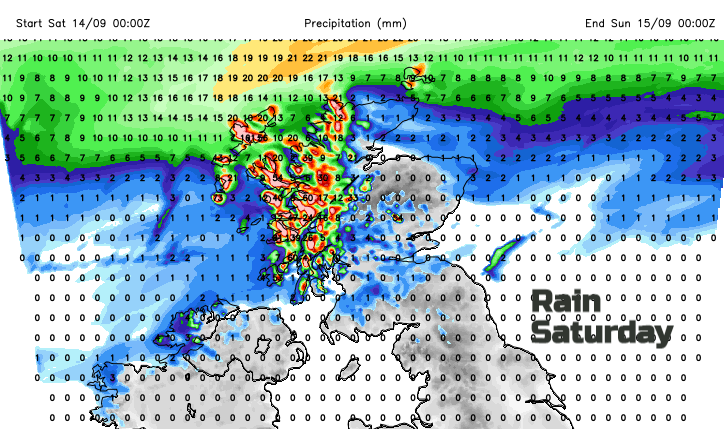
A low pressure whizzes towards Iceland on Saturday, the warm front brings early rain to western Scotland and more cloud over northern Britain and in the afternoon the cold front will bring heavier rain to the Islands and NW Highlands. The SW winds will strengthen bringing gales in the far north which veer tot the west of Shetland overnight.
Away from this unsettled weather it will be bright or sunny, calmer with some warmth on Saturday caught up in the warm sector. Temperatures widely in the high teens and low 20sC for southern Britain.
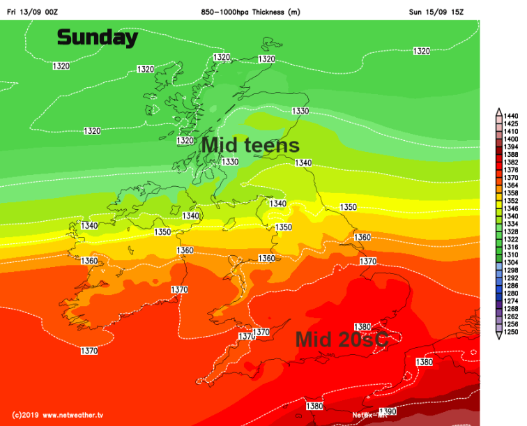
During Saturday night, the cold front sinks southwards with a bit of rain. Ahead of this there will be more warmth for Sunday, into the mid 20sC. To the north it says cooler and breezy. The boundary front now looks to remain a feature on Sunday, so bringing some outbreaks of rain and more cloud. This looks to hover over Northern Ireland, the Isle of Man and northern England.
As the high holds on for the start of next week, Sunday’s front fades southwards on Monday leaving a lot of fine, dry and sunny weather. Cold nights though, northern Britain will notice that on Monday morning.