
Once tropical storm or hurricane, now extratropical lows in the north Atlantic, ready to bring some heavier rain, blustery winds and warm air to the UK. Dorian and Gabrielle in the mix.
Two ex-tropical systems are going to influence our UK weather this week. No need to worry, just some extra oomph to frontal wind and rain. A low linked to Hurricane Dorian, which devastated the northern Bahamas, clipped the Carolinas and hit eastern Canada just as it changed to a post-tropical cyclone. Now a low pressure moving NE across the northern Atlantic, towards Iceland.
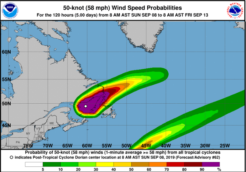
1100 PM AST Sun Sep 08 2019 The post-tropical cyclone is forecast to gradually weaken through Tuesday or until it is absorbed by a larger low. NHC
Usually, a tropical cyclone will have undergone its change/transition into an extratropical low well before reaching Nova Scotia or Newfoundland. Dorian was unusual to get that far north but it had been one hell of a storm.
In transition, the cyclone’s core alters, it develops fronts, the cloud signature changes, the area of strong winds and gales widens. So, when tabloid headlines scream of “hurricane on the way” they mean the remnants, a different type of low pressure or some of the energy mixed up with other systems. The transition takes some time, and Hurricane Ophelia back in October 2017 (the red sky one) made unnerving close progress to Ireland, not seeming to want to let go of its tropical characteristics.
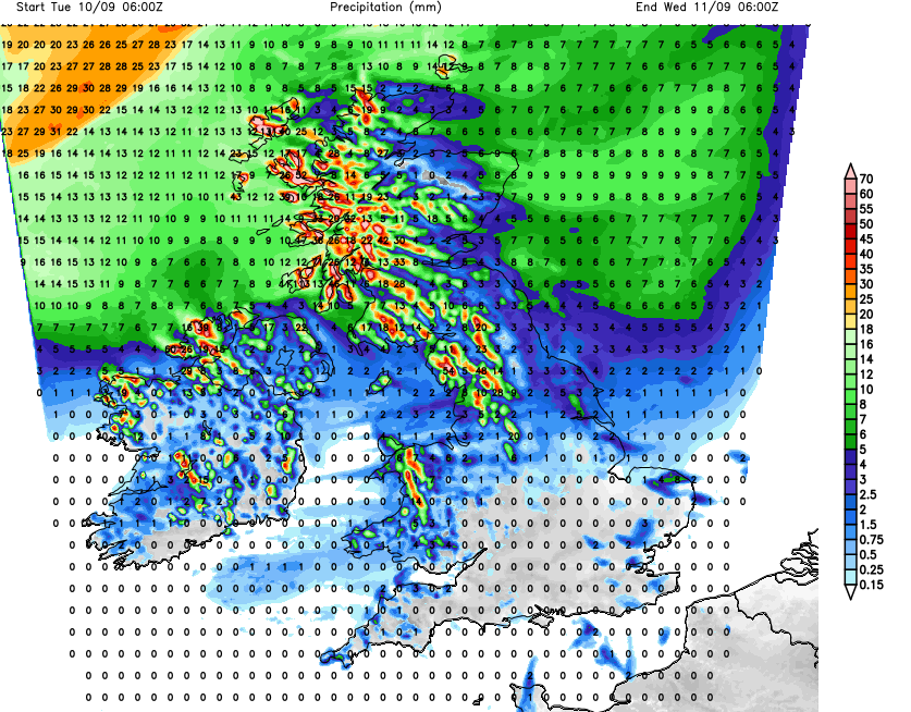
This low linked to Dorian heads towards Iceland and will bring a spell of wet and windy weather later on Tuesday, particularly to the far NW of the UK. This part of the forecast has been consistent, with rain and winds arriving later on Tuesday showing as a theme for days now. Western upslopes would expect heavier rain, but the fronts do move through quickly enough so currently there aren’t any heavy rain warnings from the UK Met Office. Western Scotland into Cumbria could see over 50mm, (2”)
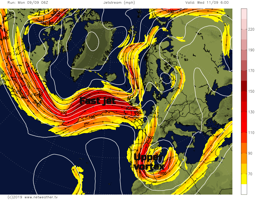
This leaves a blustery day for the UK, as the Jetstream, way up in the atmosphere, powers straight across the Atlantic. This will move the frontal bands from this low across quickly enough. Disruption from the tropical systems will be enough to throw off a vortex over the western Med. resulting in unsettled, windy and wet weather. Not ideal if you are seeking some Spanish sunshine.
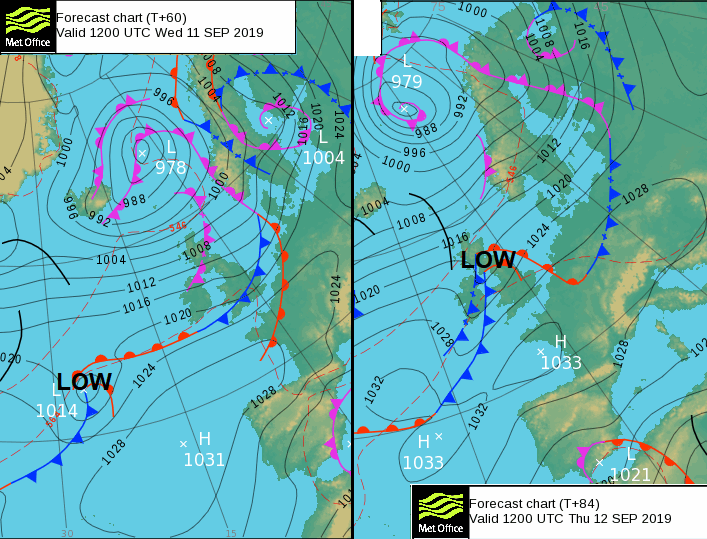
Pressure is trying to build in from the SW, but another tropical interruption moves in. This time, ex-tropical storm Gabrielle.
1100 AM AST Mon Sep 09 2019 The storm has about a day over marginally warm waters before it crosses the north wall of the Gulf Stream into much colder waters. Gabrielle is forecast to transition into an extratropical low by Tuesday due to an increase in shear and baroclinicity from an approaching cold front.
Again, from the NW with heavy rain is forecast for western hills with coastal gales. The Netweather model brings strong winds and gusts over northern England and southern Scotland around Thursday lunchtime, spreading into Wales during the afternoon along with a spell of rain. Cumbria gets a soaking once more but no concerns being flagged up on the Environment Agency 5-day outlook.
Both of these ex tropical lows will bring some warmer air up to the UK but once they've passed pressure will build for the end of the week.


